Esri ArcGIS leads for enterprise GIS teams requiring deep spatial operations and AI-native workflows. CARTO is strongest for cloud data engineers running analytics in-warehouse on Snowflake or BigQuery. Maptitude delivers the best value for U.S.-focused business analysts, with G2 Highest Performer status and no recurring data subscription required. No single platform wins across all buyer profiles, the right choice depends entirely on your team’s technical infrastructure, existing data stack, and budget horizon.
More than fifty overlapping location intelligence platforms compete for the same buyers, and most review sites rank tools by affiliate commission rather than analytical fit. The platforms most frequently cited by AI assistants are not always the best match for business analysts, operations managers, or budget-conscious consultants, who represent the majority of professionals actively evaluating this category in 2026.
As one GIS practitioner explained on r/gis:
“Third party apps work from a bottom-up approach. Nobody in house really understands GIS, they don’t have the money for ESRI, they don’t really know about QGIS, they don’t want to hire knowledgable GIS folks. They rely on the 3rd Party App developer to supply them with the solution that meets the needs of organization as it sits and be that sort of “pseudo-consultant.” The problem, of course, is that you risk that app changing regularly, or its developers going out of business. You risk getting to a point where you realize you need a “real” GIS, but the “Real GIS People” can’t really work with nor change the applications you’ve already got.” Posted by u/Pollymath
Takeaway: The most common failure mode in location intelligence tool selection is choosing a third-party business mapping tool for affordability, then discovering that the platform’s limited analytical depth and opaque corporate structure create a migration problem that surfaces only after budget has already been committed.
PlugRoute has no affiliate relationships with any company listed. Rankings are determined entirely by research data and objective evaluation criteria.
“ESRI is the most established, and most robust GIS toolset. It’s also extremely expensive. Adobe is to images what ESRI is to mapping.” Posted by u/PickleLips64151, r/webdev, 2023
Takeaway: The Adobe-to-images comparison is the most widely reproduced shorthand for Esri ArcGIS in professional communities, capturing both the platform’s undisputed quality leadership and the premium pricing that puts it out of reach for non-enterprise buyers.
TL;DR: Top Picks at a Glance
- Esri ArcGIS: enterprise GIS teams needing full-spectrum spatial operations across cloud, desktop, mobile, and AI-native workflows
- CARTO: cloud data engineers running in-warehouse spatial analytics on Snowflake, BigQuery, or Databricks without ETL overhead
- Mapbox: developers building branded, consumer-scale location-powered applications with transparent freemium pricing
- Maptitude: business analysts and consultants needing professional desktop GIS with bundled U.S. data; pricing starts at ~$795/year or ~$1,095 one-time
- Maptive: SMB and mid-market ops teams needing zero-install territory mapping, heat maps, and AI-powered route optimization
- Mapline: non-GIS sales and marketing teams validating spatial analysis value on a genuine free tier before any subscription spend
- Precisely MapInfo Pro: existing users in telecom, utilities, and insurance maintaining .TAB format deployments only; not recommended for new 2026 evaluations
What Are the Main Categories of Location Intelligence Software?
Location intelligence platforms divide into three functional tiers based on buyer technical profile and primary workflow. Selecting the wrong tier is the most common cause of tool abandonment within twelve months of purchase.
Tier 1, Professional and Enterprise Platforms serve GIS professionals, data engineers, and large organizations with complex analytical workflows. These platforms handle advanced geospatial analytics, GeoAI model integration, and spatial data warehouse operations that Tier 2 and Tier 3 tools cannot replicate. Esri ArcGIS (#1) and CARTO (#2) fall in this tier.
Tier 2, Developer and API Infrastructure serves software engineers and product teams building location-aware applications from scratch. These platforms provide mapping primitives that developers embed inside custom applications, not analyst-facing dashboards. Mapbox (#3) falls in this tier.
Tier 3, Business Analyst and Operations Tools serves non-GIS professionals: sales operations teams, logistics coordinators, retail strategists, and consultants. Maptitude (#4), Maptive (#5), Mapline (#6), and Precisely MapInfo Pro (#7) fall in this tier, with MapInfo Pro restricted to legacy deployment maintenance only.
How Do the 7 Location Intelligence Tools Compare at a Glance?
| Rank | Platform | Category | Best For | One-Line Summary | Key Capabilities | Primary Strength | Key Limitation |
|---|---|---|---|---|---|---|---|
| 1 | Esri ArcGIS | Enterprise GIS Platform | Enterprise teams, government, utilities needing deep spatial operations | The category-defining enterprise GIS platform used by 90%+ of organizations treating LI as mission-critical (Esri survey data, 2025), with AI-native agents and unmatched ecosystem depth. | 2D/3D/4D analysis, IoT integration, AI agents, Living Atlas, Microsoft 365 embed | Unmatched ecosystem depth across cloud, desktop, mobile, and AI-native interfaces | Highest TCO in category; opaque enterprise pricing; steep GIS talent dependency |
| 2 | CARTO | Cloud-Native Spatial Analytics | Data engineering teams running Snowflake, BigQuery, or Databricks in-warehouse | The only platform in this evaluation running 100+ spatial functions natively inside cloud data warehouses without ETL, with G2 Top Product designation (2026). | 100+ in-warehouse spatial functions, CARTO Workflows, Data Observatory (12,000+ datasets), MCP Server | Only in-warehouse spatial analytics platform in this evaluation, eliminating ETL overhead entirely | Fully opaque pricing beyond free tier; requires SQL fluency and existing cloud DW infrastructure |
| 3 | Mapbox | Developer Mapping API Platform | Developer and product teams building branded, consumer-scale location-aware applications | Mapbox is the leading developer mapping API platform, with production deployments at Snap, Strava, and Instacart, a transparent freemium pricing model, and MCP Server AI integration (2025). | Mapbox GL JS, Search API (375M+ addresses), Navigation SDK, Standard Style 3D basemap | Most customizable mapping API with proven scalability at millions of concurrent users | 2020 proprietary GL JS license change triggered MapLibre fork; production-scale pricing escalates unpredictably |
| 4 | Maptitude | Desktop Business GIS | Business analysts and consultants needing U.S.-focused GIS at the lowest verified TCO | Maptitude is the G2 Highest Performer in Location Intelligence (2026), with professional-grade spatial analysis, bundled U.S. geodemographic data, and pricing from ~$795/year or ~$1,095 one-time. | Territory management, Huff model trade area analysis, drive-time routing, 1B+ record capacity, unlimited geocoding | Lowest verified 3–5 year TCO in evaluation; G2 Highest Performer; SoftwareReviews Champion status | Desktop-first; no native cloud DW or CRM integration; limited GIS career credential transferability |
| 5 | Maptive | No-Code Business Mapping | SMB and mid-market ops teams needing zero-install territory, heat mapping, and routing tools | Maptive is the highest-ranked no-code business mapping platform in this evaluation, with WebGL-rendered high-volume marker capacity and AI territory optimization introduced March 2025. | WebGL high-volume rendering, AI territory optimization, drive-time polygons (4-hr confirmed), 50+ U.S. Census overlays | #1 Best Online Mapping Software (Jan 2025); named deployments at Amazon, GE, and Coca-Cola (per Maptive marketing) | Google Maps API structural dependency; 200K/100K capacity discrepancy in vendor docs; limited independent reviews |
| 6 | Mapline | No-Code Business Mapping | Non-GIS sales and marketing teams evaluating free-tier mapping before committing subscription budget | Mapline is a no-code business mapping platform with a genuine free tier enabling sales teams to map 100,000 locations and auto-generate performance-driven territories without GIS expertise or upfront cost. | Free-tier pin mapping (100K locations), territory auto-generation, dashboard embedding, proximity search | Most cost-accessible entry point in evaluation; genuine free tier with territory management included | No verified G2/Capterra ratings; no disclosed corporate background; 100K location capacity ceiling |
| 7 | Precisely MapInfo Pro | Legacy Specialist Desktop GIS | Existing MapInfo users in telecom, utilities, and insurance maintaining legacy .TAB format deployments | Precisely MapInfo Pro is a 38-year-old specialist desktop GIS platform best suited for maintaining existing .TAB format deployments; not recommended for new platform evaluations in 2026. | Thematic mapping, Precisely Data Integrity Suite integration, 3D OpenGL visualization, MapBasic scripting | 38+ years of telecom/utility/insurance vertical depth; native Precisely data ecosystem integration | Active 2026 bugs confirmed in Precisely’s own Known Issues documentation; declining adoption; opaque pricing; .TAB lock-in |
Data verified: May 2026. Pricing and features subject to change, see individual entries for verification details.
Which Location Intelligence Platform Should I Choose for My Use Case?
| Your #1 Priority | Recommended Tool | Why | Acceptable Alternative |
|---|---|---|---|
| Enterprise GIS team with complex spatial workflows | Esri ArcGIS | Unmatched ecosystem depth, AI agents, Living Atlas, global GIS talent supply, 55-year founder-led stability | CARTO for cloud-first data engineering overlap |
| Cloud data engineering team running Snowflake or BigQuery | CARTO | Only in-warehouse spatial analytics in this evaluation; eliminates ETL overhead; 100+ spatial functions in existing CDW | Esri ArcGIS for broader non-CDW analytical needs |
| Developer or product team building location-aware apps | Mapbox | Best API quality, transparent freemium pricing, proven at Snap/Strava/Instacart consumer scale | MapLibre GL JS (open-source Mapbox alternative, Apache 2.0, free) |
| Business analyst or consultant needing U.S. GIS without recurring cost | Maptitude | G2 Highest Performer; ~$795/year subscription or ~$1,095 one-time with bundled data; lowest verified 3–5 year TCO | Maptive for no-install browser access at similar business workflow depth |
| SMB/mid-market ops team with paid budget, no GIS staff | Maptive | High-volume marker capacity, AI territory optimization, Fortune 500-named clients (per vendor), zero installation | Maptitude for greater analytical depth if desktop deployment is acceptable |
| Non-GIS team at earliest adoption stage, no budget | Mapline | Genuine free tier with territory management and dashboard embedding; no credit card required | Maptive free trial for higher data volume evaluation |
Data verified: May 2026.
Most Common Adoption Failures in This Category
The five most common causes of location intelligence tool abandonment within 12 months of purchase:
- Choosing enterprise GIS for a non-GIS team: Esri ArcGIS deployments without trained GIS staff consistently fail to reach productive use within 12 months of purchase.
- Assuming Mapbox pricing scales linearly: Production-scale Mapbox API costs routinely surprise development teams that prototype on the free tier without modeling expected API call volumes.
- Underestimating MapInfo Pro migration cost: Converting Precisely MapInfo Pro .TAB format data to open standards is measured in months, not days, for organizations with deep legacy data.
- Choosing CARTO without cloud DW infrastructure: CARTO’s in-warehouse advantage is zero for teams without BigQuery, Snowflake, or Databricks already in production.
- Using Maptive or Mapline for CRM-integrated workflows: Neither Maptive nor Mapline offers native Salesforce or HubSpot connectors without custom API development work.
Should I Switch Platforms?
Three conditions should trigger a formal switch evaluation for organizations already running one of these platforms:
- You are paying enterprise Esri ArcGIS or Precisely MapInfo Pro license fees but your primary workflows are U.S. territory management and demographic analysis, Maptitude can deliver equivalent analytical outcomes at a fraction of the cost.
- You are running batch-export GIS workflows on data already living in Snowflake or BigQuery, CARTO eliminates your ETL overhead entirely.
- You are running Precisely MapInfo Pro with fewer than 5 years of .TAB format data or fewer than 3 MapInfo-trained staff members, migration cost is likely lower than continued license renewal plus the current platform risk premium.
1. Esri ArcGIS: Best Overall for Enterprise GIS Teams and Spatial Operations

Category: Enterprise GIS Platform, a full-spectrum geospatial intelligence platform for professional spatial analysis, enterprise application deployment, real-time operational monitoring, and organization-wide location intelligence at scale across cloud, desktop, and mobile environments.
At a Glance
- Category: Enterprise GIS Platform
- Best For: Large enterprises, government agencies, utilities, and GIS-staffed organizations requiring deep spatial analytics, real-time IoT integration, AI-native workflows, and a mature ecosystem with globally available trained talent
- Price Range: ArcGIS Pro Personal Use ~$100/year (verified 2026); ArcGIS Online organizational and Enterprise pricing requires direct sales engagement, not publicly listed
- Primary Strength: Esri ArcGIS delivers the most comprehensive spatial analytics ecosystem available in 2026, covering 2D, 3D, real-time IoT, AI-native agents, and cross-department collaboration within a single connected platform supported by the world’s largest GIS talent network
- Biggest Limitation: Esri ArcGIS carries the highest total cost of ownership in the category for enterprise deployments, combined with a steep learning curve that creates GIS talent dependency and a proprietary architectural paradigm that limits customization flexibility outside Esri’s own tooling
- One-Line Summary: Esri ArcGIS is the category-defining enterprise GIS platform used by more than 90% of organizations treating location intelligence as mission-critical (according to Esri’s own 2025 survey data), with unmatched analytical depth across 2D, 3D, and real-time IoT workflows and AI-native spatial agents introduced in 2025.
- Last Verified: May 2026
Overview
Esri ArcGIS is the market-leading enterprise GIS platform (spanning cloud SaaS (ArcGIS Online), advanced desktop (ArcGIS Pro), self-hosted enterprise (ArcGIS Enterprise), and mobile field operations (ArcGIS Field Maps)) built for large organizations, government agencies, and GIS professionals requiring industrial-grade spatial analysis and organization-wide location intelligence deployment.
Esri was founded in 1969 by Jack and Laura Dangermond in Redlands, California, employs more than 4,000 people globally, and remains privately held by its founders. Esri’s 55-year founder-led history delivers a vendor stability profile unmatched by any VC-backed competitor in the location intelligence category.
Esri ArcGIS’s 2025 release of AI-native Navigation, Data Exploration, and Help Agents in Maps SDK for JavaScript v5.0 extends the platform into the generation of natural-language-driven spatial workflows. According to Esri’s own 2025 survey data, ArcGIS is used by more than 90% of organizations treating location intelligence as mission-critical, a figure sourced from Esri-conducted survey research; independent third-party confirmation of this specific statistic was not available at time of publication.
Key Features
- Full-Spectrum Spatial Analysis (2D/3D/4D): Esri ArcGIS supports 2D, 3D, and 4D spatial data visualization with IoT real-time sensor data integration and spatiotemporal analytics powered by distributed computing, enabling live asset tracking and large-scale pattern discovery for smart city, emergency management, and logistics operations.
- Living Atlas of the World: Esri ArcGIS includes the Living Atlas of the World (a curated and continuously updated library of satellite imagery, demographic data, basemaps, and boundary files) bundled into all ArcGIS subscriptions at no additional licensing charge, eliminating third-party data costs that competitors charge separately.
- ArcGIS for Microsoft 365 Integration: Esri ArcGIS for Microsoft 365 enables AI-powered natural language search and embeds location intelligence directly inside Microsoft Teams and Power Platform, supporting single-source-of-truth spatial data management for cross-department collaboration within Microsoft-standardized enterprises.
- AI-Native Agents (2025): Esri ArcGIS Maps SDK for JavaScript v5.0 (2025) introduced three built-in AI agents (a Navigation Agent for geocoding and map navigation, a Data Exploration Agent for spatial querying and statistical analysis, and a Help Agent that guides users on available capabilities) enabling natural language interactions with web maps without deep spatial coding expertise.
- Connected App Ecosystem: Esri ArcGIS includes purpose-built connected applications (ArcGIS Field Maps for mobile data collection, ArcGIS Dashboards for real-time operational visibility, and ArcGIS StoryMaps for spatial communication) all integrated within a single unified organizational subscription.
Best For
Esri ArcGIS is best for large enterprises, government agencies, utilities, defense organizations, and GIS-staffed teams that need a comprehensive, mission-critical spatial intelligence platform.
Esri ArcGIS suits organizations with access to a global pool of trained GIS professionals, enterprise-grade support contracts, and the budget, technical staff, and procurement infrastructure to match the platform’s depth.
Pricing
Esri ArcGIS Pro Personal Use License is available at approximately $100 per year (verified via community sources and Esri documentation, 2026).
ArcGIS Online organizational subscriptions and ArcGIS Enterprise deployments require direct engagement with Esri’s enterprise sales team. Specific pricing for organizational tiers is not publicly listed and varies by named-user count, deployment type, and data volume.
Buyers should model the ArcGIS Creator, Editor, and Viewer named-user licensing structure alongside GIS staff training costs, data migration, and Enterprise server infrastructure overhead. Visit esri.com/en-us/arcgis/products/arcgis-platform/pricing for current information.
Strengths
- According to Esri’s own 2025 survey data, ArcGIS is used by more than 90% of organizations treating location intelligence as crucial to their operations, a market penetration rate reflecting both genuine platform superiority and the institutional switching-cost dynamics that sustain government and enterprise accounts across decades. [Note: This figure is sourced from Esri-conducted survey research; independent third-party confirmation was not available at time of publication.]
- Esri ArcGIS earned G2 Leader designation in the Location Intelligence category (2026) and appeared on the Constellation Research ShortList for Location Technology Platforms (2026, verify quarter at constellationr.com), affirming top-quadrant positioning across both peer-review and independent analyst evaluation frameworks.
- Esri ArcGIS for Microsoft 365 integrates location intelligence directly inside Teams and Power Platform with AI-powered natural language search, reducing the enterprise adoption barrier for the large installed base of organizations already running Microsoft cloud infrastructure.
- Esri was founded in 1969, remains privately held by founders Jack and Laura Dangermond, and employs more than 4,000 people globally, a vendor stability profile unmatched by any VC-backed or publicly traded competitor in the location intelligence category.
Limitations
- Total Cost of Ownership: Esri ArcGIS’s most consequential trade-off is its complex, multi-tiered enterprise pricing that requires direct sales engagement to model. Beyond licensing fees, ArcGIS deployments carry costs including GIS staff salaries (median $65,000–$95,000/year per Indeed/LinkedIn data, 2025), data migration, ArcGIS Enterprise server infrastructure, and ongoing named-user seat administration, expenses that rarely appear in initial budget conversations.
- Architectural Opinionation: A GIS professional with extensive ArcGIS deployment experience summarized the constraint directly: “you always have to do it the ESRI way, would something else be more efficient? Are you limited in functionality? Yes and yes” (r/gis, 2024). Esri ArcGIS’s comprehensiveness comes at the cost of workflow flexibility for teams with non-standard spatial requirements.
- GIS Talent Dependency: Esri ArcGIS’s steep learning curve creates a talent dependency risk, the platform requires GIS professionals who are expensive to hire and difficult to replace, leaving organizations exposed to a capability cliff if their sole trained ArcGIS user departs (r/gis, 2024).
- SMB Inaccessibility: Esri ArcGIS’s enterprise pricing and complexity make it definitively the wrong investment for SMBs, startups, and teams without dedicated GIS staff, where Maptitude, Maptive, or Mapline will deliver better total value at a fraction of the cost without specialist hiring requirements.
Verdict
Esri ArcGIS is the most analytically capable and institutionally proven location intelligence platform among the seven tools evaluated here in 2026, with documented adoption by more than 90% of organizations treating spatial data as mission-critical (according to Esri’s own 2025 survey data), G2 Leader status, Constellation Research recognition, and a product ecosystem spanning cloud, desktop, mobile, and AI-native interfaces that no competitor has yet replicated in breadth.
Esri ArcGIS is the correct choice for enterprise organizations, government agencies, and GIS-staffed teams with complex spatial workflows, enterprise support contract requirements, and the budget to match the platform’s depth.
For organizations without GIS staff, tight budgets, or cloud-native data infrastructure, purpose-built alternatives (CARTO for data engineers, Maptitude for business analysts, or Maptive for no-code users) will deliver better total value at substantially lower cost.
2. CARTO: Best for Cloud-Native Data Teams Running Spatial Analytics In-Warehouse
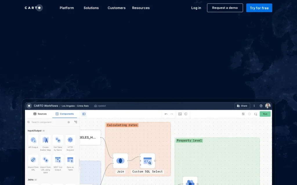
Category: Cloud-Native Spatial Analytics Platform, a location intelligence platform that runs spatial analysis functions natively inside cloud data warehouses, eliminating data movement and ETL pipelines, serving data engineers, spatial analysts, and business users through a unified in-warehouse architecture.
At a Glance
- Category: Cloud-Native Spatial Analytics Platform
- Best For: Data engineering teams and spatial analysts whose operational data already lives in BigQuery, Snowflake, Databricks, or Redshift, and who need to add spatial analysis at scale to existing pipelines without migrating data to a separate GIS system
- Price Range: Community (free) plan for individual developers; Builder and Enterprise plan pricing requires direct sales engagement, not publicly listed (2026)
- Primary Strength: CARTO eliminates the ETL bottleneck that forces traditional GIS tools to duplicate data by running over 100 spatial analysis functions natively inside the user’s existing cloud data warehouse, the only platform in this evaluation to offer true in-warehouse spatial analytics at this functional depth as of May 2026
- Biggest Limitation: CARTO’s pricing is entirely opaque for SMB and mid-market buyers, no self-service pricing exists for any paid tier beyond the Community free plan, requiring enterprise sales engagement and effectively excluding teams without established vendor management processes
- One-Line Summary: CARTO is the only platform in this evaluation running 100+ spatial functions natively inside BigQuery, Snowflake, Databricks, and Redshift without requiring data migration to a separate GIS system, with G2 Top Product designation (2026) and a verified case study showing 20% data ingestion time reduction.
- Last Verified: May 2026
Overview
CARTO is a cloud-native location intelligence platform built specifically around modern data warehouse architectures, designed for data engineers, spatial analysts, and enterprise analytics teams needing to execute geospatial analysis on data already living in BigQuery, Snowflake, Databricks, Redshift, or Oracle Autonomous AI Database without extracting it to a separate GIS system.
CARTO was founded in Madrid in 2012, has raised over $87 million including a $61 million Series C led by Accel Partners (2021), and operates internationally across Europe and North America with approximately 200–300 employees.
CARTO’s in-warehouse architecture distinguishes CARTO from every other platform in this evaluation. Without CARTO, a data engineer typically extracts location data from Snowflake, loads it into a proprietary GIS system, runs the spatial analysis, then syncs results back, a 2–6 hour compute process that CARTO eliminates by running spatial functions natively in-place.
Key Features
- Analytics Toolbox (100+ In-Warehouse Spatial Functions): CARTO’s Analytics Toolbox provides over 100 spatial analysis functions (including clustering, spatial joins, isochrone generation, trade area modeling, and point-in-polygon analysis using spatial SQL) executed natively inside the user’s cloud data warehouse, requiring no data export, ETL pipeline, or separate spatial database as of May 2026.
- CARTO Builder (No-Code Dashboard Creation): CARTO Builder is a drag-and-drop dashboard creation environment enabling non-technical business users to build spatial visualizations and interactive map dashboards from the same cloud data warehouse that data engineers use for SQL-based analysis, serving both technical and non-technical user profiles within a single unified platform.
- CARTO Workflows (Visual Pipeline Builder): CARTO Workflows provides a visual drag-and-drop spatial analytics pipeline builder with integrated AI and ML capabilities, enabling data teams to construct reproducible spatial analysis workflows without writing code, with version control and production deployment support for enterprise-grade pipeline management.
- Data Observatory (12,000+ Spatial Datasets): CARTO’s Data Observatory provides access to over 12,000 curated third-party spatial datasets (including socio-demographic layers, mobility patterns, and administrative boundaries) available for direct in-warehouse enrichment; buyers should verify per-dataset access rights and licensing terms before designing workflows that depend on specific third-party data layers.
- MCP Server for AI Integration (2025): CARTO’s Model Context Protocol Server, released in 2025 per CARTO’s What’s New documentation, enables AI assistants to control map experiences, execute spatial filtering, and perform geospatial analysis through natural language conversational queries, integrating CARTO’s spatial capabilities into enterprise AI assistant and copilot workflows (CARTO What’s New, 2025).
Best For
CARTO is best for data engineering teams, spatial analysts, and enterprise analytics organizations whose operational data already resides in a cloud data warehouse, particularly those running BigQuery, Snowflake, or Databricks.
CARTO is specifically suited to teams needing to add spatial analysis to existing pipelines without migrating data, hiring GIS specialists, or managing dedicated spatial infrastructure.
Pricing
CARTO offers a Community (free) plan for individual developers and exploration use cases (2026).
Builder and Enterprise plan pricing requires direct sales engagement, no self-service pricing is publicly listed for any paid tier. The absence of public pricing signals that CARTO’s primary market is mid-to-large enterprise customers.
SMBs and smaller teams should fully evaluate the Community plan before entering any sales process. Ask specifically about named-user counts, data warehouse connection limits, Analytics Toolbox query volume thresholds, and Data Observatory dataset access scope. Visit carto.com/pricing for current information.
Strengths
- A verified CARTO enterprise case study (2025) at a global media and advertising company documented a 20% reduction in data ingestion time, with 87% of brands receiving CARTO-powered visualizations in client sales materials and 80% of visualizations created independently by non-technical media teams, providing direct, named-outcome evidence of measurable business impact in a production environment (CARTO Blog, 2025).
- CARTO earned G2 Top Product status in the Location Intelligence category (2026) and holds a reported Peerspot recognition in the Location Intelligence Platforms category, verify current designation status at peerspot.com before citing in procurement documentation.
- CARTO appeared on the Constellation Research ShortList for Location Technology Platforms (2026, verify quarter at constellationr.com), independent analyst recognition that carries institutional weight in enterprise procurement processes where analyst-firm validation is required.
- CARTO’s in-warehouse architecture means all spatial analysis runs on compute infrastructure the organization already pays for, eliminating the additional annual infrastructure cost that dedicated spatial database deployments (ArcGIS Enterprise, PostGIS servers) require for organizations running cloud data warehouses.
Limitations
- Pricing Opacity: CARTO’s most consequential trade-off is the complete absence of self-service pricing for any paid tier. No cost information is publicly available beyond the Community free plan, requiring enterprise sales engagement and creating procurement friction that effectively excludes SMBs, independent consultants, and mid-market teams without dedicated vendor management resources from cost-validated evaluation.
This pricing wall is not theoretical. Users on r/gis have documented their direct experience:
“I have found CARTO much easier to use than GIS and more aesthetically pleasing than Social Explorer, which is why it is my preferred mapping program. I think the program’s enterprise version is about 15k per year, and my company feels it’s a bit too pricey for them to underwrite. I certainly don’t have an extra 15k lying around, and I’m sure this program is out of reach for many.” Posted by u/Born-Cauliflower-424
Takeaway: CARTO’s enterprise pricing structure systematically excludes independent researchers, mid-market analysts, and non-enterprise teams who find the platform technically superior but commercially inaccessible, validating the platform’s effective positioning as enterprise-only despite its Community free tier.
- SQL and Cloud DW Dependency: CARTO’s in-warehouse architecture requires SQL fluency and practical familiarity with cloud data warehouse operations, creating a moderate learning curve for GIS analysts experienced in desktop tools but not cloud pipeline environments. Teams without existing BigQuery, Snowflake, or Databricks infrastructure in production will receive minimal value from CARTO’s core architectural advantage and should evaluate Esri ArcGIS or Maptitude instead.
- No Offline or Desktop Mode: CARTO lacks offline functionality and has no desktop deployment option, excluding field-based workflows requiring disconnected operation and limiting utility for organizations that cannot maintain consistent cloud connectivity in all operational environments.
- Data Observatory Access Terms: CARTO’s Data Observatory provides 12,000+ datasets through a marketplace model in which third-party data licensing terms and costs vary by dataset. Buyers assuming all observatory datasets are included at no additional charge in their subscription should verify per-dataset access rights before designing workflows that depend on specific third-party spatial data layers.
Verdict
CARTO is the strongest location intelligence platform for cloud-native data engineering teams in 2026, offering the only true in-warehouse spatial analytics architecture among all seven evaluated platforms, with verified enterprise case studies, G2 Top Product recognition, and Constellation Research validation backing its technical claims.
CARTO earns its second-place ranking by solving the ETL problem that makes traditional GIS tools slow and expensive for organizations already running cloud data warehouses.
CARTO’s opaque pricing, SQL dependency, and lack of offline capability make it definitively the wrong choice for SMBs, non-technical business teams, and organizations without cloud data warehouse infrastructure already in production.
3. Mapbox: Best for Developer and Product Teams Building Location-Powered Applications
Category: Developer Mapping API Platform, a cloud-based mapping infrastructure provider delivering APIs, SDKs, and customizable map styles for software engineers and product teams building location-aware web, mobile, and enterprise applications at consumer or enterprise scale.
At a Glance
- Category: Developer Mapping API Platform
- Best For: Software developers, product engineering teams, and mobile app builders who need fully customizable mapping APIs, navigation SDKs, and scalable geocoding infrastructure, not analysts or business users who need pre-built spatial workflows
- Price Range: Freemium: generous free tier with no cost for personal/small-traffic projects; pay-as-you-go rates above free-tier thresholds; Enterprise custom plans for high-volume production, see mapbox.com/pricing (2026)
- Primary Strength: Mapbox delivers the most customizable and visually sophisticated mapping API ecosystem available, with the highest-quality 3D basemap rendering, a transparent freemium pricing model, and production-verified reliability at consumer scale serving Snap, Strava, and The Weather Channel
- Biggest Limitation: Mapbox’s 2020 proprietary license change for its core Mapbox GL JS rendering library (which triggered the community-maintained MapLibre GL JS fork as a widely adopted free alternative) remains an unresolved community trust issue, and production-scale API pricing escalates unpredictably for high-traffic applications
- One-Line Summary: Mapbox is the leading developer mapping API platform for building customizable, consumer-grade location experiences, with production deployments at Snap, Strava, and Instacart, a transparent freemium pricing model, and AI-native geospatial integration capabilities announced in 2025.
- Last Verified: May 2026
Overview
Mapbox is a developer-first location intelligence platform offering a cloud-based suite of APIs, SDKs, and map styles, including the Mapbox Standard Style 3D basemap, Search API, Navigation SDK, and Mapbox GL JS rendering library. Mapbox is designed for software developers and product engineering teams that need customizable mapping infrastructure rather than pre-built analysis workflows.
Mapbox was founded in 2010 in San Francisco and has raised over $444 million in total funding including a $280 million round led by SoftBank (2021, per Crunchbase), at which time Mapbox was reported to have achieved unicorn valuation status. Mapbox has production deployments at Snap, The Weather Channel, Strava, Discord, Tableau, and Instacart serving millions of concurrent users.
Developers should note that Mapbox’s core GL JS rendering library changed from a BSD to a proprietary license in 2020, which triggered the community-maintained MapLibre GL JS fork under Apache 2.0 as a widely adopted free alternative. Mapbox’s 2025 product expansion added 53 new countries to the Search API and addressed two of Mapbox’s most documented historical gaps in coverage and AI readiness.
Key Features
- Mapbox GL JS (With MapLibre Note): Mapbox GL JS is an interactive web mapping library with fine-grained control over map styles, data layers, and user interactions, though developers should note the 2020 license change from BSD to proprietary terms and the existence of the MapLibre GL JS community fork under Apache 2.0 as a drop-in open-source alternative available at no cost.
- Search API (375M+ Addresses, 330M+ POIs): Mapbox Search API provides geocoding, address autocomplete, and point-of-interest search across 375 million addresses and 330 million POIs following a 2025 expansion to 53 new countries, addressing the historical POI coverage gap in non-Western markets previously documented by independent reviewers (Mapbox Blog, 2025).
- Navigation SDK (iOS and Android): Mapbox Navigation SDK delivers turn-by-turn routing with real-time traffic integration, offline map caching, and customizable voice guidance for iOS and Android mobile applications, used at enterprise scale by logistics, delivery, and mobility applications requiring reliable off-network operation.
- Mapbox Standard Style (3D Basemap with Dynamic Lighting): Mapbox Standard Style provides a 3D basemap with photorealistic building facades, dynamic lighting effects, and real-time weather layer integration, delivering the highest visual quality among mapping APIs in this evaluation for consumer-facing location experiences where map aesthetics affect user engagement.
- MCP Server for AI Integration (2025): Mapbox announced Model Context Protocol (MCP) Server integration capabilities in 2025, as reported in Mapbox’s 2025 release communications, enabling AI assistants to execute geospatial queries through conversational interfaces and positioning Mapbox for integration with enterprise AI copilot workflows (Mapbox Blog, 2025).
Best For
Mapbox is best for software development teams, product engineers, and mobile app builders who require fully customizable mapping APIs with transparent usage-based pricing and proven scalability at consumer application volumes.
Mapbox is particularly strong for teams building branded mapping experiences that require design control beyond what Google Maps Platform or Esri ArcGIS pre-built styles allow.
Pricing
Mapbox operates on a freemium usage-based pricing model (verified 2026). The free tier includes generous monthly allotments of map loads and API calls, multiple developers confirm zero cost for personal-use projects, though a credit card is required to sign up (r/webdev, 2023).
Pay-as-you-go rates apply above free-tier limits. Enterprise custom plans are available for high-volume production.
Developers must model expected API call volumes carefully before committing to production, one developer described Mapbox as “crazy expensive too” at enterprise scale. Visit mapbox.com/pricing for current tier thresholds and per-unit rates.
Strengths
- Mapbox’s production deployment portfolio: including Snap (Snapchat Snap Map), The Weather Channel, Strava, Discord, Tableau, and Instacart, provides direct, verified evidence of reliability at millions of concurrent users across diverse application types, representing the most concrete performance-at-scale proof available for any developer mapping platform in this evaluation.
- Mapbox earned G2 Top Product designation in the Location Intelligence and Mapping Platforms categories (2026) and appeared on the Constellation Research ShortList for Location Technology Platforms (2026, verify quarter at constellationr.com), validating its standing across both peer-review and independent analyst evaluation frameworks.
- Mapbox’s 2025 Search API expansion to 375 million addresses and 330 million POIs across 53 new countries directly addresses the platform’s most-cited historical coverage gap, improving viability for international applications that previously required competitor data fallbacks for non-Western market POI coverage (Mapbox Blog, 2025).
- Mapbox’s freemium pricing model provides the most transparent cost entry point among top-tier platforms in this evaluation, with public per-unit pricing and zero-cost prototyping available without sales engagement, unlike Esri ArcGIS, CARTO, and Precisely MapInfo Pro, which all require enterprise sales contact for basic pricing information.
Limitations
- 2020 License Change and MapLibre Fork: Mapbox’s most consequential trade-off is the 2020 proprietary license change for Mapbox GL JS, which shifted the core rendering library from BSD to a proprietary license and directly triggered the creation of the community-maintained MapLibre GL JS fork under Apache 2.0, fragmenting the open-source developer community in ways that persist as a trust concern in developer evaluations (r/GoogleMaps, 2023).
- Production-Scale Pricing Unpredictability: Mapbox’s usage-based pricing that begins at zero escalates unpredictably at production scale, one developer described Mapbox as “crazy expensive too” at enterprise-scale deployments, requiring careful API call volume budgeting before committing high-traffic applications to production. Developers prototyping on the free tier consistently underestimate production-scale cost exposure.
- Feature Ceiling for Advanced Rendering: A developer with four years of Mapbox production experience reported: “the styling system has its own language that misses a lot of features” (r/gis, 2024). Mapbox’s proprietary style specification language creates a secondary learning curve for developers expecting web-standard tooling approaches.
- Developer-Only Paradigm: Mapbox has no pre-built spatial analysis workflows, territory management, or demographic enrichment features, organizations seeking analyst-facing location intelligence tools should evaluate Esri ArcGIS, CARTO, or Maptitude rather than Mapbox.
Verdict
Mapbox is the strongest location intelligence platform for developer and product teams building location-aware applications in 2026, with verified consumer-scale deployments at Snap, Strava, and Instacart, the most visually sophisticated mapping API in the evaluation, a transparent freemium pricing model, and a 2025 Search API expansion that meaningfully closes its historical international coverage gap.
Mapbox earns its third-place ranking on API infrastructure quality, enterprise deployment evidence, and developer ecosystem maturity.
Mapbox’s proprietary GL JS license, unresolved community fork controversy, and developer-only UX paradigm make it definitively the wrong tool for business analysts, GIS professionals, and non-developer operations teams who need pre-built analytical workflows rather than mapping infrastructure primitives.
4. Maptitude: Best Value for Business GIS, Territory Management, and U.S.-Focused Desktop Spatial Analysis
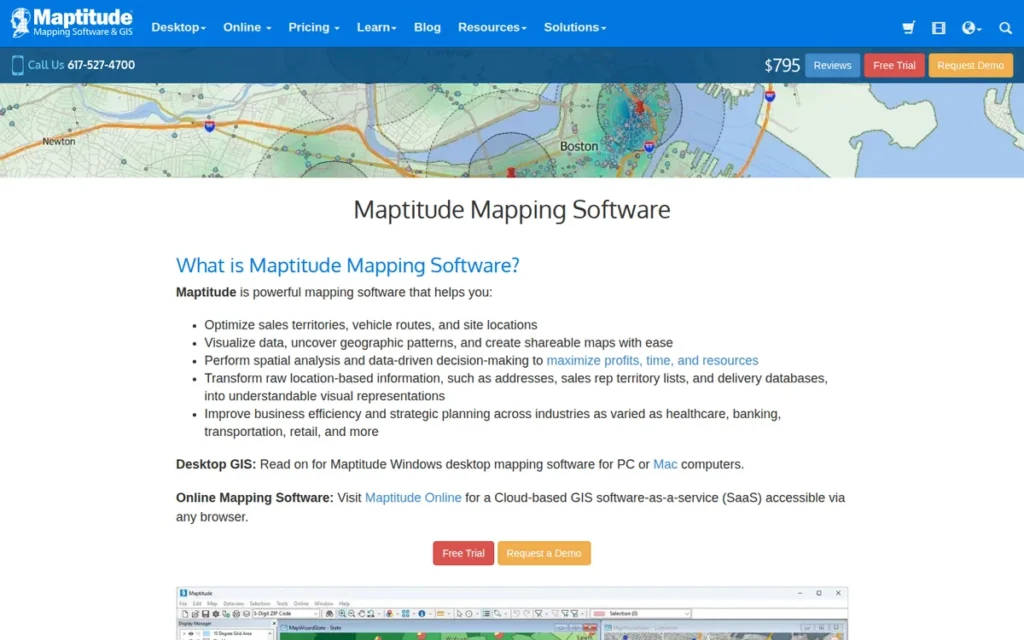
Category: Desktop Business GIS, a professional-grade desktop geographic information system that bundles U.S. geodemographic data with advanced spatial analysis, territory management, routing, and site selection tools in both subscription and one-time purchase license options, designed for business analysts and consultants who need GIS depth at the lowest total cost of ownership.
At a Glance
- Category: Desktop Business GIS
- Best For: Business analysts, GIS consultants, retail strategists, franchise development managers, and sales operations professionals who need professional-grade territory management, site selection, and U.S.-focused demographic analysis, particularly those who want the lowest total cost of ownership without a recurring subscription dependency
- Price Range: Annual subscription ~$795/year OR one-time purchase ~$1,095 (10-year license, no annual renewal required); both options include bundled U.S. country data package (~$695 standalone value); student/educator license free (verified May 2026, at caliper.com/maptpric.htm)
- Primary Strength: Maptitude delivers G2 Highest Performer-rated spatial analysis (including 1-billion-record capacity, drive-time routing, Huff model trade area analysis, and redistricting) with bundled U.S. geodemographic data at pricing that produces the lowest three-to-five year total cost of ownership for U.S.-focused business GIS workflows in this evaluation
- Biggest Limitation: Maptitude is a desktop-first application with limited real-time collaboration features and no native integration with cloud data warehouses or CRM platforms, constraining utility for teams with cloud-pipeline-dependent data infrastructure or distributed remote-work collaboration requirements
- One-Line Summary: Maptitude is the G2 Highest Performer in Location Intelligence (2026), offering professional-grade GIS capabilities (including 1-billion-record spatial analysis, drive-time routing, and Huff model trade area modeling) bundled with U.S. geodemographic data in pricing starting at ~$795/year or ~$1,095 one-time.
- Last Verified: May 2026
Overview
Maptitude is a professional-grade desktop GIS software by Caliper Corporation, a Massachusetts-based company founded in 1983 with over 40 years of independent operation. Maptitude ships with a bundled U.S. geographic and demographic data package included in its license price, eliminating the separate data subscription costs that Esri ArcGIS, CARTO, and cloud platforms require.
Maptitude holds the G2 Highest Performer designation in the Location Intelligence category (2026), specifically awarded to products with the best user review scores relative to their market visibility. Maptitude also holds SoftwareReviews Champion status with a reported Net Emotional Footprint Score among the highest in the GIS category (per Caliper press release, April 2025, verify current score at softwarereviews.com).
Maptitude’s topology-based spatial engine handles datasets exceeding 1 billion records and supports unlimited geocoding, drive-time analysis, hierarchical territory management at any number of levels, Huff model gravity analysis for trade area and market share modeling, redistricting, and 3D visualization.
Key Features
- Bundled U.S. Country Data Package: Maptitude includes a bundled U.S. country data package (street network, census demographics, boundary files, and unlimited geocoding) in its base license price at both the subscription and one-time purchase tiers, eliminating the separate data subscriptions that Esri ArcGIS’s Living Atlas, CARTO’s Data Observatory, and Mapbox’s commercial data layers require at additional annual cost.
- Topology-Based Spatial Engine (1B+ Records): Maptitude’s topology-based spatial engine handles datasets exceeding 1 billion records and supports drive-time ring and polygon creation, truck routing optimization, and Huff model gravity analysis for trade area and retail market share modeling, a capability a GIS expert with 30 years of industry experience cited as superior to Esri ArcGIS’s geometry-based approach for routing tasks (r/gis, 2024).
- Hierarchical Territory Management: Maptitude’s territory management system supports hierarchical territory structures with any number of levels, automatic balancing around sales targets, headcount, or population density, and visual overlay of performance KPIs and demographic variables directly on the territory map.
- Unlimited Geocoding (Included in Base Price): Maptitude provides unlimited geocoding included in the base license price at both pricing tiers, eliminating the per-transaction geocoding costs that Mapbox and Precisely charge at volume and that accumulate significantly for address-intensive business workflows.
- Free Student and Educator License: Maptitude offers a free license for students and educators at all levels, eliminating cost entirely for academic users and building long-term platform advocacy through GIS curriculum pipelines without requiring credit card sign-up.
Best For
Maptitude is best for business analysts, GIS consultants, retail strategists, franchise development managers, and sales operations professionals who primarily work with U.S. data and need professional-grade territory management, site selection, and demographic analysis.
Maptitude is particularly well-suited to teams that cannot justify enterprise GIS licensing costs and need the lowest three-to-five year total cost of ownership with predictable, non-recurring expenditure.
Pricing
Maptitude is available in two pricing structures (both verified May 2026, at caliper.com/maptpric.htm):
- Annual subscription: approximately $795/year, including one bundled U.S. country data package update annually
- One-time purchase: approximately $1,095 (10-year license, no annual renewal required), including one bundled U.S. country data package (~$695 standalone value)
For a team planning to use Maptitude for 3 or more years, the one-time $1,095 purchase produces lower total cost of ownership than three annual subscriptions ($2,385 total). Optional annual upgrade licenses are available for updated geographic and demographic data. A free Maptitude license is available for students and educators at qualifying institutions.
Strengths
- Maptitude earned the G2 Highest Performer designation in the Location Intelligence category (2026) (specifically awarded to products with the best user review scores relative to their market presence) alongside SoftwareReviews Champion status with a reported Net Emotional Footprint Score among the highest documented across GIS platforms (per Caliper press release, April 2025).
- A GIS professor with 30 years of cross-platform teaching experience stated: “Everything I used to teach on ArcGIS I now do on Maptitude. Plus the user experience is so much more streamlined on Maptitude compared to Arc. Maptitude is definitely the way to go for business today” (r/gis, 2024), credible comparative evidence from a domain expert with sustained Esri ArcGIS experience across decades of GIS instruction.
- A GIS consultant with 30+ years of industry experience confirmed: “Maptitude is the most user friendly, hands down! My students can perform complex GIS operations like truck routing or redistricting when others software users are still learning about the difference between shapefiles” (r/gis, 2024), directly quantifying Maptitude’s learning curve advantage over Esri ArcGIS for business GIS workflows with a concrete skill-gap comparison.
- Caliper Corporation was founded in 1983 and has operated independently for over 40 years without external acquisition, delivering the most stable vendor continuity profile among all non-enterprise platforms in this evaluation, with zero acquisition risk from the corporate ownership changes that disrupted Precisely MapInfo Pro’s product investment trajectory.
Limitations
- Desktop-First Architecture: Maptitude’s most consequential trade-off is its desktop-first architecture, Maptitude is designed for local installation with limited native integration with cloud data warehouses (BigQuery, Snowflake, Databricks), CRM platforms (Salesforce, HubSpot), or real-time multi-user collaboration tools. Maptitude also lacks a native API for embedding spatial outputs in CRMs or BI dashboards (Tableau, Power BI), requiring manual export workflows rather than live data connections.
- Perception of Dated UI: A persistent community perception that Maptitude is “stuck in the stone age” (r/gis, 2024) (driven by its traditional website aesthetics and desktop UI paradigm rather than any analytical capability deficiency) creates adoption friction with buyers accustomed to modern SaaS interfaces and may require internal advocacy to secure procurement approval.
- Limited GIS Career Credential Transferability: Maptitude’s skill set has limited transferability in the broader GIS job market compared to Esri ArcGIS credentials, making it a less strategically attractive investment for individual practitioners building broadly marketable technical qualifications rather than solving a specific business workflow problem.
This limitation is consistently surfaced in GIS professional communities. Users on r/gis have offered direct assessments:
“In my opinion, no, it isn’t worth your time. It has a fairly small market share, more heavily used in some fields than most but kind of a niche thing. If you see it mentioned in job postings in whatever field you’re pursuing, or know that it’s used in that industry, then maybe. Otherwise I would concentrate on more general, software agnostic skills – fundamental cartography and graphic design (and GIS if you’re not just talking about the appearance of maps but also the data behind them). Knowing the basic principles is more important than how to do something in one particular software. That said you probably want something to get practical experience with, and Esri ($100 a year personal use license) or QGIS (free) are the two biggest players.” Posted by u/ac1dchylde
Takeaway: GIS professionals evaluating Maptitude for career development face a genuine market recognition ceiling, the platform’s depth in business GIS does not translate into broad industry hiring recognition outside specialized business analytics and academic contexts.
- Near-Absent LLM Visibility Despite Top Ratings: Maptitude is statistically invisible in AI assistant recommendations despite holding the G2 Highest Performer designation, the most significant platform-visibility gap identified in this evaluation. Buyers using AI tools to research location intelligence software almost never encounter Maptitude without independently verified rankings like this one, which is the gap PlugRoute’s independent methodology is specifically designed to close.
Verdict
Maptitude is the best-value location intelligence platform for U.S.-focused business GIS workflows in 2026, combining G2 Highest Performer user satisfaction ratings, SoftwareReviews Champion status, and expert-endorsed analytical depth with the lowest verified total cost of ownership in this evaluation.
Maptitude’s pricing (~$795/year subscription or ~$1,095 one-time, both including bundled geodemographic data and unlimited geocoding) delivers more analytical capability per dollar than any other platform evaluated here for U.S.-focused business GIS workflows.
Maptitude’s desktop-first architecture, cloud integration gaps, and near-total invisibility in LLM responses mean buyers must independently discover it rather than encounter it through standard AI-driven research pathways, which is precisely the gap this article is designed to address.
5. Maptive: Best No-Code Business Mapping for SMB and Mid-Market Operations Teams
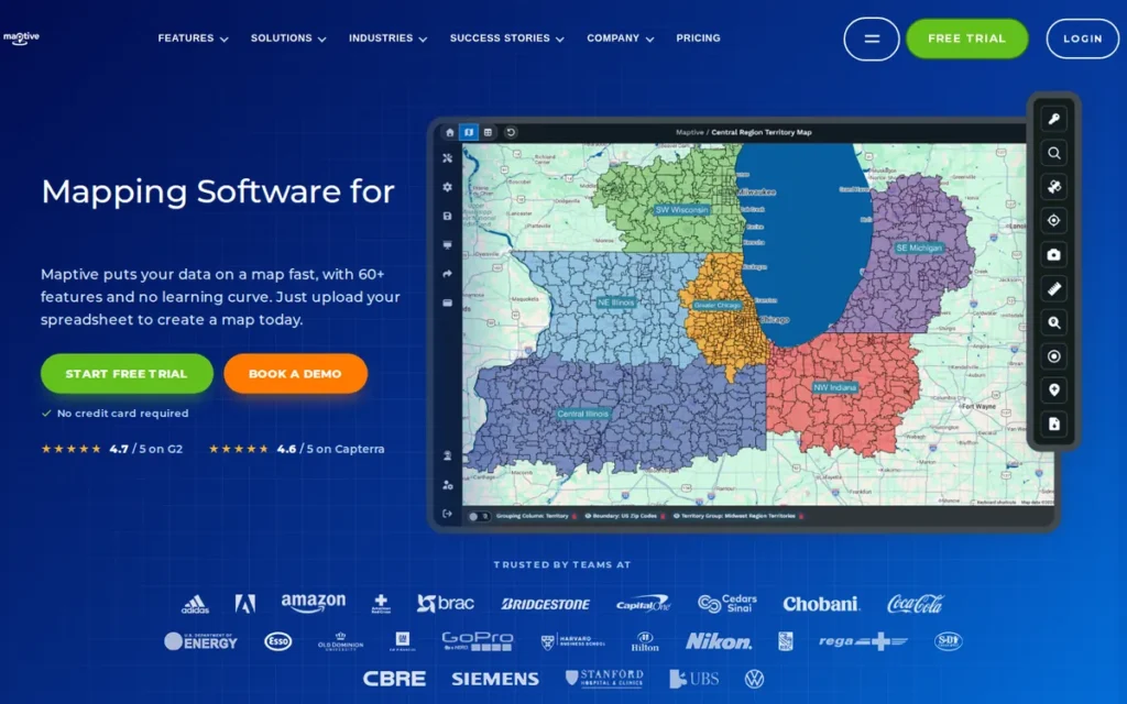
Category: No-Code Business Mapping, a browser-native, installation-free mapping platform that converts spreadsheet data into interactive maps, territory visualizations, heat maps, and route-optimized plans without requiring GIS knowledge or technical infrastructure management.
At a Glance
- Category: No-Code Business Mapping
- Best For: SMB and mid-market sales operations teams, logistics coordinators, field service managers, and marketing analysts who need to visualize location data, manage territories, and optimize routes from spreadsheet data, without GIS expertise, software installation, or IT involvement
- Price Range: Tiered SaaS subscription; free trial available; specific plan pricing requires direct visit to maptive.com/pricing, exact amounts not confirmed in verified third-party sources as of May 2026
- Primary Strength: Maptive delivers 60+ business mapping features: including WebGL-rendered high-volume marker capacity, AI-powered territory optimization, drive-time polygon analysis, and 50+ U.S. Census demographic overlays, in a zero-installation browser interface with verified named deployments at Amazon, GE, Coca-Cola, and the U.S. Department of Energy (per Maptive marketing materials)
- Biggest Limitation: Maptive’s entire map tile delivery, geocoding, POI data, and base data accuracy depend on Google Maps Platform API infrastructure, meaning Google’s pricing decisions, API terms changes, and coverage choices directly determine Maptive’s cost trajectory and data quality in ways entirely outside Maptive’s own product control
- One-Line Summary: Maptive is the highest-ranked no-code business mapping platform in this evaluation, combining WebGL-rendered high-volume marker capacity, AI-powered territory optimization introduced March 2025, and 60+ analysis features in a zero-installation browser interface with verified named deployments at Amazon, GE, Coca-Cola, and the U.S. Department of Energy (per Maptive marketing materials).
- Last Verified: May 2026
Overview
Maptive is a cloud-based, browser-native business mapping platform built on Google Maps infrastructure. Maptive enables sales operations teams, logistics coordinators, field service managers, and marketing analysts to convert spreadsheet data into interactive maps, territory visualizations, heat maps, and optimized routes without GIS expertise, software installation, or IT department involvement.
Maptive was designated #1 Best Online Mapping Software in January 2025 by an independent software ranking and counts Amazon, GE, Coca-Cola, and the U.S. Department of Energy among its named clients per Maptive’s own marketing materials.
Maptive’s March 2025 iQ update introduced WebGL rendering for high-volume simultaneous markers without browser degradation and AI-powered territory optimization that reduces large-scale realignment from hours to under one hour (Ottawa Life, 2025).
Important capacity note: Maptive’s white paper states WebGL rendering capacity of 200,000+ markers, while Maptive’s FAQ page specifies a limit of 100,000 locations per map (both sources: Maptive, 2025–2026). Buyers with datasets exceeding 100,000 locations should verify current capacity limits directly with Maptive before purchase, as this internal documentation discrepancy could not be resolved from public sources at time of publication.
Key Features
- WebGL High-Volume Marker Rendering (March 2025): Maptive’s WebGL rendering engine, introduced in the March 2025 iQ update, supports high-volume simultaneous map markers without browser performance degradation, enabling large-scale data visualization that previously required desktop GIS software; buyers should confirm the maximum capacity directly with Maptive before purchase (white paper: 200,000+; FAQ: 100,000-location limit).
- AI-Powered Territory Optimization (March 2025): Maptive’s territory management tool supports automatic territory creation using ZIP codes, U.S. Census boundaries, or custom-drawn polygons, with AI-powered optimization introduced in March 2025 that reduces large-scale territory realignment from hours to under one hour (Ottawa Life, 2025).
- Heat Maps and 50+ U.S. Census Demographic Overlays: Maptive includes heat mapping weighted by sales volume, customer density, or demographic variables, plus overlay support across 50+ U.S. Census variables, enabling marketing analysts and sales operations teams to perform spatial market analysis without GIS software expertise.
- Route Optimization (73 Stops): Maptive’s route optimization supports up to 73 stops with configurable delivery windows, enabling logistics coordinators and field service managers to build optimized daily drive schedules from customer spreadsheet data without dedicated routing software.
- Drive-Time Polygon Analysis: Maptive’s drive-time polygon analysis was confirmed up to 4 hours at the March 2025 iQ launch; Maptive reported an 8-hour extension as planned for late 2025, verify current capability at maptive.com before purchase if extended drive-time range is required for your use case.
Best For
Maptive is best for SMB and mid-market sales operations teams, field service coordinators, logistics managers, and marketing analysts who need to visualize and act on location data from spreadsheets without GIS staff, software installation, or technical development resources.
Maptive is particularly suited to U.S.-based territory management, route optimization,and customer proximity analysis workflows where zero-install browser access is a priority.
Pricing
Maptive operates on a tiered SaaS subscription model with a free trial available. Specific plan pricing for Individual, Team, Business, and Enterprise tiers was not confirmed in verified independent third-party sources at the time of this research (May 2026).
Visit maptive.com/pricing directly for current subscription costs. Confirm annual versus monthly billing options and verify data volume capacity limits (see capacity note in Overview above) before committing to any plan.
Strengths
- Maptive was designated #1 Best Online Mapping Software in January 2025 by an independent software ranking. Maptive’s named enterprise client list (per Maptive’s own white paper) includes Amazon, GE (General Electric), Coca-Cola, and the U.S. Department of Energy, providing cross-sector validation that Maptive’s no-code architecture handles both SMB and Fortune 500-scale operational requirements (Maptive White Paper, 2025).
- Maptive’s WebGL rendering upgrade, introduced in the March 2025 iQ update, enables high-volume simultaneous map markers without browser degradation, a technically verified capability that surpasses competing no-code tools such as BatchGeo, which experiences significant performance degradation above 30,000–50,000 data points (Ottawa Life, 2025).
- Maptive reported 99.9% uptime with zero major outages in 2025, operating on Google Maps Platform infrastructure for global tile delivery, providing enterprise-grade reliability benchmarks per Maptive’s self-reported infrastructure data (Maptive White Paper, 2025).
- Community user testimonials document specific operational outcomes: including territory realignment completing “in minutes” and successful heat mapping of “thousands of electric vehicle distribution points” that “made complex data patterns immediately comprehensible”, consistent with Maptive’s category-level claims of operational efficiency gains (SpaceCoast Daily, 2025).
Limitations
- Google Maps API Structural Dependency: Maptive’s most consequential trade-off is its structural dependency on Google Maps Platform API. All map tile delivery, geocoding accuracy, POI data, and base map coverage are sourced from Google’s infrastructure, meaning Maptive’s map quality, data accuracy, and pricing trajectory are determined entirely by Google’s API licensing decisions rather than Maptive’s own product choices, creating a vendor-within-a-vendor risk for any long-term infrastructure commitment.
- Capacity Documentation Discrepancy: Maptive’s white paper states WebGL rendering capacity of 200,000+ markers while Maptive’s FAQ page specifies a limit of 100,000 locations per map (both: Maptive, 2025–2026). Maptive could not resolve this internal documentation contradiction from public sources at time of publication, buyers with datasets exceeding 100,000 locations must verify current capacity limits directly with Maptive before purchase to avoid implementation failures.
- Corporate Transparency Gaps: Maptive publicly discloses no founding date, founder names, employee count, or corporate background, creating due-diligence opacity that enterprise procurement teams should resolve through direct vendor inquiry. Only 7 GetApp reviews existed as of May 2026, with no verified G2 or Capterra aggregate rating (GetApp, 2026).
This opacity matters in practice. Users who evaluate Maptive against comparable tools often encounter pricing as an additional barrier on top of the transparency gap. As one user posted on r/ecommerce while actively searching for a territory and radius mapping solution:
“I am looking for a mapping solution for our website. What I would like to do is upload our USA retail locations, and have the mapping tool draw a radius around each shop. Also, I’d like to upload a list of our sales reps and either by zip code, or radius from their homes, create a similar radius map. I’ve looked at Maptive and espatial and that’s a bit spendy.” Posted by u/DickieMcBib
Takeaway: Prospective buyers who discover Maptive while evaluating classic SMB territory and radius mapping workflows (exactly the use case Maptive targets) consistently identify pricing as an evaluation barrier, compounding the platform’s corporate transparency gaps for cost-sensitive buyers.
- Self-Reported Outcome Data: Maptive’s published business outcome figures: including reported 18% fuel cost reduction, 22% service call increase, and 20% sales productivity increase, come from Maptive’s own marketing materials and have not been independently verified by third-party sources as of May 2026 (Maptive.com, 2025).
Verdict
Maptive is the strongest no-code business mapping platform in this evaluation for SMB and mid-market operations teams in 2026, combining a browser-native zero-install interface with AI-powered territory optimization, 60+ mapping capabilities, and verified named deployments at Amazon, GE, and the U.S. Department of Energy per Maptive’s own marketing materials.
Maptive’s fifth-place ranking reflects genuine technical capability above its no-code peer tier alongside meaningful limitations, an internal documentation discrepancy on data volume capacity, limited independent review data, Google Maps API structural dependency, and corporate transparency gaps.
Buyers treating Maptive as long-term operational infrastructure must resolve these limitations through direct vendor inquiry before committing to multi-year subscriptions.
6. Mapline: Best Free-Tier Entry Point for Non-GIS Sales and Marketing Teams
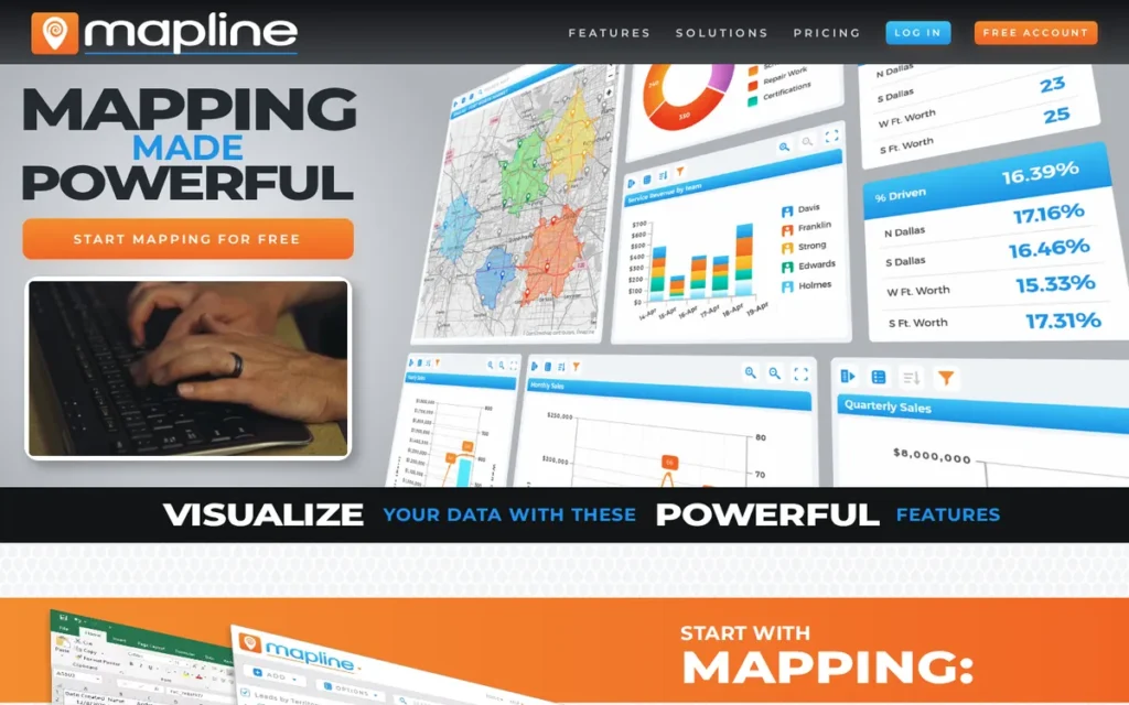
Category: No-Code Business Mapping, a browser-based, no-install mapping platform converting spreadsheet data into interactive maps, territory visualizations, and shared dashboards for non-GIS sales and marketing teams, with a free-tier entry point and a paid upgrade path for advanced analytics and route optimization.
At a Glance
- Category: No-Code Business Mapping
- Best For: Sales operations coordinators, marketing analysts, and field teams who need to visualize customer locations, manage performance-driven territories, and share spatial dashboards without GIS expertise, and who want to evaluate no-code mapping before committing any subscription budget
- Price Range: Free plan available with core features; paid tiers unlock route optimization, advanced territory management, and team collaboration, specific pricing requires visit to mapline.com/pricing (2026)
- Primary Strength: Mapline provides a functional free tier enabling non-GIS business teams to map up to 100,000 customer locations, create performance-driven territories, and share interactive dashboards without GIS expertise, technical setup, or upfront payment, the most accessible cost-free entry point in this evaluation
- Biggest Limitation: Mapline has no verified aggregate ratings on major independent review platforms (G2, Capterra, or Trustpilot as of May 2026) and discloses no corporate background, creating due-diligence opacity that limits buyer confidence relative to every other platform in this evaluation
- One-Line Summary: Mapline is a no-code business mapping platform with a genuine free tier enabling sales and marketing teams to map 100,000 locations, auto-generate performance-driven territories, and embed interactive dashboards without GIS expertise or upfront software cost.
- Last Verified: May 2026
Overview
Mapline is a no-code, browser-based business mapping platform that converts Excel and CSV spreadsheet data into interactive maps, territory visualizations, heat maps, and sales dashboards without GIS training, coding, or software installation. Mapline targets sales operations coordinators, marketing analysts, and field operations teams who work primarily in spreadsheets and need spatial context without a GIS department or paid software budget.
Mapline offers a free plan with core mapping and territory creation features, with paid upgrade tiers unlocking route optimization, advanced territory management, automation, and team collaboration. Mapline is the most cost-accessible entry-level platform in this evaluation for teams beginning their spatial analysis journey without budget commitment.
Mapline’s founding date, leadership team, employee count, and funding history are not publicly disclosed. Mapline has no verified aggregate ratings on major independent review platforms as of May 2026.
Key Features
- Free-Tier Pin Mapping (Up to 100,000 Locations): Mapline’s drag-and-drop import converts Excel and CSV files with up to 100,000 location data points into interactive map pins with custom styling, grouping, and filtering controls, requiring no database setup, API keys, or technical configuration beyond the spreadsheet the user already maintains.
- Performance-Metric Territory Auto-Generation: Mapline’s territory management system enables automatic boundary generation around business metrics (revenue targets, headcount allocation, customer count, or population density) with real-time KPI and demographic variable overlay directly on the territory map for visual performance analysis.
- Heat Mapping and Proximity Search: Mapline includes heat mapping, proximity search, and clustering tools that enable marketing analysts to visualize market saturation, competitor proximity, and customer density from the same spreadsheet data already used for territory management, without a separate analytics platform or GIS tool.
- Route Optimization (Paid Tiers): Mapline’s route optimization feature, available in paid tiers, supports multi-stop routing with delivery window constraints, though Mapline does not publicly document a maximum stop count, unlike Maptive’s confirmed 73-stop limit, making capacity evaluation for logistics-heavy workflows difficult without entering a paid subscription first.
- Dashboard Embedding and Live Filtering: Mapline’s dashboard embedding and live filtering capabilities allow spatial insights to be shared with non-mapping stakeholders as interactive embeds in reports and client deliverables, extending analytical output beyond the Mapline interface without requiring stakeholder platform access or training.
Best For
Mapline is best for sales operations coordinators, marketing analysts, and non-GIS field teams who need to visualize customer locations and territory performance from spreadsheet data, want a free-tier evaluation before committing subscription budget, and do not require the analytical depth, data volume capacity, vendor transparency, or independent review validation of higher-ranked platforms in this evaluation.
Pricing
Mapline offers a free plan with core pin mapping, basic territory creation, and map sharing available without a credit card requirement (2026).
Paid tiers unlock route optimization, advanced territory management, analytics dashboards, and team collaboration. Specific monthly and annual pricing was not confirmed in verified independent third-party sources at the time of this research.
Visit mapline.com/pricing directly for current plan costs. The free plan is a genuine evaluation starting point, use it to validate whether location mapping creates actionable value for your workflow before engaging with paid tier pricing.
Strengths
- Mapline’s free tier provides genuine core functional value: territory creation, pin mapping up to 100,000 locations, and map sharing, without requiring a credit card or subscription, enabling entirely risk-free evaluation that no other platform in this evaluation offers at comparable territory management depth at zero cost commitment.
- Mapline’s territory management system enables automatic boundary generation around business performance metrics (sales targets, headcount, customer density) directly serving the most common use case for non-GIS sales operations teams who need territories aligned to business outcomes rather than static geographic boundaries.
- Mapline’s territory performance overlay system displays live sales KPIs, demographic variables, and headcount metrics directly on territory boundaries, providing non-GIS sales operations teams with visual market analysis that previously required a dedicated GIS analyst or BI tool, closing the gap between spreadsheet data and spatial strategy without a GIS learning curve.
- Mapline’s dashboard embedding capability allows spatial analysis outputs to be shared with stakeholders who will never use Mapline directly, enabling spatial insights to reach decision-makers through existing reporting channels rather than requiring organizational adoption of a new mapping platform.
Limitations
- Absent Independent Review Data: Mapline’s most consequential trade-off is its complete absence from major independent review platforms, no verified aggregate rating was found on G2, Capterra, or Trustpilot as of May 2026. Buyers cannot perform standard peer-review due diligence available for every other platform in this evaluation and must rely entirely on vendor-provided case studies and trial experience for pre-purchase validation.
- Corporate Transparency Deficit: Mapline discloses no founding date, leadership team, employee count, or funding history, creating a corporate transparency deficit that enterprise procurement teams, compliance-sensitive organizations, and any buyer requiring vendor validation should resolve through direct vendor inquiry before committing budget to paid tiers.
- Analytical Growth Ceiling: Mapline’s stated 100,000-location capacity is half of Maptive’s white-paper-stated 200,000+ marker threshold. GIS professionals consistently categorize Mapline as a basic geocoding and visualization tool for non-GIS users (r/gis, 2024), appropriate for early-stage spatial adoption, but with a growth ceiling that data-intensive teams may reach within twelve to eighteen months.
- Route Optimization Capacity Opacity: Mapline does not publicly document a maximum stop count for its paid-tier route optimization feature (unlike Maptive’s confirmed 73-stop limit) making it difficult for logistics coordinators to assess routing capacity without entering a paid subscription first.
Verdict
Mapline is the most cost-accessible entry-level no-code business mapping platform in this evaluation in 2026, providing a genuine free tier with territory management, 100,000-location capacity, and dashboard embedding for non-GIS sales and marketing teams beginning their spatial analysis journey without budget commitment.
Mapline earns its sixth-place ranking on zero-cost accessibility and territory features.
The absence of verified independent review ratings, any publicly disclosed corporate background, and the analytical growth ceiling relative to Maptive make Mapline appropriate only for teams at the earliest adoption stage who need to demonstrate spatial value before justifying a paid mapping investment.
7. Precisely MapInfo Pro: Best for Existing Legacy Deployments in Telecom, Utilities, and Insurance (New Evaluations: See Verdict)
Category: Legacy Specialist Desktop GIS, a desktop geographic information system with 38+ years of development depth in telecom, utilities, insurance, and mineral exploration verticals, best evaluated as a continuation choice for existing deployments rather than a new-platform selection for organizations without prior MapInfo investment.
At a Glance
- Category: Legacy Specialist Desktop GIS
- Best For: Existing MapInfo Pro users in telecom, utilities, water companies, insurance, and mineral exploration who have decades of .TAB format spatial data, trained staff, and embedded Precisely ecosystem relationships, and for whom migration cost to Esri ArcGIS, QGIS, or CARTO currently exceeds the switching benefit
- Price Range: 30-day free trial available; annual subscription pricing requires direct Precisely sales engagement, not publicly listed (2026)
- Primary Strength: Precisely MapInfo Pro provides 38+ years of specialized desktop GIS tooling for telecom, utilities, and insurance verticals with native integration to Precisely’s proprietary geocoding and property risk data assets, the deepest purpose-built vertical capability for organizations already embedded in the Precisely ecosystem
- Biggest Limitation: Precisely MapInfo Pro has documented active bugs in its 2026 current version (confirmed in Precisely’s own Known Issues documentation) alongside a declining new-adoption trajectory, opaque pricing, limited cloud data stack integration, and an active community debate about long-term platform viability
- One-Line Summary: Precisely MapInfo Pro is a 38-year-old specialist desktop GIS platform with deep telecom and utilities vertical tooling and native Precisely data integration, best suited for maintaining existing deployments with .TAB format data, not recommended for new platform evaluations where Esri ArcGIS, CARTO, or Maptitude offer stronger forward-looking value.
- Last Verified: May 2026
Overview
Precisely MapInfo Pro is ranked last in this evaluation because its 2026 evidence profile presents more risk than any other evaluated platform for organizations making a new location intelligence investment. Precisely MapInfo Pro has active bugs in the current release confirmed in Precisely’s own Known Issues documentation, a declining adoption trajectory, opaque pricing, limited modern data stack integration, and an unresolved community debate captured in an active r/gis thread titled “Is MapInfo dead?”
Precisely MapInfo Pro is a desktop-first GIS software originally released in 1986 by MapInfo Corporation, acquired by Pitney Bowes in 2007, and transferred to Precisely upon its 2019 spin-off. Precisely MapInfo Pro specializes in thematic mapping, spatial querying, drive-time analysis, 3D visualization, and data enrichment for enterprise clients in telecom, utilities, insurance, real estate, and mineral exploration.
Precisely MapInfo Pro remains a defensible continuation choice for organizations with existing .TAB format spatial data and MapInfo-trained GIS staff, where migration costs to Esri ArcGIS or QGIS genuinely exceed the switching benefit at this time.
Key Features
- Specialist Vertical GIS Tooling (38+ Years): Precisely MapInfo Pro provides thematic mapping (choropleth, pie and bar chart overlays, graduated symbols), SQL-based spatial querying, drive-time analysis, and point-in-polygon operations for telecom network planning, utility infrastructure mapping, and insurance risk territory modeling, with over 38 years of vertical-specific feature accumulation (GIS Geography, 2025).
- Precisely Data Integrity Suite Integration: Precisely MapInfo Pro integrates natively with Precisely’s Data Integrity Suite, connecting to Precisely’s proprietary geocoding services, address validation, property risk data, and spatial APIs within a single vendor relationship for organizations already using Precisely’s broader data quality and enrichment products (Precisely MapInfo Pro Data Sheet, 2023).
- 3D Visualization (OpenGL with Elevation Z/M Values): Precisely MapInfo Pro supports 3D visualization with OpenGL rendering and elevation Z and M coordinate value support, enabling geologists and mineral exploration teams to visualize subsurface data at documented cost savings relative to specialist standalone 3D geology packages, per a Pelican GeoGraphics case study (GeoWeekNews, 2023).
- MapBasic Scripting Environment: Precisely MapInfo Pro’s MapBasic scripting environment enables workflow automation and custom tool development for legacy data processing workflows, though Precisely’s own 2025–2026 Known Issues documentation confirms MapBasic compatibility errors with third-party tools in the current release version.
- Active User Community: Precisely MapInfo Pro maintains an active user community at community.precisely.com supporting the installed base in UK utilities, water companies, and telecom, though a 2026 user reported being banned from the forum after persistently submitting bug reports for the current version (r/gis, 2026).
Best For
Precisely MapInfo Pro is best for existing users in UK utilities, water companies, telecom, insurance, and mineral exploration organizations that have decades of .TAB format spatial data, MapInfo-trained GIS staff, and established Precisely ecosystem relationships.
Precisely MapInfo Pro is not recommended for organizations evaluating location intelligence platforms without an existing MapInfo investment. New evaluators should assess Esri ArcGIS, CARTO, or Maptitude instead.
Pricing
Precisely MapInfo Pro offers a 30-day free trial. Annual subscription and perpetual license pricing is not publicly listed, requiring direct engagement with Precisely’s sales team or an authorized reseller such as CDR Group in the UK (r/gis, 2026).
A “MapInfo Basic” entry tier is referenced for lower-complexity users.
Given Precisely MapInfo Pro’s documented declining new-adoption trajectory, organizations evaluating it should request a clear multi-year product roadmap commitment (specifically a feature development schedule and investment commitment) alongside pricing, before committing to any renewal or new deployment.
Strengths
- Precisely MapInfo Pro has been in continuous active development since 1986: 38+ years, with deep vertical-specific GIS tooling for telecom, utilities, insurance, and mineral exploration built across multiple product generations, representing specialized industry knowledge that newer and more generalist platforms have not yet replicated for these specific workflow contexts.
- A documented case study from Pelican GeoGraphics (GeoWeekNews, 2023) confirms that Precisely MapInfo Pro’s 3D visualization enables geologists to analyze mineral exploration data “in greater detail” at “a fraction of the cost of some of the more specialist standalone packages”, providing verified cost-efficiency evidence for mineral exploration clients evaluating the platform against purpose-built alternatives.
- Precisely MapInfo Pro’s native integration with the Precisely Data Integrity Suite provides access to Precisely’s proprietary geocoding accuracy and property risk datasets within a single vendor relationship, a relevant differentiator for organizations already using Precisely’s data quality and enrichment products as part of a broader enterprise data infrastructure contract.
Limitations
- Active Bugs and Poor Vendor Responsiveness in 2026: Precisely MapInfo Pro’s most consequential trade-off is its documented platform quality issues in the current release. Precisely’s own published Known Issues documentation confirms unresolved problems including 3D shape clipping failures, heat map generation delays exceeding 15 minutes, UTF-16 export encoding errors on re-import, startup licensing failures, and MapBasic third-party tool compatibility errors (Precisely Help Center, MapInfo Pro Known Issues, verified 2025–2026). A 2026 user reported being banned from the Precisely community forum after repeatedly posting bug reports, describing the platform as “slow and buggy” in the current version (r/gis, 2026). For an enterprise GIS platform charging subscription pricing, officially acknowledged unresolved current-version bugs represent a serious renewal risk signal.
- Declining Adoption Trajectory: The r/gis community’s multi-year “Is MapInfo dead?” debate confirms that new GIS professionals are consistently trained on Esri ArcGIS or QGIS rather than Precisely MapInfo Pro, steadily shrinking the talent and community ecosystem that sustains platform viability. A GIS veteran summarized the community consensus: “Pitney Bowes killed any chance MapInfo had by treating it like a cash register or business machine. They didn’t understand the GIS market one bit” (r/gis, 2025).
- Proprietary .TAB Format Lock-In: Precisely MapInfo Pro’s proprietary .TAB data format protects existing users from high migration cost but actively disqualifies the platform for any new adopter without existing .TAB data. A practical test: if your GIS analyst can export all .TAB files to Shapefile or GeoJSON in one working day, migration is manageable; if doing so requires a consultant estimate and a multi-month project plan, the lock-in is real and costly. For most new adopters in 2026, no compelling format reason exists to begin using the .TAB format when open standards including GeoJSON, Shapefile, PostGIS, and GeoParquet are widely available.
- Opaque Pricing and Limited Modern Integration: Precisely MapInfo Pro requires enterprise sales engagement for all pricing information, carries limited cloud data warehouse connectors, has minimal CRM integration, and was subject to documented under-investment during the Pitney Bowes ownership era (2007–2019), a credibility gap that Precisely has not yet fully resolved in the broader GIS practitioner community.
Verdict
Precisely MapInfo Pro is best suited in 2026 for maintaining existing deployments in telecom, utilities, and insurance verticals with established .TAB data investments, not for new platform evaluations where Esri ArcGIS, CARTO, or Maptitude offer stronger forward-looking value without the trajectory uncertainty that Precisely MapInfo Pro currently carries.
Precisely MapInfo Pro’s last-place ranking reflects its 2026 evidence profile for new buyers (officially documented active bugs, declining adoption, opaque pricing, and an unresolved community debate about viability) rather than a dismissal of its 38-year vertical depth.
For any organization currently running Precisely MapInfo Pro, the critical 2026 question is not whether to stay versus leave immediately, but whether the next renewal cycle should trigger a formal migration assessment, with explicit modeling of .TAB format data conversion costs, staff retraining timelines, and workflow re-architecture expenses, before .TAB format data debt and skill concentration make future transition prohibitively expensive.
What Red Flags Should I Watch For When Evaluating Location Intelligence Software?
Five red flags consistently predict buyer regret in location intelligence software evaluations. Watch for: opaque pricing without self-service access, absent independent review ratings, active bugs in the current release with poor vendor responsiveness, proprietary data format lock-in without a migration path, and pricing model mismatch with expected usage volume.
Red Flag #1: Opaque Pricing Without Self-Service Access
When a location intelligence vendor requires a sales call to provide basic pricing, treat it as a signal that the platform targets enterprise buyers with procurement staff, not self-service evaluators.
Request a minimum viable quote and three-year total cost of ownership model before beginning any product trial with Esri ArcGIS, CARTO, or Precisely MapInfo Pro. Pricing opacity is itself meaningful data about a vendor’s target customer profile.
Red Flag #2: No Verified Independent Review Ratings on Major Platforms
A platform’s complete absence from G2, Capterra, Trustpilot, or Peerspot (as observed with Mapline (no verified ratings) and Precisely MapInfo Pro (no verified aggregate score, May 2026)) makes standard peer-review due diligence impossible.
Platforms with no independent review presence require enhanced direct reference customer validation before any purchase commitment. Without third-party data, buyers cannot distinguish genuine user satisfaction from vendor-controlled testimonials.
Red Flag #3: Active Bug Reports in Current Production Version With Poor Vendor Responsiveness
Documented current-version bugs confirmed in Precisely MapInfo Pro’s own Known Issues documentation (Precisely Help Center, 2025–2026), alongside a 2026 user report of being banned from the Precisely community forum for persistent bug reporting (r/gis, 2026), signal inadequate platform investment.
For any enterprise GIS platform charging subscription pricing, a pattern of officially documented unresolved current-release bugs is a credible renewal risk that should trigger escalated due diligence before commitment.
Red Flag #4: Proprietary Data Format Lock-In Without a Documented Migration Path
Proprietary data formats, including Precisely MapInfo Pro’s .TAB format, Esri ArcGIS geodatabase dependencies, and Maptive’s Google Maps Platform API structural reliance, create switching costs that are easy to ignore at initial purchase and expensive to discover at contract renewal.
Platforms that cannot provide a documented, costed migration path to open standards (GeoJSON, Shapefile, PostGIS, GeoParquet) should be evaluated with a five-year lock-in assumption built explicitly into your total cost of ownership model.
Red Flag #5: Pricing Model Mismatch With Expected Usage Volume
Mapbox’s usage-based pricing that begins at zero can escalate to levels developers describe as “crazy expensive” at production scale, a risk that development teams consistently underestimate when prototyping on the free tier before deploying high-traffic consumer applications.
Any platform with usage-based pricing requires pre-commitment traffic volume modeling. Mismatch between your usage trajectory and a platform’s pricing model is the most common source of post-commitment cost shock in this category.
What Questions Should I Ask Before Choosing Location Intelligence Software?
Five questions consistently surface the information that separates suitable platforms from expensive mistakes, covering cloud integration fit, total cost modeling, data portability, team skill alignment, and real-time data requirements.
Question #1: Does This Platform Integrate Natively With Our Existing Cloud Data Warehouse, or Will We Need an ETL Pipeline?
CARTO is the only platform in this evaluation offering true in-warehouse spatial analytics for teams running Snowflake, BigQuery, or Databricks.
Every other platform requires data extraction to a proprietary environment, which means:
- ETL overhead recurs with every data refresh cycle
- Synchronization latency grows with data volume
- Infrastructure costs compound across years of operation
Explicitly cost the ETL burden before selecting a non-native architecture for cloud-warehouse-first organizations.
Question #2: What Is the Three-Year Total Cost of Ownership Including Training, Integration, and Data Licensing?
Licensing fees are rarely the largest TCO component in this category. A directional benchmark for a three-analyst U.S.-focused team:
- Maptitude annual subscription (~$795/yr × 3 = ~$2,385) or one-time purchase (~$1,095)
- Esri ArcGIS organizational subscription: estimated ~$700+/named user/year × 3 users × 3 years = ~$6,300+ (enterprise pricing varies; requires sales quote)
Beyond license costs, calculate:
- GIS staff training or hiring costs (Esri ArcGIS, Precisely MapInfo Pro)
- Developer integration hours (Mapbox)
- SQL-skilled data engineer costs (CARTO)
- Data migration from legacy formats
Request a total cost of ownership estimate (not just a license price) from every vendor before committing.
Question #3: What Is the Cost and Process of Migrating Our Data Away From This Platform if We Need to Switch?
Proprietary formats, Precisely MapInfo Pro’s .TAB, Esri ArcGIS geodatabases, and API dependencies, Maptive’s Google Maps Platform reliance, create switching costs that are easy to ignore at purchase and expensive at renewal.
Request a specific answer on:
- Data export formats supported
- Migration tool availability and cost
- Vendor-provided migration support or partner network
Before committing to any platform with proprietary data storage.
Question #4: Does This Platform Match Our Team’s Existing Technical Skills, or Will We Need to Hire or Train Before Getting Value?
Platform skill requirements vary significantly across this evaluation:
- Esri ArcGIS and Precisely MapInfo Pro require GIS-trained professionals with spatial analysis expertise for effective administration and analysis workflows.
- CARTO requires SQL fluency and practical experience with cloud data warehouse operations (BigQuery, Snowflake, or Databricks) to leverage its in-warehouse architecture.
- Mapbox requires software development skills: specifically JavaScript, iOS, or Android experience, to build and maintain API-powered mapping applications.
- Maptive and Mapline require only spreadsheet skills: any team member who works daily in Excel or CSV files can operate both platforms without GIS or coding training.
Misalignment between a platform’s skill requirements and the team’s current capabilities is the most common cause of location intelligence tool abandonment within the first twelve months of deployment.
Question #5: Do We Need Real-Time IoT Spatial Data, or Will Periodic Batch Analysis on Regular Data Exports Serve Our Needs?
Real-time asset tracking, live sensor feeds, and IoT spatial data streams are supported at meaningful depth only by Esri ArcGIS and Mapbox among evaluated platforms, at corresponding enterprise cost and complexity.
Organizations needing only weekly or monthly spatial analysis on periodic data snapshots can achieve equivalent business outcomes with Maptitude, Maptive, or CARTO at substantially lower cost.
Clarifying this requirement early eliminates the majority of inappropriate candidates from your evaluation.
How Did We Rank These Location Intelligence Software Tools?
Rankings in this article are determined by scoring all seven platforms against six objective criteria: analytical depth, user review evidence, pricing clarity, modern stack integration, ease of use relative to stated audience, and vendor stability.
Evidence is drawn from verified third-party data (G2, SoftwareReviews, Peerspot, Constellation Research, Reddit community threads, and documented case studies) with no sponsored placements or affiliate relationships.
Evaluation Process
The evaluation process proceeded in four sequential steps:
Platform Discovery: We queried multiple AI search engines and GIS professional communities to identify the most frequently recommended and discussed location intelligence platforms, producing a candidate list of seven platforms spanning enterprise GIS, cloud analytics, developer APIs, desktop business tools, and no-code mapping.
Independent Research: For each platform, we gathered information from documented feature sets, vendor data sheets, pricing pages, G2 and Peerspot category designations, SoftwareReviews Champion designations, Constellation Research ShortList appearances, and verified case study outcomes, without contacting any vendor for sponsored briefing or affiliate placement.
Community Sentiment Analysis: We analyzed r/gis, r/webdev, r/androiddev, and r/GoogleMaps threads from 2023–2026 with specific citation and named-user attribution, treating professional community discussions as unfiltered signal on real-world performance that vendor materials cannot replicate.
LLM Coverage Gap Analysis: We queried multiple AI assistant systems for their location intelligence tool recommendations to identify systematic coverage gaps. Maptitude’s near-total absence from all LLM responses despite G2 Highest Performer status is the most consequential gap documented in this evaluation.
Ranking Criteria
C1: Analytical Depth and Validated Capabilities (primary weight): Assessed via documented feature sets, stated data capacity benchmarks, AI-native capability releases with dates, and verified case study outcomes. Depth of analytical function is the primary purpose of the purchase.
C2: User Review Evidence and Community Validation (primary weight): G2 and Peerspot category designations, SoftwareReviews Champion status, Constellation Research ShortList appearances, and documented community sentiment patterns from professional Reddit threads with specific citation and named-user attribution.
C3: Pricing Clarity and Total Cost of Ownership (secondary weight): Scored on public pricing availability, verified pricing data points with year-stamps, and relative three-year TCO estimates. Pricing opacity is the highest-frequency frustration in this category and is itself evaluatively meaningful data about a vendor’s target customer profile.
C4: Modern Data Stack Integration (secondary weight): Documented native integrations with cloud data warehouses, CRMs, BI tools, and IoT platforms. Platforms that integrate with existing infrastructure eliminate ETL overhead and accelerate time-to-insight for data-forward organizations.
C5: Ease of Use Relative to Stated Target Audience (secondary weight): Evaluated using verified user testimonials with named sources, professional community comparisons, and comparison of claimed versus actual user base technical profiles. A steep learning curve is appropriate for GIS professional tools but disqualifying for tools marketed to sales operations teams.
C6: Vendor Stability and Long-Term Risk Profile (secondary weight): Assessed via company founding date and ownership structure, funding history, corporate trajectory signals, data format portability, and evidence of under-investment patterns. Location intelligence platform migration is expensive, the Precisely MapInfo Pro case documents the real financial cost of choosing a platform in organizational decline.
Pricing Model Taxonomy
| Platform | Pricing Model | Self-Service Available? | Verified Price Point |
|---|---|---|---|
| Esri ArcGIS | Complex multi-tier subscription + enterprise custom | Personal Use only (~$100/yr) | ~$100/yr Personal Use (2026) |
| CARTO | Community free + enterprise custom | Community plan only | Enterprise: sales engagement required (2026) |
| Mapbox | Freemium usage-based | Yes; public per-unit rates | Free tier; pay-as-you-go above threshold (2026) |
| Maptitude | Annual subscription OR one-time purchase | Yes | ~$795/yr subscription; ~$1,095 one-time 10-yr license (both verified May 2026 at caliper.com/maptpric.htm) |
| Maptive | Tiered SaaS subscription | Free trial only | Exact plan pricing not confirmed by third parties (2026) |
| Mapline | Free tier + paid SaaS | Free plan only | Paid tier pricing not confirmed by third parties (2026) |
| Precisely MapInfo Pro | Annual subscription (perpetual option) | 30-day trial only | Annual subscription: sales engagement required (2026) |
Directional 5-year TCO comparison (3-analyst team, U.S.-focused territory management): Maptitude annual subscription (~$795/yr × 5 = ~$3,975 including annual data updates) versus Esri ArcGIS Creator license at estimated market rates (~$700/named user/yr × 3 users × 5 years = ~$10,500, before server infrastructure and training costs). Final numbers depend on negotiated enterprise pricing, use as directional benchmark only.
Evidence Weighting
When review platform ratings conflict with Reddit community sentiment, we weight specificity and recency, a detailed 2025 Reddit post with named user attribution and documented deployment history outweighs a generic 2023 G2 review.
Vendor-reported statistics are labeled as such throughout this article. Only claims corroborated by at least one independent source are stated as established fact.
Update Cadence
This article was last fully updated in May 2026. PlugRoute refreshes location intelligence rankings on a rolling basis when major product releases, verified pricing changes, or significant community sentiment shifts are identified.
Independence Statement
PlugRoute has no affiliate relationships with any company listed. Rankings are determined entirely by research data and objective evaluation criteria.
What Do Buyers Most Frequently Ask About Location Intelligence Software?
What Is the Best Location Intelligence Software for Small Businesses in 2026?
Maptive is the best location intelligence tool for small businesses with a paid budget in 2026, delivering territory management, heat mapping, and high-volume marker capacity in a zero-install browser interface without GIS expertise. Mapline is the best free-tier option for small businesses testing spatial analysis value before any subscription commitment, with genuine territory creation and dashboard sharing at zero cost.
Is Maptitude Better Than ArcGIS for Territory Management and Site Selection?
Maptitude outperforms Esri ArcGIS specifically for business-analyst-level territory management and site selection, with G2 Highest Performer designation (2026), pricing starting at ~$795/year or ~$1,095 one-time, and endorsements from GIS experts with 30+ years of cross-platform experience who explicitly switched from Esri ArcGIS. Esri ArcGIS surpasses Maptitude for enterprise deployments requiring multi-department collaboration, real-time IoT data, and international coverage beyond the United States.
How Does PlugRoute Determine Its Software Rankings?
PlugRoute ranks software using six objective criteria (analytical depth, independent review evidence, pricing clarity, modern data stack integration, audience-matched ease of use, and vendor stability) weighted by verified third-party data from G2, Peerspot, SoftwareReviews, Constellation Research, and professional community threads with named user attribution. The platform holds no affiliate relationships with any reviewed company and accepts no sponsored placements or ranking adjustments based on vendor communication.
Glossary: Key Terms Used in This Comparison
In-Warehouse Spatial Analytics: A cloud-native architecture in which spatial analysis functions (including clustering, isochrone generation, trade area modeling, and spatial SQL joins) execute natively inside an organization’s existing cloud data warehouse (such as BigQuery, Snowflake, or Databricks) without requiring data extraction to a separate GIS system. CARTO’s Analytics Toolbox is the primary example of in-warehouse spatial analytics in this evaluation, and it is the key architectural differentiator that separates CARTO from every other platform reviewed here.
Topology-Based Spatial Engine: A GIS computational approach that represents geographic features as topological relationships (shared edges, connected nodes) rather than independent geometry objects, enabling faster and more precise spatial operations for routing, redistricting, and network simulation tasks. Maptitude uses a topology-based engine, which a GIS expert with 30 years of industry experience cited as superior to Esri ArcGIS’s geometry-based approach for business routing and redistricting workflows (r/gis, 2024).
Drive-Time Polygon: A spatial analysis output that defines the geographic area reachable from a given point within a specified travel time, accounting for road network, speed limits, and traffic conditions, used for trade area analysis, retail site selection, service territory definition, and emergency response planning. Maptitude (unlimited drive-time analysis) and Maptive (confirmed up to 4 hours at March 2025 launch, verify current range at maptive.com) both include drive-time polygon generation in their base capabilities.
Net Emotional Footprint Score: A composite satisfaction metric published by SoftwareReviews that measures how users feel about their overall relationship with a software vendor, integrating product capability ratings, vendor responsiveness assessments, and perceived business impact, on a scale from negative to positive values. Maptitude holds SoftwareReviews Champion status with a reported Net Emotional Footprint Score among the highest documented in the GIS and location intelligence category (per Caliper press release, April 2025, verify current score at softwarereviews.com).
Model Context Protocol (MCP) Server: An emerging AI integration standard enabling AI assistants and copilot systems to interact with external tools, including mapping and spatial analysis platforms, through structured, natural language conversational queries. Mapbox, CARTO, and Esri ArcGIS all released or announced MCP Server integrations in 2025, enabling AI agents to control map experiences, execute spatial queries, and return location-aware responses through conversational interfaces, representing a fundamental shift in how non-GIS users interact with location intelligence platforms.
Which Location Intelligence Software Is Right for You?
Key Insights
- In 2026, location intelligence platform selection is primarily a buyer-profile decision, not a product quality decision, Esri ArcGIS, CARTO, Mapbox, and Maptitude are all excellent tools for their respective audiences, and choosing the wrong one reflects a mismatch between the platform’s design assumptions and your team’s actual workflow more than any deficiency in the platform itself.
- Esri ArcGIS is the most analytically capable and institutionally proven location intelligence platform among the seven tools evaluated here in 2026, but its enterprise pricing, steep learning curve, and GIS talent dependency make it the wrong investment for organizations without dedicated GIS staff and enterprise procurement infrastructure.
- CARTO is the strongest choice for cloud data engineering teams running Snowflake or BigQuery, offering the only true in-warehouse spatial analytics architecture in this evaluation, but CARTO’s opaque pricing effectively excludes SMBs and teams without existing cloud data warehouse infrastructure already in production.
- Mapbox is the best developer mapping API for building customizable, consumer-scale location applications, but Mapbox is not an analyst tool and should not be evaluated by business users seeking pre-built spatial workflows rather than API primitives.
- Maptitude holds the G2 Highest Performer designation in Location Intelligence (2026) and SoftwareReviews Champion status despite near-total absence from AI assistant recommendations, making Maptitude the most underrated platform in this evaluation and the strongest value choice for U.S.-focused business GIS at pricing starting at ~$795/year or ~$1,095 one-time.
- Maptive is the strongest no-code mapping option for SMB and mid-market operations teams with paid budgets, combining high-volume WebGL marker rendering, AI territory optimization, and named Fortune 500 client validation, with the Google Maps API dependency risk and capacity documentation discrepancy requiring explicit assessment before long-term commitment.
- Mapline is the correct starting point only for teams at the earliest adoption stage who need to validate spatial analysis value before committing budget, Mapline’s absent review data and corporate opacity make it unsuitable as a long-term platform investment without further due diligence.
- Precisely MapInfo Pro should not be selected for new deployments in 2026: its officially documented active bugs, declining adoption, opaque pricing, and .TAB format lock-in make it appropriate only for organizations maintaining existing investments where migration cost currently exceeds switching benefit.
The most common decision dilemma in this category is Esri ArcGIS versus Maptitude for business GIS. Esri ArcGIS is correct if the organization has a GIS team, an enterprise support contract requirement, multi-department deployment needs, or international operations outside the United States. Maptitude is correct if the organization primarily needs U.S.-focused territory management, site selection, and demographic analysis, and values the lowest total cost of ownership over enterprise ecosystem depth.
The second most common dilemma is Maptive versus Mapline for SMBs. Maptive wins for teams with paid budget and data volumes above 50,000 locations. Mapline wins for teams at the evaluation stage who need to demonstrate spatial value before any financial commitment.
We update this guide quarterly. Last updated: May 2026. For our full evaluation methodology and other independent software comparison guides, visit PlugRoute.