Bentley iTwin is the best infrastructure digital twin software for civil capital programs such as roads, bridges, rail and water. Esri ArcGIS is best for utility and water networks, and Cesium for developer-built city-scale 3D twins. No single tool fits every asset class, so match the product to your data.
“Digital twin” is a vague term. It can mean anything from a 3D viewer to a live operational system. Vendor ROI claims also rarely come with independent, like-for-like benchmarks. This ranking separates those claims from evidence you can check, and every source is dated.
PlugRoute has no affiliate relationships with any company listed. Rankings are determined entirely by research data and objective evaluation criteria.
“This sounds more like a wildly complicated way to look at a few run of the mill sensor readings than it does a digital twin.” (u/Any_Letterheadd, r/MechanicalEngineering (Reddit, 2023))
Takeaway: Practitioners tell a true digital twin apart from a sensor dashboard, so ask every vendor which asset relationships its product models.
What Are the 6 Categories of Infrastructure Digital Twin Tools?
Infrastructure digital twin tools fall into six categories, based on where the twin’s data starts. That starting point can be engineering models, GIS network topology, open developer components, building operations, reality capture or operational-technology (OT) simulation. Matching the category to your asset class and starting data matters more than comparing headline features across categories.
The six categories, and the products ranked in each, are:
- Engineering-Model Twin: This category combines design, construction, reality-capture and operational data across the asset lifecycle. Bentley iTwin is the ranked product.
- GIS-Led Network Twin: This category uses location and network topology as the twin’s system of record. Esri ArcGIS is the ranked product.
- Developer Foundation: This category supplies open components and APIs for building custom twin applications. Cesium is the ranked product.
- Operational Building Twin: This category runs live operations, maintenance and IoT analytics for buildings, campuses and facilities. Willow and Autodesk Tandem are the ranked products.
- Reality-Capture-Led Twin: This category builds the twin from measured, survey-grade as-built data. Hexagon Smart Digital Reality is the ranked product.
- OT/Simulation-Led Twin: This category connects physics-based models to grid, rail and control-system data. Siemens Xcelerator is the ranked product.
Where does your best data live today?
- If your authoritative data lives in engineering models such as DGN, DWG or IFC files, start with an Engineering-Model Twin.
- If your authoritative network data already lives in GIS, start with a GIS-Led Network Twin.
- If you have in-house developers and need a custom public 3D viewer, start with a Developer Foundation.
- If your best data lives in Revit models or a building-management system, start with an Operational Building Twin.
- If your only reliable records are laser scans or survey data, start with a Reality-Capture-Led Twin.
- If your key data comes from SCADA, PLCs or grid control systems, start with an OT/Simulation-Led Twin.
Is a 3D Viewer, GIS or Maintenance System a Digital Twin?
Most infrastructure software is a component of a twin rather than a full twin. A full infrastructure digital twin combines geometry, asset information, live data and change history for a real asset. 3D viewers, sensor dashboards, GIS and maintenance systems usually supply only one or two of those layers. PlugRoute uses the working definitions below, which are editorial rather than vendor-sourced.
- 3D viewer: A 3D viewer shows geometry but does not, on its own, track asset relationships, live data or change history.
- Sensor dashboard: A sensor dashboard displays readings but has no model of how the assets connect to each other.
- GIS: A GIS such as Esri ArcGIS can be the twin’s foundation when network topology is the main requirement. Otherwise it complements an engineering twin.
- EAM/CMMS: An enterprise asset management (EAM) or maintenance (CMMS) system such as IBM Maximo or Octave Attune EAM manages work orders and maintenance history. It usually feeds a twin rather than being one.
- Full twin: A full infrastructure digital twin combines geometry, asset information, live data and change history for a real asset.
A digital twin is only as good as the asset relationships it models. Geometry without connectivity is a 3D viewer, and readings without a model are a dashboard.
Interoperability often moves geometry without moving what the assets mean. An IFC bridge model can open in three tools and look identical in each, yet only one of them may know that bearing B-14 belongs to the span inspected last March. Ontologies such as RealEstateCore exist to carry that meaning between systems.
Most twins in practice are still basic. A peer-reviewed literature review found that 90% of city digital twin studies are at initial-to-medium maturity, which means visualization and monitoring rather than prediction (Big Earth Data, Taylor & Francis, 2023).
Is It a Turnkey Product or a Developer Platform?
Delivery model affects your implementation effort as much as your choice of product. Three products sit closest to turnkey, Bentley iTwin Experience is a hybrid, and four offerings are toolkits that need developers or an integrator. Classifying each shortlisted product early stops a pilot budget from being used up by unplanned custom development.
- Autodesk Tandem, Willow and the Esri ArcGIS apps are the closest to finished, turnkey applications.
- Bentley iTwin Experience is a hybrid application that runs on top of the iTwin Platform developer layer.
- Cesium, the Bentley iTwin Platform APIs, Siemens Xcelerator and the Hexagon Smart Digital Reality portfolio are toolkits that need assembly, developers or an integrator.
How Big Is the Digital Twin Market, and Why Are Owners Buying Now?
Analysts put the overall digital twin market at between about $21B and $36B for 2025. No analyst in our research publishes a consistent figure for infrastructure alone, because each firm defines the market differently. For infrastructure, the main drivers are BIM mandates, digital as-built requirements, public funding and open data formats.
- MarketsandMarkets estimates the digital twin market at $21.14B in 2025, rising to $149.81B by 2030 (MarketsandMarkets, accessed November 2026).
- Grand View Research estimates the digital twin market at $35.8B in 2025, rising to $328.5B by 2033 (Grand View Research, accessed November 2026).
- ISO 19650 and national BIM mandates push owners to require structured asset information models at handover.
- Digital as-built requirements and US Infrastructure Investment and Jobs Act (IIJA) funding are encouraging agencies to fund twin pilots.
- Open formats such as IFC, 3D Tiles, I3S, CityGML and OpenUSD make it easier to combine data from several vendors.
- Cybersecurity rules such as NIS2 and IEC 62443 shape which deployment models critical-infrastructure owners can accept.
How Do the Top Infrastructure Digital Twin Platforms Compare at a Glance?
Bentley iTwin (4.15) leads on asset-class fit and data integration for civil programs. Esri ArcGIS (3.80) leads on network topology and independent reviews. The other five products each specialize. Ranks 3–5 and ranks 6–7 are near-ties, so asset-class fit should decide between them.
- Cesium specializes in developer-built 3D twins.
- Willow and Autodesk Tandem specialize in building and airport operations.
- Hexagon Smart Digital Reality specializes in survey-grade reality capture.
- Siemens Xcelerator specializes in electric grids and OT-heavy assets.
| Rank | Company | Category | Best For | One-Line Summary | Key Capabilities | Primary Strength | Key Limitation |
|---|---|---|---|---|---|---|---|
| 1 (4.15) | Bentley iTwin | Engineering-Model Twin | Civil capital programs: roads, bridges, rail, water | Bentley iTwin is the highest-scoring digital twin platform for civil infrastructure capital programs in this evaluation. | Delivery: Hybrid (Experience) / Toolkit (Platform APIs). DGN/DWG/IFC models, reality meshes, IoT, SYNCHRO 4D, AssetWise | Combines engineering models without replacing the tools that made them | Often needs developers or partners; enterprise pricing is quote-only |
| 2 (3.80) | Esri ArcGIS | GIS-Led Network Twin | Utility, water and city-scale networks | Esri ArcGIS is the recommended foundation for utility and water-network twins where location and topology are the system of record. | Delivery: Closest to turnkey (apps). Utility Network, GeoBIM, Reality, Velocity IoT, I3S | Native Utility Network tracing and topology; largest review base (Capterra 508) | Less BIM detail; Utility Network migration is hard |
| 3 (2.90) | Cesium | Developer Foundation | Custom city, state and corridor 3D twins | Cesium is the most price-transparent developer foundation in this evaluation, built on the open 3D Tiles standard. | Delivery: Toolkit. CesiumJS, Cesium ion, 3D Tiles, Self-Hosted | Open standard plus fully published pricing | No asset registry, IoT or work orders; Bentley-owned since 2024 |
| 4 (2.88) | Willow | Operational Building Twin | Airports, campuses, building portfolios | Willow is an operations-first twin with quantified savings figures from Dallas Fort Worth Airport. | Delivery: Closest to turnkey. Knowledge graph on Azure Digital Twins, Copilot, Activate | Quantified airport and portfolio savings claims | Limited civil/GIS depth; depends on Azure; smaller vendor |
| 5 (2.78) | Autodesk Tandem | Operational Building Twin | Revit building handover | Autodesk Tandem is the closest-to-turnkey route from Revit models to operational building twins. | Delivery: Closest to turnkey. Revit ingestion, MQTT IoT, Tandem Connect, Insights | Highest delivery-model score; free tier for 3 facilities | Not designed for road, rail or utility networks |
| 6 (2.58) | Hexagon Smart Digital Reality | Reality-Capture-Led Twin | Brownfield assets without design models | Hexagon Smart Digital Reality is the only measurement-first option in this evaluation for survey-grade brownfield twins. | Delivery: Toolkit (two vendors since Octave). Leica capture, reality meshes, Luciad, SDx, Attune EAM | Survey-grade as-built data | Stack now split between Hexagon (Leica) and Octave (SDx, Luciad, EAM) after 2026 spinout |
| 7 (2.45) | Siemens Xcelerator | OT/Simulation-Led Twin | Electric grids, rail, OT-heavy assets | Siemens Xcelerator is the only grid-specific twin product in this evaluation, built for grids and OT-heavy assets. | Delivery: Toolkit/enterprise. Gridscale X, Railigent X, Simcenter/Altair, PLC/SCADA links | Physics simulation tied to control systems | Thinnest public infrastructure evidence |
Table notes: Scores are weighted totals out of 5.00 after the November 2026 rescoring described in the methodology. Ranks 3–5 are within 0.12 points of each other and ranks 6–7 within 0.13 points, so treat both groups as near-ties. Bentley Systems acquired Cesium on September 6, 2024, and each product was scored on its own evidence. Last verified: November 2026.
Which Infrastructure Digital Twin Software Should I Choose for My Use Case?
Choose by asset class first, then by your starting data and in-house skills. The table below maps each common priority to a recommended tool and an acceptable alternative. A buyer can go from a single requirement, such as utility topology or Revit handover, straight to a two-product shortlist.
| Your #1 Priority | Recommended Tool | Why | Acceptable Alternative |
|---|---|---|---|
| Roads, bridges, rail or water capital programs | Bentley iTwin | Engineering-model data combined across design, construction and operations | Hexagon Smart Digital Reality (brownfield) |
| Utility and water networks already in GIS | Esri ArcGIS | Native Utility Network topology and tracing | Bentley iTwin (water capital projects) |
| Custom city or corridor 3D with in-house developers | Cesium | Open 3D Tiles and published pricing | Esri ArcGIS (I3S scene layers) |
| Airport, campus or portfolio operating savings | Willow | Quantified airport savings figures (vendor-reported and customer-stated) | Autodesk Tandem |
| Revit building handover to operations | Autodesk Tandem | Close-to-turnkey Revit-to-operations pipeline | Willow |
| Brownfield assets without design models | Hexagon Smart Digital Reality | Survey-grade reality capture | Esri ArcGIS Reality (imagery-derived meshes) |
| Electric grids and OT-heavy assets | Siemens Xcelerator | Grid network twin plus physics simulation | Esri ArcGIS (network GIS) |
| Prototype budget under ~$10K/year | Cesium ion Commercial | $149–$524/month published tiers | Bentley iTwin Platform Standard ($199/month) |
Note: Bentley iTwin and Cesium share a corporate parent. We list them where their evidence fits, not as default alternatives.
What Are the Best Infrastructure Digital Twin Software Platforms in 2026?
PlugRoute ranked seven platforms on six weighted criteria. Bentley iTwin ranks first (4.15), followed by Esri ArcGIS (3.80), Cesium (2.90), Willow (2.88), Autodesk Tandem (2.78), Hexagon Smart Digital Reality (2.58) and Siemens Xcelerator (2.45). Every entry follows the same structure, so you can compare evidence and limitations side by side.
1. Bentley iTwin: Best Overall for Civil Infrastructure Capital Programs (Roads, Bridges, Rail, Water)

Category: Engineering-Model Twin, combines design, construction, reality-capture and operational data across the asset lifecycle.
At a Glance
- Category: Engineering-Model Twin
- Best For: Transportation agencies, water authorities and engineering firms running civil capital programs
- Price Range: Free developer tier; iTwin Platform $199–$499/month; Enterprise and operational apps by quote (verified November 2026)
- Primary Strength: Bentley iTwin combines engineering, GIS, reality-capture and sensor data into one versioned infrastructure twin without replacing the tools that created that data.
- Biggest Limitation: Bentley iTwin mixes a developer platform with finished applications, so many buyers need developers or an implementation partner.
- One-Line Summary: Bentley iTwin is the highest-scoring digital twin platform for civil infrastructure capital programs in this evaluation, and suits owners who have engineering-model data and a budget for implementation support.
- Last Verified: November 2026
Score: 4.15/5. Bentley iTwin leads on C1 asset-class fit (5.0) and C2 data integration (5.0). It loses points on C4 delivery model (3.0), C5 reviews (3.0) and C6 pricing (3.5).
Overview
Bentley iTwin is Bentley Systems’ family of cloud services and developer APIs for infrastructure digital twins. It combines engineering models, GIS, reality capture and sensor data into one twin, for owners and engineering firms that manage roads, bridges, rail, water and utility assets.
Bentley iTwin has two main parts. The iTwin Platform is a developer layer with published monthly tiers. iTwin Experience is the operational application, and it is quoted separately. Buyers should confirm which Bentley iTwin components they are actually buying.
Key Features
- Bentley iTwin combines DGN, DWG, IFC and ProjectWise engineering files with GIS data, documents and sensor feeds in versioned cloud “iModels” that track changes.
- Bentley iTwin Capture turns photos, drone imagery, LiDAR and point clouds into reality meshes that sit alongside design models.
- Bentley iTwin connects to SYNCHRO 4D for construction scheduling and to AssetWise for asset management, so it covers design through operations.
- Bentley iTwin streams city- and corridor-scale 3D data through Cesium’s 3D Tiles format, which Bentley has used since 2016 and owned since 2024.
- Bentley iTwin publishes its iTwin.js developer toolkit as open source.
Best For
Bentley iTwin is best for transportation agencies, water authorities and engineering firms that already produce engineering models and need one twin covering design, construction and operations. Bentley iTwin is a weaker fit for owners who have no engineering-model data or no developer or partner capacity.
Strengths
- Bentley iTwin has the most quantified infrastructure outcomes in this evaluation. Mott MacDonald reported saving 13,600 hours and more than £3.7M by reusing standardized digital components across about 100 projects for seven UK water clients (Bentley Going Digital Awards, 2023, vendor-reported).
- Bentley iTwin and SYNCHRO were used by Project Controls Cubed to combine 22 engineering projects into one twin for Sacramento’s EchoWater program, which finished about $400M under budget (Bentley, 2023, vendor-reported, multi-product).
- Bentley iTwin was credited by 64% of finalists in Bentley’s 2023 Going Digital Awards, which Bentley runs itself (Bentley, 2023, vendor-reported).
- Bentley iTwin publishes developer pricing from free to $499/month, so prototyping costs are predictable in a category where pricing is mostly quote-only (Bentley developer pricing page, accessed November 2026).
Limitations
- Bentley iTwin’s breadth comes at the cost of simplicity. It often needs developers, custom connectors or an implementation partner, and reviewers criticize the data-preparation effort and unclear enterprise pricing (rfp.wiki review aggregation, 2026).
- Bentley iTwin’s headline outcomes come from Bentley’s own awards program and often combine ProjectWise or SYNCHRO with iTwin, as at EchoWater. The gains cannot be credited to iTwin alone.
- Bentley iTwin has thin product-specific review evidence: Capterra 4.3/5 from 30 reviews and Gartner Peer Insights 4.7/5 from 9 reviews (via rfp.wiki aggregation, 2026). A larger G2 count appears to cover the whole Bentley portfolio, so PlugRoute set it aside.
- Bentley iTwin has no verified Gartner, Verdantix or IDC leader placement, and buyers should confirm which products Bentley’s ISO 27001 and SOC 2 claims cover. Bentley Systems also acquired Cesium on September 6, 2024, so buyers who want the 3D Tiles ecosystem to stay vendor-neutral should note that both products now belong to one vendor.
Users on r/civilengineering shared their experience:
“I would add that Bentley is in a weird spot. They just went public and their business model has been less about good support and good products to “how can we make as much profit as possible?” I’m looking for a good alternatives to stop using their programs. Their software is a mess right now. Connect is anything but.” Posted by u/Everythings_Magic
Takeaway: Some long-time Bentley engineering users criticize the vendor’s support and software quality, so Bentley iTwin buyers should test support responsiveness during reference checks.
Verdict
Bentley iTwin is the highest-scoring infrastructure digital twin for civil capital programs covering roads, bridges, rail and water in 2026. Bentley iTwin received the highest lifecycle-coverage and integration scores in this evaluation (5.0 each).
Buyers should still budget for implementation partners, confirm which iTwin components they need, and treat Bentley iTwin’s published outcomes as vendor-reported.
2. Esri ArcGIS: Best for Utility Networks, Water Systems and City-Scale GIS-Led Twins
Category: GIS-Led Network Twin, uses location and network topology as the twin’s system of record.
At a Glance
- Category: GIS-Led Network Twin
- Best For: Electric, gas and water utilities, water authorities and municipalities managing distributed networks
- Price Range: Creator $700, Professional $2,200 and Professional Plus $4,200 per user/year (US list) plus credits; Utility Network, GeoBIM and Velocity add cost (accessed November 2026)
- Primary Strength: Esri ArcGIS Utility Network models connectivity, tracing and subnetworks for electric, gas, water, wastewater and telecom networks.
- Biggest Limitation: Esri ArcGIS has less engineering and BIM detail than model-centric twins, and migrating to the Utility Network model is difficult.
- One-Line Summary: Esri ArcGIS is the recommended foundation for utility and water-network digital twins where location and network topology are the system of record, especially for organizations already running ArcGIS.
- Last Verified: November 2026
Score: 3.80/5. Esri ArcGIS leads on C5 independent reviews (4.5). It trails Bentley iTwin mainly on C3 outcomes (2.5, because its outcomes are qualitative only) and C2 integration (4.0, because GeoBIM links two platforms rather than sharing one).
Overview
Esri ArcGIS is a geographic information system (GIS) platform that makes location the twin’s system of record. It is built for utilities, water authorities and municipalities that manage networks spread over large areas.
Esri ArcGIS combines Utility Network topology, GeoBIM links, reality imagery and real-time IoT feeds, and it supplies the network detail that advanced distribution management systems (ADMS) need. Esri ArcGIS is often the most practical foundation when an organization’s authoritative asset data already lives in GIS.
Key Features
- Esri ArcGIS Utility Network models connectivity, tracing, subnetworks and rules for electric, gas, water, wastewater and telecom networks.
- Esri ArcGIS GeoBIM links GIS data to Autodesk Construction Cloud and BIM Collaborate Pro through an integration between the two platforms.
- Esri ArcGIS Reality produces orthomosaics, meshes and point clouds from imagery.
- Esri ArcGIS Velocity brings real-time IoT data streams into the geospatial twin.
- Esri ArcGIS streams 3D content through I3S scene layers, an open specification associated with the OGC.
Best For
Esri ArcGIS is best for utilities, water authorities and municipalities that manage distributed networks and keep their authoritative asset data in GIS. Esri ArcGIS is a weaker fit when the twin’s core requirement is detailed engineering or BIM modeling of individual structures.
Strengths
- Esri ArcGIS has the largest independent review base in this evaluation: Capterra 4.6/5 from 508 reviews and G2 4.3/5 from 173 ArcGIS Pro reviews. Users value its real-time operational data, utility mapping and 2D/3D analysis (Capterra, 2026; G2, 2026).
- Esri ArcGIS Utility Network gave Provo, Utah accurately modeled water, wastewater and stormwater networks with tracing fully working (Esri Infrastructure Customer Success ebook, Volume 2, accessed November 2026, vendor-reported, qualitative).
- Esri ArcGIS Utility Network let the electric utility CORE build a single transmission-and-distribution model as the base of its twin. FirstEnergy moved off a legacy CAD-based GIS to get the network detail its ADMS requires (Esri, accessed November 2026, vendor-reported).
- Esri ArcGIS GeoBIM, a joint Esri–Autodesk solution, won an Innovation in AEC award at the GeoBuiz Summit (GeoBuiz, 2022).
Limitations
- Esri ArcGIS gives up engineering depth in exchange for network breadth. Its BIM and structural detail is less than Bentley iTwin’s or Autodesk Tandem’s, and GeoBIM connects two separate platforms rather than sharing one data model.
- Esri ArcGIS migrations to the Utility Network model are difficult enough that Esri’s own case studies describe needing specialist partner tools (Esri, accessed November 2026).
- Esri ArcGIS reviewers on G2 cite expensive licensing, a steep learning curve and credit costs that are hard to forecast. Reviewers on Gartner Peer Insights report crashes on large projects and cumbersome enterprise updates (G2, 2026; Gartner Peer Insights, accessed November 2026).
- Esri ArcGIS has no published percentage outcomes for utilities, DOTs or cities, and buyers should confirm the scope of its FedRAMP-related services.
Users on r/gis noted:
“Is there a clear solution yet for viewing associated data in the pop ups of an emap? We use electric junction objects contained in electric devices to track component info and need to show this on our eMaps, and all I’ve come across is custom Java development.” Posted by u/vanilla_rare
Takeaway: Esri ArcGIS Utility Network users still run into custom-development work when publishing network detail to ArcGIS Online and Portal maps, which confirms how complex it is to implement.
Verdict
Esri ArcGIS is the recommended foundation in this evaluation for utility and water-network digital twins where location and network topology must be the authoritative system of record. Esri ArcGIS also has the most reliable review base in the category.
Organizations already on ArcGIS should consider extending Utility Network and Velocity before buying a separate twin. They should add an engineering-model twin when they need structure-level detail.
3. Cesium: Best Developer Foundation for Custom City-, State- and Corridor-Scale 3D Twins

Category: Developer Foundation, open components and APIs for building custom twin applications.
At a Glance
- Category: Developer Foundation
- Best For: Development teams and integrators building custom city-, state- or corridor-scale 3D twin applications
- Price Range: Free community tier; Commercial $149–$524/month; Premium $499–$874/month; Custom and Self-Hosted by quote (verified November 2026)
- Primary Strength: Cesium provides the open 3D Tiles standard and open-source CesiumJS for streaming very large 3D geospatial datasets on the web, with fully published pricing.
- Biggest Limitation: Cesium is a toolkit rather than a finished twin, with no built-in asset registry, IoT handling or work orders.
- One-Line Summary: Cesium is the most price-transparent developer foundation in this evaluation for custom city- and corridor-scale 3D twins, but it requires developers and has been owned by Bentley Systems since 2024.
- Last Verified: November 2026
Score: 2.90/5, a near-tie with Willow (2.88) and Autodesk Tandem (2.78). Cesium earns the only 5.0 on C6 pricing transparency and scores 1.0 on C5 because it has no verified review profiles.
Overview
Cesium is an open-source 3D geospatial developer platform made up of CesiumJS, the Cesium ion hosting service and the 3D Tiles standard. It is built for development teams creating custom city-, state- and corridor-scale twin applications.
Cesium is not a finished product for buyers who want an out-of-the-box twin. Bentley Systems has owned Cesium since September 6, 2024, which matters for buyers who value vendor neutrality.
Key Features
- Cesium offers CesiumJS, an Apache 2.0 open-source web 3D globe for browser-based twin applications.
- Cesium ion handles hosted tiling, storage and streaming of 3D content, including reality meshes and point clouds.
- Cesium created 3D Tiles in 2015, and the format became an OGC Community Standard in 2019.
- Cesium ion Self-Hosted runs on cloud, private-cloud, edge and Kubernetes infrastructure.
- Cesium supplies plugins for Unreal, Unity and NVIDIA Omniverse and supports Google Photorealistic 3D Tiles.
Best For
Cesium is best for development teams, integrators and public agencies building custom geospatial twins who want open standards and predictable platform pricing. Cesium is a poor fit for owners who need an out-of-the-box asset register, IoT monitoring or maintenance workflows.
Strengths
- Cesium underpins Terria-built digital twins for Victoria, New South Wales and Queensland, three states that together hold about 78% of Australia’s population (Cesium, 2022; Bentley Systems SEC annual report, 2025).
- Cesium’s 3D Tiles format has been an OGC Community Standard since 2019, and Bentley used it to stream roads, bridges and buildings from 2016 onward (OGC, 2024; Bentley, 2024).
- Cesium publishes the most complete pricing of the seven products evaluated, listing dollar tiers, metering units and team plans for up to five members (Cesium ion pricing page, accessed November 2026).
- Cesium ion Self-Hosted supports cloud, private-cloud, edge and Kubernetes deployment for critical-infrastructure owners with data-sovereignty requirements (Cesium ion Self-Hosted page, accessed November 2026).
Users on r/Mars shared their experience:
“I’m sharing this here to show how easy it is to build a free 3D Mars viewer in a website, and add your own data to it. I’m hoping this is useful to scientists and other fans of Mars, you can pretty much stick CesiumJS with this Mars configuration/code into any web page that you can upload to a webserver and have your own 3D Mars.” Posted by u/XenonOfArcticus
Takeaway: CesiumJS lets developers embed a free, custom 3D globe with their own data in any web page, and that is the core appeal of Cesium as a developer foundation.
Limitations
- Cesium offers openness in exchange for not being a finished application. It has no built-in asset registry, IoT handling, work orders or maintenance integration, so the total cost depends mostly on developer or integrator effort.
- Cesium ion meters storage, streaming and reality-modeling gigapixels, so costs are hard to forecast for public apps that serve large meshes.
- Cesium has no verified G2 or Capterra presence, so there is no independent peer-review evidence.
- Cesium has no verified percentage outcomes from DOTs or utilities.
- Cesium was acquired by Bentley Systems on September 6, 2024 (Bentley, 2024). Bentley then increased its OGC investment (OGC, 2024), but buyers should still weigh roadmap and pricing risk under Bentley ownership.
Verdict
Cesium is the most price-transparent developer foundation for custom city-, state- and corridor-scale 3D digital twins in this 2026 evaluation. Cesium’s open 3D Tiles standard and its use in state-scale Australian twins are strong credentials.
Owners should choose Cesium only if they have developer or integrator capacity, and should factor in its Bentley ownership.
4. Willow: Best for Operational Twins of Airports, Campuses and Building Portfolios
Category: Operational Building Twin, runs live operations, maintenance and IoT analytics for buildings, campuses and facilities.
At a Glance
- Category: Operational Building Twin
- Best For: Operators of airports, campuses, transit facilities and large building portfolios who want to cut operating costs
- Price Range: Pricing on request; third-party estimates put single-asset pilots at $50K–$200K (2026)
- Primary Strength: Willow links BIM, GIS, building-management, maintenance and IoT data in a knowledge graph that supports fault detection and maintenance decisions.
- Biggest Limitation: Willow has limited GIS and civil-engineering depth, depends on Microsoft Azure, and is much smaller than the other vendors evaluated.
- One-Line Summary: Willow is an operations-first digital twin with quantified savings figures from Dallas Fort Worth Airport, though those figures are vendor-reported or customer-stated and its civil-infrastructure depth is limited.
- Last Verified: November 2026
Score: 2.88/5. Willow ties Bentley iTwin for the highest C3 outcome score (4.0), based mainly on Dallas Fort Worth Airport results. It scores 1.0 on C5 reviews and 2.5 on C1 asset-class fit.
Overview
Willow is an operations-first digital twin platform that builds a knowledge graph of asset relationships on Microsoft Azure Digital Twins. It is built for operators of airports, campuses, transit facilities and large building portfolios.
Willow focuses on running assets that are already in operation rather than designing or building them. Willow combines building, maintenance and sensor data so that operators can detect faults and prioritize maintenance.
Key Features
- Willow models asset relationships using the RealEstateCore building ontology, a standard vocabulary for buildings.
- Willow combines BIM, GIS, building-management-system, CMMS and IoT data in one operational twin.
- Willow Activate, launched in 2023, adds operational workflows.
- Willow Copilot lets operators query twin data in natural language.
- Willow integrates with Procore and Microsoft Dynamics 365, and has been offered as “Willow+ Powered by Microsoft” since 2024.
Best For
Willow is best for operators of airports, campuses and commercial portfolios whose priority is reducing maintenance and downtime costs. Willow is a poor fit for linear civil networks, utility topology or design-phase engineering.
Strengths
- Willow reported that Dallas Fort Worth Airport had reached nearly $4M in savings across more than 171,000 connected assets by September 2026 (Willow press release via Business Wire, 2026, vendor-reported).
- Willow’s DFW deployment led CFO Chris Poinsatte to project 20–25% lower maintenance costs per square foot by 2030. That figure is a five-year target, not a result (Willow, accessed November 2026, customer-stated).
- Willow helped Walmart identify 842 potential failures across 20 stores in six months, cut critical-system downtime costs by 20% and avoid an estimated $1.4M (Willow case study, 2018, customer-stated; retail buildings, not infrastructure).
- Willow uses the open RealEstateCore ontology and was an early member of the Digital Twin Consortium (Object Management Group Digital Twin Consortium announcement, 2020).
Limitations
- Willow focuses on operations, which gives it depth across building portfolios but little civil or network breadth. Its limited GIS and civil-engineering capability means it cannot replace an engineering-model or GIS-led twin for roads, rail or utility networks.
- Willow depends on Microsoft Azure, which matters for owners with multi-cloud or data-sovereignty requirements.
- Willow is much smaller than the other vendors evaluated. The company was founded in Australia in 2017 and has a US presence in Dallas, so check its financial stability during due diligence (Willow, accessed November 2026).
- Willow’s most-cited outcome outside DFW, the Walmart case, dates from 2018 and covers retail stores, not infrastructure.
- Willow’s claimed SOC 2 and ISO 27001 certifications were not confirmed by primary sources. Its only G2 listing may belong to an unrelated product, so there is no reliable independent review evidence.
Verdict
Willow is the operations-first digital twin in this evaluation with the most quantified savings evidence for airports, campuses and building portfolios. Willow’s DFW figures are compelling, but they are vendor-reported or customer-stated rather than audited.
Buyers should verify Willow’s financial stability and security certifications, and pair it with a GIS or engineering twin for linear assets.
5. Autodesk Tandem: Best for BIM-to-Operations Handover of Buildings, Campuses and Stations
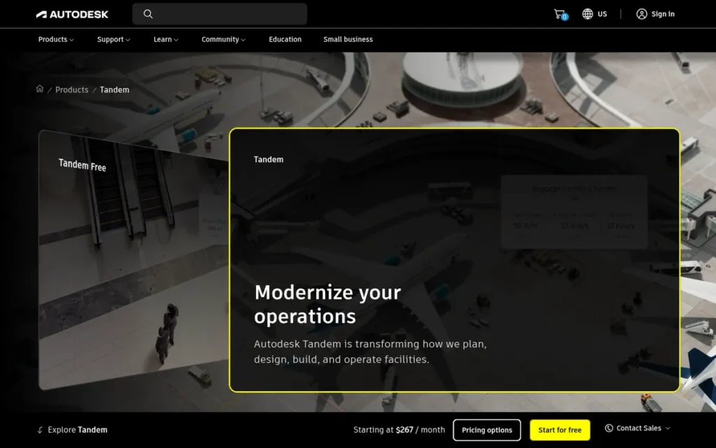
Category: Operational Building Twin.
At a Glance
- Category: Operational Building Twin
- Best For: Owners, contractors and facility managers of Revit-modeled buildings, campuses, stations and terminals
- Price Range: Free tier (3 facilities, 500 tagged assets); paid capacity subscriptions from 10,000 assets; dollar prices not displayed by Autodesk (November 2026)
- Primary Strength: Autodesk Tandem turns Revit BIM models into operational twins with asset classification, system mapping and IoT streams, close to out of the box.
- Biggest Limitation: Autodesk Tandem is built for buildings and campuses and does not scale naturally to road, rail or utility networks.
- One-Line Summary: Autodesk Tandem is the closest-to-turnkey option for turning Revit models into operational building twins at handover, but it is not designed for linear or networked infrastructure.
- Last Verified: November 2026
Score: 2.78/5. Autodesk Tandem has the highest C4 delivery-model score of all seven products (4.0). Its C3 score is low (2.0) because no ROI figures are published.
Overview
Autodesk Tandem is a cloud-based building digital twin application that turns Revit BIM models into operational twins. It is built for owners, contractors and facility managers handing buildings, campuses and stations over from construction to operations.
Autodesk Tandem’s main job is closing the handover gap between construction and facilities management. Autodesk Tandem is not documented for linear road, rail or pipe networks, so infrastructure owners typically use it for stations, terminals and depots.
Key Features
- Autodesk Tandem imports Revit models from version 2017 onward, and Autodesk describes support for other formats as “evolving.”
- Autodesk Tandem applies facility templates and classification to organize model elements into assets and systems.
- Autodesk Tandem streams IoT data, including over MQTT, with thresholds, alerts and heatmaps.
- Autodesk Tandem Connect and APIs link the twin to external building and maintenance systems.
- Autodesk Tandem Insights adds analytics on top of operational twin data.
Best For
Autodesk Tandem is best for owners and contractors delivering Revit-modeled buildings, campuses, stations or terminals who need a structured digital handover to operations. Autodesk Tandem is a poor fit as the primary twin for citywide road, rail or utility networks.
Strengths
- Autodesk Tandem is a standard handover deliverable from Windover Construction to clients including Phillips Exeter and Endicott, which shows repeatable construction-to-operations use (Autodesk, accessed November 2026, vendor-reported).
- Autodesk Tandem was piloted by NV5 across a 26-property casino group and paired with SkySpark analytics to model staffing optimization, though no ROI figures were published (NV5 case study, accessed November 2026).
- Autodesk Tandem was used in an NV5 airport proof of concept that forecast takeoff times from 20–40 data points, and Autodesk lists Denver International Airport as a customer (Autodesk, accessed November 2026).
- Autodesk Tandem received the highest delivery-model score of the seven products and is backed by Autodesk, a large established vendor (PlugRoute C4 assessment: 4.0, highest of seven).
Limitations
- Autodesk Tandem is simple to deploy because its scope is narrow. It is built for buildings and campuses, depends on Revit input with other formats still “evolving,” and is not documented for road, rail or utility networks.
- Autodesk Tandem’s case evidence consists of pilots and customer listings without ROI figures. An “85% design workflow improvement” claim found online could not be verified as a Tandem result.
- Autodesk Tandem’s G2 rating of 4.5/5 rests on a small number of reviews, and no Tandem-specific Capterra or Gartner profile exists (G2, 2026).
- Autodesk Tandem Free stops at 3 facilities and 500 tagged assets, so portfolio pilots need a paid tier (Autodesk Tandem help documentation, accessed November 2026).
- Autodesk Tandem’s SOC 2 or ISO 27001 coverage was not confirmed, and capacity pricing makes costs climb as sensor and asset counts grow.
Users on r/bim noted:
“First of all my opinion is that Tandem is decent but still an early version under development. It accepts your Revit models on import and most of the times all model components are transfered correctly. Now for the DT part; it really depends on what you try to achieve with the digital twin.” Posted by u/SuccessfulContest155
Takeaway: Autodesk Tandem imports Revit models reliably, but practitioners still see it as an early-stage product whose digital-twin value depends on a clearly defined use case.
Verdict
Autodesk Tandem is the closest-to-turnkey route from Revit BIM models to an operational building twin at handover. Within an infrastructure portfolio, Autodesk Tandem suits stations, terminals and campuses better than linear networks.
Buyers should model Autodesk Tandem’s capacity-based costs against their real sensor counts, and compare Willow when quantified operating savings are the priority.
6. Hexagon Smart Digital Reality: Best for Brownfield Assets Led by Reality Capture
Category: Reality-Capture-Led Twin, builds the twin from measured, survey-grade as-built data.
At a Glance
- Category: Reality-Capture-Led Twin
- Best For: Owners of brownfield cities, corridors and plants with no reliable design model
- Price Range: Pricing on request; third-party estimate of $100K–$500K+/year for Octave Attune EAM licensing, plus the capital cost of Leica hardware (2026)
- Primary Strength: Hexagon Smart Digital Reality builds twins from survey-grade Leica reality capture, so owners can model brownfield assets that have no clean design model.
- Biggest Limitation: Hexagon Smart Digital Reality’s stack is now split between Hexagon (Leica capture) and Octave (SDx, Luciad, Attune EAM) after the 2026 spinout, so buyers face two vendors’ contracts and roadmaps.
- One-Line Summary: Hexagon Smart Digital Reality is the only measurement-first option in this evaluation for survey-grade brownfield infrastructure twins, but its software stack now spans two companies after the 2026 Octave spinout.
- Last Verified: November 2026
Score: 2.58/5. Hexagon Smart Digital Reality scores 3.5 on both C1 and C2, higher than ranks 3–5. Its rank is driven down by C3 outcomes (1.5), C4 stability (2.0) and C6 pricing (2.0).
Overview
Hexagon Smart Digital Reality is a reality-capture-led approach to digital twins. It combines Leica capture hardware, reality-mesh processing, Luciad visualization and asset-information software, for owners of brownfield cities, corridors and plants who need survey-grade as-built twins.
Hexagon spun off its Asset Lifecycle Intelligence, Safety, Infrastructure & Geospatial and other software units as Octave, and the separation was reported complete in May 2026. Leica capture stays with Hexagon, while SDx, Luciad and Attune EAM now belong to Octave (Verdantix, 2026; Octave, 2026).
Key Features
- Hexagon Smart Digital Reality captures physical assets with Leica laser scanners, GNSS and mobile mapping systems.
- Hexagon Smart Digital Reality processes the captured data into reality meshes for 3D as-built models.
- Hexagon Smart Digital Reality uses Luciad, now part of Octave, to visualize live 2D, 3D and 4D geospatial data.
- Hexagon Smart Digital Reality manages asset information through HxGN SDx, now part of Octave.
- Hexagon Smart Digital Reality handles maintenance through Octave Attune EAM (formerly HxGN EAM), including preventive maintenance and work-order history.
Best For
Hexagon Smart Digital Reality is best for owners of brownfield assets who need survey-grade as-built accuracy and have no reliable design model to start from. Hexagon Smart Digital Reality is a weaker fit for buyers who want one coherent product from one vendor with published pricing.
Strengths
- Octave Attune EAM (formerly HxGN EAM) has been named a Leader in Verdantix Green Quadrant reports and in the IDC MarketScape for AI-enabled asset-intensive EAM applications (Verdantix, 2026; IDC, 2025, independent). These placements cover EAM, not digital twins.
- Hexagon Smart Digital Reality is the only measurement-first approach in this evaluation, because its twins start from Leica capture rather than design models (BuiltWorlds 2026 Infrastructure Top 50, 2026).
- Hexagon’s HxGN SDx customers Nynas, LG Chem and Bayer report centralized documents, faster handovers and alignment with ISO 14224, though these are industrial customers, not civil infrastructure (Hexagon, accessed November 2026, customer-stated).
- Octave Attune EAM is praised by Capterra reviewers for configurability and preventive maintenance, with a features sub-score of 3.9/5 (Capterra, 2026).
Limitations
- Hexagon Smart Digital Reality offers capture accuracy at the cost of a coherent product. Buyers must assemble several products from two companies, which means two contracts and two roadmaps after the 2026 Octave spinout.
- Octave Attune EAM rates 3.5/5 on Capterra from 24 reviews, with value for money at 2.8 and ease of use at 3.2 (Capterra, 2026).
- Octave Attune EAM reviewers cite a dated interface, a learning curve and the need for SQL or specialists to build reports (Capterra, 2026).
- Octave Attune EAM implementations are estimated to take 12–24 months (Softabase, accessed November 2026, third-party estimate).
- PlugRoute checked Hexagon’s city-twin projects in Singapore, Rennes and Cyprus and found no published quantified outcomes. PlugRoute also set aside an implausible G2 review count for Octave Attune EAM.
Verdict
Hexagon Smart Digital Reality is the only measurement-first option in this evaluation for building survey-grade twins of brownfield infrastructure that has no usable design model. Hexagon Smart Digital Reality’s rank reflects thin public infrastructure outcomes and a two-vendor stack, not weak capture capability.
Buyers should get contract and roadmap commitments from both Hexagon and Octave before committing.
7. Siemens Xcelerator: Best for Electric Grids, Rail Operations and OT-Heavy Assets
Category: OT/Simulation-Led Twin, connects physics-based models to grid, rail and control-system data.
At a Glance
- Category: OT/Simulation-Led Twin
- Best For: Electric grid operators, distribution system operators, rail operators and owners of OT-heavy assets
- Price Range: Pricing on request; no public prices for Gridscale X, Building X, Railigent X, PSS®E or PlantSight (verified November 2026)
- Primary Strength: Siemens Xcelerator connects physics-based grid and rail models directly to operational-technology and control-system data.
- Biggest Limitation: Siemens Xcelerator has no verified infrastructure ROI outcomes or review ratings for its twin products, and its GIS and civil-design capabilities are limited.
- One-Line Summary: Siemens Xcelerator is the only grid-specific digital twin product in this evaluation, but it has the thinnest public evidence on infrastructure outcomes, reviews and pricing.
- Last Verified: November 2026
Score: 2.45/5. Siemens Xcelerator matches Hexagon on C1 and C2 (3.5 each), but finishes last on C5 reviews (1.0) and C6 pricing (1.0) because it has no review ratings or public pricing.
Overview
Siemens Xcelerator is Siemens’ portfolio of operational and simulation twins, including Gridscale X for power grids and Railigent X for rail maintenance. It is built for grid operators, rail operators and owners of OT-heavy assets who need physics-based models connected to control systems.
Siemens Xcelerator’s strength is physics simulation and its connection to operational technology, the control-system layer that grid operators run alongside OMS, DMS and SCADA. Siemens Xcelerator is not designed around GIS or civil design.
Key Features
- Siemens Xcelerator’s Gridscale X links grid planning, operations, asset management and metering through one network twin built on EnergyIP.
- Siemens Xcelerator includes Railigent X for rail maintenance, Building X for smart buildings and Electrical Digital Twin for power networks.
- Siemens Xcelerator provides physics-based simulation through Simcenter and Altair, which Siemens acquired in March 2025.
- Siemens Xcelerator connects directly to PLC, SCADA and other OT equipment.
- Siemens Xcelerator offers the Digital Twin Composer, built with NVIDIA on Omniverse, and PlantSight, developed with Bentley.
Best For
Siemens Xcelerator is best for electric grid and rail operators that need physics-based simulation tied directly to control systems. Siemens Xcelerator is a weaker fit for civil design, GIS-led networks or buyers who need transparent pricing.
Strengths
- Siemens Xcelerator’s Gridscale X is built on EnergyIP, which has 75 million devices under contract (Siemens Gridscale X product page, accessed November 2026, vendor-reported).
- Siemens is the largest vendor evaluated by revenue, reporting €78.9B in FY2025. Its Smart Infrastructure business reported an 18.3% margin, or 17.0% excluding a one-time €315M gain (Siemens FY2025 report, 2025; Siemens Q4 FY2025 shareholder letter, 2025).
- Siemens strengthened its physics-simulation capability by completing the Altair acquisition on March 26, 2025, for about €9.5B, including €0.4B for share-based awards (Siemens FY2025 report, 2025).
- Siemens SIMIT virtual testing cut SECO/WARWICK’s testing workload from 400–500 hours to 100–150 hours, though this is an industrial case, not infrastructure (Siemens, accessed November 2026, vendor-reported).
Limitations
- Siemens Xcelerator offers simulation and OT depth at the expense of GIS and civil-design capability, and buyers should expect enterprise contracts with long implementations.
- Siemens Xcelerator’s infrastructure evidence is the thinnest in this evaluation, because every quantified outcome found is industrial and no utility, DSO or rail percentages were verified.
- Siemens Xcelerator’s twin products have no verified review ratings, and Siemens’ IDC MarketScape Leader placement is for life-sciences labs, not infrastructure.
- Siemens Xcelerator twin pricing is quote-only, with no public prices or credible third-party estimates for Gridscale X, Building X, Railigent X, PSS®E or PlantSight (Siemens FY2025 report, 2025).
Verdict
Siemens Xcelerator is the only grid-specific digital twin option in this evaluation for electric grids, rail and OT-heavy infrastructure where physics simulation must connect to control systems. Siemens Xcelerator ranks last because public infrastructure outcomes, reviews and pricing are missing, not because capability is missing.
Grid operators should ask Siemens Xcelerator for named utility references and confirm the scope of Siemens’ IEC 62443 and ISO 27001 alignment.
Which Infrastructure Digital Twin Is Best for Roads and Bridges?
Bentley iTwin is the best-evidenced choice for roads and bridges in this evaluation. It combines engineering models across design, 4D construction and operations, and it has the most quantified transportation outcomes. Cesium suits agencies building custom 3D corridor viewers. Hexagon Smart Digital Reality suits brownfield corridors that lack usable design models.
The transportation evidence PlugRoute found is:
- WSP’s Melbourne level-crossing removal project reported 60% less modeling time, 25% higher productivity and a 30% lower carbon footprint using ProjectWise, SYNCHRO and Bentley iTwin together (Bentley, 2023, vendor-reported, multi-product).
- Arcadis modeled the ground under Canary Wharf with Bentley tools and cut ground-investigation scope by 30% and design costs by 12% (Bentley, 2023, vendor-reported).
- Bentley streams large models of bridges and highways through Cesium’s 3D Tiles format (Bentley, 2024).
All of the quantified transportation outcomes PlugRoute found were published by Bentley. That reflects what vendors publish, not an independent comparison, so ask every vendor for DOT references (see Question #5).
No vendor in this evaluation published verified percentage outcomes for a DOT. A widely repeated claim that a Bentley bridge-inspection case cut costs by “up to 40%” could not be verified, so PlugRoute excluded it.
Which Digital Twin Platform Is Best for Utilities and Water Networks?
Esri ArcGIS is the best starting point for electric, gas and water network twins because its Utility Network models connectivity and tracing natively. Bentley iTwin is stronger for water capital programs that run on engineering models. Siemens Xcelerator’s Gridscale X is the only grid-specific option for running electric grids.
The utility and water evidence PlugRoute found is:
- Provo, Utah modeled its water, wastewater and stormwater networks in Esri ArcGIS Utility Network with tracing fully working (Esri, accessed November 2026, vendor-reported, qualitative).
- CORE built a single transmission-and-distribution model in Esri ArcGIS Utility Network as the base of its twin (Esri, accessed November 2026, vendor-reported).
- FirstEnergy moved off a legacy CAD-based GIS to get the network detail its ADMS requires (Esri, accessed November 2026, vendor-reported).
- Mott MacDonald saved 13,600 hours and more than £3.7M across about 100 projects for seven UK water clients using Bentley tools (Bentley Going Digital Awards, 2023, vendor-reported).
- Sacramento’s EchoWater program combined 22 engineering projects using Bentley iTwin and SYNCHRO and finished about $400M under budget (Bentley, 2023, vendor-reported, multi-product).
Your starting data decides the category. A water utility whose pipes live in GIS should start from Esri ArcGIS. The same utility’s treatment-plant expansion, which lives in engineering models, fits Bentley iTwin, which is the route Sacramento’s EchoWater treatment program took.
Utilities already running Esri ArcGIS should usually extend Utility Network and Velocity before buying a separate twin. Grid operators remain wary of AI layers built on poor data:
“All of that requires clean, concise data across systems OMS/DMS/SCADA into Engineer Analysis Models. AI is a buzzword in this context.” (u/Exmortu5, r/Grid_Ops (Reddit, 2023))
Takeaway: Grid operators judge twins and AI layers by the quality of data across OMS, DMS and SCADA, not by their AI features.
Which Infrastructure Digital Twin Products Work Well Together?
Most real infrastructure twins combine two or more products, because no product in this evaluation is a full GIS, BIM tool, maintenance system and IoT platform in one. The three combinations below each pair a system of record with a specialist layer. Each one appears in PlugRoute’s research as a realistic architecture.
- Esri ArcGIS Utility Network can serve as the network system of record, while Bentley iTwin handles a treatment-plant or other capital program that runs on engineering models.
- Autodesk Tandem can run the operational building twin, while an EAM system such as IBM Maximo or Octave Attune EAM manages work orders and maintenance history.
- Cesium can serve as a public-facing 3D viewer for data maintained in Esri ArcGIS or Bentley iTwin.
What Does Infrastructure Digital Twin Software Cost?
Infrastructure digital twin software ranges from free developer tiers to multi-million-dollar programs. Among the seven products, Bentley iTwin Platform, Cesium ion and Esri ArcGIS Online publish dollar prices, while operational twin applications are mostly quoted. Third-party estimates put a focused pilot at about $45K–$200K and a first-site deployment at $250K–$750K.
Published and documented pricing by product (accessed November 2026):
- Bentley iTwin Platform offers a free Community tier (100 credits/month, not for production use), Standard at $199/month (200 credits, 1 TB reality storage), Premium at $499/month (500 credits) and custom Enterprise pricing. Extra credits cost $1.20 each (Bentley developer pricing page).
- Bentley iTwin’s operational applications (iTwin Experience, Capture, IoT, AssetWise and SYNCHRO) are quoted separately. Licensing mixes named-user subscriptions, Virtuoso/E365 usage-based access and credits (Bentley licensing page).
- Esri ArcGIS Online US list prices are $700 per user per year for Creator, $2,200 for Professional and $4,200 for Professional Plus. Public-sector, regional and enterprise-agreement pricing differ, and credits are extra (Esri buy page).
- Cesium ion offers a free Community tier, Commercial at $149/month (individual) or $524/month (team), and Premium at $499/month (individual) or $874/month (team). Custom and Self-Hosted plans are quoted (Cesium ion pricing page).
- Autodesk Tandem offers a free tier for up to 3 facilities and 500 tagged assets, an Essentials tier sold only in bundles, and paid capacity subscriptions from 10,000 assets and 1 billion data points with unlimited users. Autodesk’s page displayed no dollar prices when checked (Autodesk Tandem compare page).
- Willow sells by quote. DWU Consulting estimates the DFW Willow/Parsons contract at about $2.9M over five years (DWU Consulting, third-party estimate).
- Hexagon Smart Digital Reality has no public pricing. Softabase estimates Octave Attune EAM licensing at about $100K–$500K+ per year, and Leica hardware is an extra capital cost (Softabase, third-party estimate).
- Siemens Xcelerator twin pricing is quote-only, and buyers should budget separately for licenses, OT integration, sensors, cybersecurity and system integrators (Siemens FY2025 report, 2025).
The licensing models used across the seven products are:
- Named-user or user-type: Esri ArcGIS and Bentley’s operational applications license by user type.
- Credits or metered usage: Bentley iTwin, Esri ArcGIS and Cesium meter credits, storage or streaming.
- Capacity: Autodesk Tandem charges by assets, data points and connection usage.
- Enterprise quote: Siemens Xcelerator, Hexagon Smart Digital Reality and Willow sell by quote.
Total cost of ownership bands are as follows (Framesixty and Maccelerator, accessed November 2026, third-party estimates):
- A focused pilot costs about $45K–$200K.
- A first site or asset-class deployment costs $250K–$750K, plus $80K–$200K per year.
- A multi-site program costs $500K–$2M+.
- An enterprise program takes 18–36 months.
Buyers frequently underestimate these hidden costs:
- Connectors and data preparation often require custom engineering before any twin goes live.
- Implementation partners and integrators are frequently needed for toolkit products such as Cesium and the Bentley iTwin Platform APIs.
- Sensors and reality-capture hardware add capital cost on top of software subscriptions.
- OT cybersecurity work adds cost whenever a twin connects to SCADA or other control systems.
- Credit, streaming or capacity overruns can push metered products past budget once usage grows.
In PlugRoute’s assessment, software licenses are usually the smallest line item in an infrastructure digital twin. Connectors, data preparation and implementation partners decide the total cost.
McKinsey reports 20–30% gains in capital efficiency and operations for public-sector and transit twins (McKinsey, “Digital twins: Boosting ROI of government infrastructure investments,” accessed November 2026). Treat that as context, not proof. PlugRoute excluded the widely repeated claim that “80% of digital twin projects fail” because it has no transparent source.
Which Related Tools Were Not Ranked, and Why?
Several tools often named alongside infrastructure digital twins were not ranked. Some solve different problems, such as factory simulation, horizontal IoT, maintenance or drone inspection. For others, our research did not apply the full evidence protocol. Many of them work well alongside a ranked twin as complements.
- IBM Maximo is an EAM complement that usually feeds a twin rather than being one.
- Trimble Quadri is a civil BIM collaboration tool that our evidence protocol did not cover.
- Azure Digital Twins is a horizontal developer IoT platform, and Willow is a finished application built on it.
- Ansys Twin Builder and Dassault 3DEXPERIENCE are mainly product and factory simulation platforms.
- NVIDIA Omniverse is a 3D simulation and rendering platform that Siemens and Cesium integrate with.
- GE Vernova focuses on energy asset performance, and our evidence protocol did not cover it.
- vHive is a point solution for drone inspection.
What Red Flags Should I Watch For When Evaluating Infrastructure Digital Twin Software?
The six biggest red flags are dashboards sold as twins, ROI drawn from self-run awards or product bundles, metering you can’t forecast, missing exit terms, security certifications not scoped to the product, and AI outputs that cannot be audited. Each is numbered below so buyers can cite it when questioning vendors.
Red Flag #1: The “Twin” Is Only a Sensor Dashboard A product that shows sensor readings without modeling how assets relate to each other or tracking change history is a dashboard, not a twin. A peer-reviewed review found 90% of city-twin studies at visualization and monitoring maturity (Big Earth Data, Taylor & Francis, 2023).
Red Flag #2: ROI Figures From Self-Run Awards or Multi-Product Bundles Outcome figures from a vendor’s own awards program, or from deployments that combine several products, cannot be credited to the twin alone. Bentley iTwin’s EchoWater and WSP outcomes, for example, each combine several Bentley products. Ask whether each figure is vendor-reported, customer-stated or independently verified.
Red Flag #3: Unforecastable Credit or Capacity Metering Pricing based on credits, streaming or capacity can grow faster than your budget once a twin goes public or you add sensors. For example, Cesium ion Commercial includes 150 GB/month of streaming, which a public city viewer serving large meshes can use up quickly. Esri ArcGIS and Bentley iTwin reviewers also report difficulty forecasting costs (G2, 2026; rfp.wiki, 2026).
Red Flag #4: No Published Data-Export or Exit Terms Few vendors in this evaluation publish data-export or exit terms, which leaves buyers exposed to lock-in once their data sits in a proprietary cloud model. Get written confirmation of export formats, data ownership and post-contract data access before you sign.
Red Flag #5: Security Certifications Claimed but Not Scoped to the Product Vendor-level ISO 27001, SOC 2, IEC 62443, FedRAMP or NIS2 claims may not cover the specific twin product you are buying. In PlugRoute’s research, certification scope went unconfirmed for Bentley iTwin, Esri ArcGIS, Siemens Xcelerator, Willow and Autodesk Tandem, and was not assessed for Cesium or Hexagon/Octave.
Red Flag #6: AI Copilot Outputs That Cannot Be Audited AI features that operators cannot audit conflict with how regulated grids and utilities make decisions. This applies equally to Siemens Industrial Copilot and Willow Copilot. One grid practitioner put it plainly: “An AI model is a black box, it cannot be audited” (u/Energy_Balance, r/Grid_Ops, Reddit, 2023).
What Questions Should I Ask Before Choosing Infrastructure Digital Twin Software?
Before choosing infrastructure digital twin software, ask every vendor six questions. They cover supported asset classes and lifecycle stages, delivery model, open-standard import and export, the full cost of a pilot and deployment, quantified infrastructure references, and how recent acquisitions or spinouts affect your roadmap and contract. The answers separate genuine fits from relabelled tools.
Question #1: Which asset classes and lifecycle stages does the product natively support? Look for documented support for your specific assets, such as roads, rail, water or grids, and for each lifecycle stage you need. Building-first products such as Autodesk Tandem and Willow are not documented for linear road, rail or pipe networks.
Question #2: Is this a turnkey application, or will we need developers or an integrator? Ask the vendor to classify the product as turnkey, hybrid or toolkit. Cesium and the Bentley iTwin Platform APIs need developers, while Autodesk Tandem and Willow are closer to finished applications. Owners with data-sovereignty needs should also ask about self-hosted options such as Cesium ion Self-Hosted.
Question #3: Which open standards (IFC, 3D Tiles, I3S, RealEstateCore, MQTT) does it support for import and export? Strong vendors name the specific standards they support for both import and export. In this evaluation, Bentley iTwin reads IFC, DGN and DWG, Cesium authored 3D Tiles, Esri ArcGIS uses I3S, Willow uses RealEstateCore, and Autodesk Tandem accepts MQTT. Support for import only limits your exit options.
Question #4: What will the pilot and first deployment cost, including connectors and partners? Ask for an all-in figure covering licenses, metering, connectors, data preparation and partner fees. Compare it with third-party bands of $45K–$200K for a pilot and $250K–$750K for a first deployment (Framesixty and Maccelerator, accessed November 2026, third-party estimate).
Question #5: Can you provide named infrastructure references with quantified, dated outcomes? Ask for references from your own asset class with dated, quantified outcomes, and ask whether those outcomes were independently checked. Industrial or retail case studies, such as Siemens’ SECO/WARWICK or Willow’s Walmart cases, do not prove performance on infrastructure.
Question #6: How will recent acquisitions or spinouts affect our roadmap and contract? Ask about recent corporate events directly. These include Bentley’s acquisition of Cesium (September 2024), Siemens’ acquisition of Altair (March 2025) and Hexagon’s Octave spinout (2026). Ask for contract terms that protect pricing and roadmap commitments through any future ownership change.
How Did We Rank These Infrastructure Digital Twin Software Platforms?
PlugRoute ranked seven infrastructure digital twin platforms by weighted score across six criteria: asset-class fit (25%), data integration (20%), documented outcomes (20%), delivery model and vendor stability (15%), independent reviews (10%) and pricing transparency (10%). Every outcome is labelled by how independent its source is, and near-ties are disclosed.
PlugRoute has no affiliate relationships with any company listed. Rankings are determined entirely by research data and objective evaluation criteria.
| Criterion | Weight | Why It Matters | How Scored (1 / 3 / 5) |
|---|---|---|---|
| C1: Asset-Class Fit and Lifecycle Coverage | 25% | No single tool fits every asset class, and building tools often fail at network scale. | 1 = one narrow asset class; 3 = some infrastructure classes or partial lifecycle; 5 = multiple civil and network classes across the full lifecycle |
| C2: Data Integration and Open Standards | 20% | Siloed engineering, GIS, capture, IoT and maintenance data drive up integration cost and lock-in. | 1 = single source, closed formats; 3 = several sources or some open standards; 5 = broad federation plus open or open-sourced standards |
| C3: Documented Outcome Evidence | 20% | Buyers need named, quantified, dated outcomes to build a business case. | 1 = none or qualitative only; 3 = multiple quantified vendor-reported outcomes or a large named adoption figure; 5 = multiple independent quantified infrastructure outcomes |
| C4: Delivery Model, Implementation and Stability | 15% | Toolkits, long implementations and corporate events affect cost and risk. | 1 = toolkit or portfolio in transition, multi-year implementation; 3 = hybrid; 5 = turnkey, stable vendor, flexible deployment |
| C5: Independent Review Evidence | 10% | Peer ratings are one of the few independent signals in the category. | 1 = no verified product-specific reviews; 3 = under 50 product-specific reviews (low confidence); 5 = large, product-specific review base |
| C6: Pricing Transparency and TCO Clarity | 10% | Opaque or metered pricing makes total cost of ownership hard to forecast. | 1 = quote-only, no estimate; 2 = quote-only with credible third-party estimate; 3 = published licensing model, dollars unverified; 5 = published dollar tiers with metering units |
| Product | C1 | C2 | C3 | C4 | C5 | C6 | Weighted Total |
|---|---|---|---|---|---|---|---|
| Bentley iTwin | 5.0 | 5.0 | 4.0 | 3.0 | 3.0 | 3.5 | 4.15 |
| Esri ArcGIS | 4.5 | 4.0 | 2.5 | 3.5 | 4.5 | 4.0 | 3.80 |
| Cesium | 2.5 | 3.5 | 3.0 | 2.5 | 1.0 | 5.0 | 2.90 |
| Willow | 2.5 | 3.5 | 4.0 | 3.0 | 1.0 | 2.0 | 2.88 |
| Autodesk Tandem | 2.5 | 3.0 | 2.0 | 4.0 | 2.5 | 3.0 | 2.78 |
| Hexagon Smart Digital Reality | 3.5 | 3.5 | 1.5 | 2.0 | 2.0 | 2.0 | 2.58 |
| Siemens Xcelerator | 3.5 | 3.5 | 1.5 | 2.5 | 1.0 | 1.0 | 2.45 |
Scores updated November 2026:
- Esri ArcGIS C6 moved from 3.0 to 4.0 because US list prices are now published.
- Autodesk Tandem C6 moved from 2.5 to 3.0, and Hexagon Smart Digital Reality C6 moved from 1.5 to 2.0, for consistency with the rubric.
- Bentley iTwin C5 moved from 3.5 to 3.0 because its 39 product-specific reviews fall below the 50-review confidence threshold.
- Willow C3 stays at 4.0 because Dallas Fort Worth Airport supplies quantified, infrastructure-relevant airport results, while the 2018 Walmart retail case carries less weight.
- The rank order did not change.
Ranks 3–5 (Cesium, Willow and Autodesk Tandem) are within 0.12 points of each other, and ranks 6–7 are within 0.13 points. A gap that small is not a quality difference, so within each group, choose whichever tool matches your asset class.
Siemens Xcelerator and Hexagon Smart Digital Reality score lower mainly because public evidence is thin, not because their capabilities are weak.
Every outcome figure carries one of these labels:
- A vendor-reported figure was published by the vendor or its awards program.
- A customer-stated figure is attributed to a named customer but not audited.
- A third-party estimate comes from consultants or pricing analysts.
- An independent figure was verified by a party with no commercial stake.
- An unverified figure was excluded from scoring and from the article’s claims.
These ratings were flagged or set aside:
- Bentley’s G2 count appears to cover the whole Bentley portfolio, so PlugRoute used only the Capterra and Gartner figures.
- Octave Attune EAM’s G2 count is implausible for an enterprise EAM product, so PlugRoute did not use it.
- Willow’s G2 listing may belong to an unrelated product, so PlugRoute did not use it.
- G2’s category average of 4.86/5 across 153 products is inflated by small vendors with few reviews (G2, 2026).
Bentley Systems acquired Cesium on September 6, 2024, so two of the seven ranked products share one corporate parent. Each was scored on its own evidence, and every product received the same research protocol.
Citations use one format: (Source, publication year, evidence label). Where a source carried no publication date, the citation gives the month PlugRoute accessed it.
What Do Buyers Most Often Ask About Infrastructure Digital Twin Software?
Buyers most often ask whether a GIS counts as a full twin, whether they need developers or a partner, and how PlugRoute ranks products. In brief: a GIS can anchor a network twin, most deployments need some outside implementation support, and rankings come from six published, weighted criteria. Short answers follow.
Is a GIS like Esri ArcGIS a full digital twin or just a complement?
Esri ArcGIS can be the foundation of a full digital twin for utility and water networks, where network topology is the system of record. Esri ArcGIS is a complement when the twin needs structure-level BIM detail. In that case, pair Esri ArcGIS with an engineering-model twin such as Bentley iTwin through integrations like GeoBIM.
Do I need developers or an implementation partner to deploy an infrastructure digital twin?
Most infrastructure digital twins need some developer or partner support, depending on delivery model:
- Cesium and the Bentley iTwin Platform APIs are toolkits that need developers.
- Autodesk Tandem, Willow and the Esri ArcGIS apps need the least custom work.
- Hexagon/Octave and Siemens Xcelerator usually involve enterprise implementations, which third parties estimate at 18–36 months.
How does PlugRoute determine rankings?
PlugRoute ranks products by weighted score across six published criteria. Asset-class fit (25%), data integration (20%) and documented outcomes (20%) carry the most weight. Every outcome is labelled by how independent its source is, unreliable review counts are set aside, and near-ties are disclosed so readers can decide based on their own asset class.
What Do Key Infrastructure Digital Twin Software Terms Mean?
Full Digital Twin: A full infrastructure digital twin combines four layers for a real asset: geometry, asset information, live data and change history. Most products supply only one or two of these layers, so ask each vendor which layers its product actually covers and which asset relationships it models.
Sensor Dashboard: A sensor dashboard displays readings but does not model how the assets connect to each other. Some vendors sell dashboards as twins, so check whether a product tracks asset relationships and change history before you treat it as a twin.
Network Topology: Network topology is the model of how assets in a distributed network connect, such as pipes, cables and valves. It supports tracing and subnetworks. For utilities and water authorities it is often the twin’s system of record, so strong topology support matters more to them than detailed building models.
Delivery Model (Turnkey, Hybrid, Toolkit): The delivery model tells you how finished a product is. A turnkey application works with little custom work, a hybrid runs an application on top of a developer layer, and a toolkit needs developers or an integrator to assemble. Classify each product on your shortlist early so unplanned custom development does not use up your pilot budget.
IFC: IFC is an open format for engineering and BIM models, used alongside formats such as DGN and DWG. A product that reads IFC can bring in models from several design tools. Confirm that it supports export as well as import, because import-only support limits your exit options.
3D Tiles and I3S: 3D Tiles and I3S are open formats for streaming very large 3D geospatial datasets, such as city or corridor models, over the web. Support for open streaming formats makes it easier to combine data from several vendors and lowers lock-in risk.
Ontology: An ontology is a standard vocabulary, such as RealEstateCore for buildings, that carries what assets mean between systems, not just their geometry. Without one, a model can look identical in three tools while only one of them knows which component belongs to which inspected structure.
Reality Capture: Reality capture turns laser scans, LiDAR, drone imagery and photos into reality meshes and point clouds that record an asset as it was actually built. It matters most for brownfield assets that have no reliable design model to start from.
EAM/CMMS: An enterprise asset management (EAM) or computerized maintenance management (CMMS) system manages work orders and maintenance history. It usually feeds a twin rather than being one, so expect to integrate it with your twin rather than replace it.
Operational Technology (OT): Operational technology is the control-system layer, such as SCADA and PLCs, that runs grids, rail and other physical systems. Connecting a twin to OT brings in live operational data, but it also adds cybersecurity work and cost under rules such as IEC 62443 and NIS2.
Credits and Capacity Pricing: Many products meter usage through credits, storage, streaming or capacity (the number of assets, data points or connections). These costs can grow faster than your budget once a twin goes public or you add sensors, so check your actual metered costs against the forecast during a pilot.
Total Cost of Ownership (TCO): TCO is the full cost of a twin, including licenses, metering, connectors, data preparation, implementation partners, sensors and cybersecurity work. Software licenses are usually the smallest line item, so ask vendors for an all-in figure rather than a subscription price alone.
Which Infrastructure Digital Twin Software Is Right for You?
Key Insights
The right infrastructure digital twin depends on your asset class. Bentley iTwin fits civil capital programs, Esri ArcGIS fits utility networks, Autodesk Tandem or Willow fit buildings and airports, Hexagon Smart Digital Reality fits brownfield capture, and Siemens Xcelerator fits grids. Most real deployments combine two products, so pilot one representative asset first.
- Bentley iTwin ranks first (4.15) because it leads on asset-class fit and data integration for roads, bridges, rail and water, though its outcomes are vendor-reported.
- Esri ArcGIS ranks second (3.80) and is the recommended foundation for utility and water networks, backed by the category’s most reliable review base.
- Cesium, Willow and Autodesk Tandem are a near-tie at ranks 3–5 (2.78–2.90), so asset-class fit and in-house developer capacity should decide among them.
- Hexagon Smart Digital Reality and Siemens Xcelerator rank lower mainly because public evidence is thin, not because their capture or simulation capability is weak.
- Infrastructure digital twin dollar pricing is published mainly for developer tiers and Esri ArcGIS Online, and third-party estimates put first-site deployments at $250K–$750K.
Situational guidance:
- If you run linear civil assets with engineering models, start with Bentley iTwin.
- If you manage networks already in GIS, extend Esri ArcGIS first.
- If you have developers and want a custom, price-transparent 3D foundation, consider Cesium.
- If you operate airports or building portfolios and want operating savings, shortlist Willow.
- If you are handing over Revit-modeled stations or campuses, shortlist Autodesk Tandem.
- If your brownfield assets have no usable design model, shortlist Hexagon Smart Digital Reality and confirm terms with both Hexagon and Octave.
- If you run electric grids or OT-heavy assets, shortlist Siemens Xcelerator and ask for named utility references.
Pilot scorecard:
- A pilot should record how many hours of data-integration effort it took to connect your own data.
- A pilot should compare actual metered or capacity costs with the forecast after 90 days.
- A pilot should name at least one operational decision that the twin changed.
For the full scoring evidence, see the methodology above and PlugRoute’s companion guides on digital twin TCO and pilot design.
We update this guide quarterly. Last updated: November 2026.