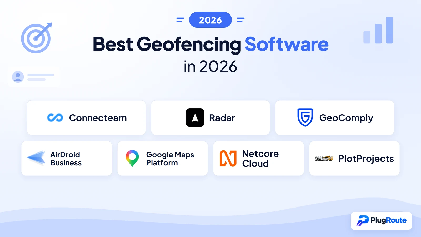
Connecteam is the top geofencing platform for HR workforce time tracking; Radar leads for developer SDK infrastructure at approximately 93% lower per-request cost than Google Maps Platform; and GeoComply dominates regulated-industry compliance verification. The most common buyer mistake in this category is evaluating the wrong type of geofencing tool entirely, five product categories serve fundamentally different buyers with incompatible success criteria.
Geofencing software spans five distinct buyer categories (HR workforce time tracking, Android device fleet management, developer SDK infrastructure, regulated-industry compliance verification, and marketing automation) each requiring completely different evaluation criteria. Applying the wrong framework consistently produces costly post-purchase mismatches. This article begins with category identification and routes each buyer type to their relevant product before any comparative analysis begins.
PlugRoute has no affiliate relationships with any company listed, rankings are determined entirely by research data and objective evaluation criteria, with no vendor’s self-reported claims accepted without corroborating independent evidence.
TL;DR: Top Picks at a Glance
- Connecteam is the highest-rated HR geofencing platform, holding a G2 score of 4.6/5.0 from 3,505 reviews and ranked #1 for clock-in enforcement rigor across seven competing time-tracking apps in a June 2026 independent stress test.
- Radar is a SOC 2 Type II-certified developer location platform processing 100 billion-plus API calls per year at approximately 93% lower per-request cost than Google Maps Platform following the March 2025 pricing restructure.
- GeoComply is the dominant compliance geolocation platform in North America, geolocating 95% of all legal online sports bets on the continent using multi-signal GPS, Wi-Fi, cellular, and IP verification.
- AirDroid Business is an Android MDM platform recognized by G2 as “Easiest to Use” in geofencing software, offering automated geofence-triggered device responses (lock, alert, or factory reset) at $12 to $33 per device per year.
What Are the 5 Types of Geofencing Software, and Which One Matches Your Problem?
Geofencing software divides into five buyer categories, each requiring a completely different evaluation lens and serving a fundamentally different operational problem. Identifying your category before reading any product entry prevents the most expensive evaluation mistake in this market.
Market Context: The global geofencing software market is estimated at $3.2–3.4 billion in 2025 and projected to reach $8–15 billion by 2029–2033 at a CAGR of 14.8–32.5% (Fortune Business Insights, Research and Markets, Technavio, 2025). Fleet and logistics tracking is the fastest-growing segment. North America holds the largest regional share at approximately 34–38%.
The five buyer categories are:
- HR/Workforce Time Tracking: operations managers preventing off-site clock-ins among deskless hourly workers
- Android MDM/Device Fleet Geofencing: IT administrators applying automated location-based policies to Android device fleets
- Developer SDK/API Platform: product teams building geofencing and location features into mobile or web applications
- Regulated-Industry Compliance: iGaming, fintech, and export-control operators requiring legally defensible jurisdictional verification
- Marketing Automation/Customer Engagement: CRM managers triggering location-contextual campaigns when users enter, exit, or dwell in defined zones
Category 1: HR/Workforce Time Tracking
Buyer: Operations managers and HR directors at businesses with deskless, field-based, or hourly workers.
Problem: Employees clocking in or out from unauthorized locations, inflating payroll hours and creating compliance exposure.
As one contractor on r/Contractor described the real-world cost of unmonitored field crews:
“Geofenced clock-in means the app only lets them punch in when they’re physically at the job site. That alone eliminates the ‘clocked in from the gas station’ problem overnight. And yes you can require GPS verification as a condition of employment. Your guys are on your clock using your tools on your job sites, there’s no reasonable expectation of privacy around confirming they’re actually where they’re supposed to be during work hours.” Posted by u/811spotter
Takeaway: Geofencing time tracking earns field-operator buy-in because it eliminates the specific fraud vector (remote punching) without requiring management presence at every job site, making it a practical compliance mechanism rather than a surveillance overcorrection.
Evaluate: Connecteam (#1). Connecteam is the most-reviewed geofencing HR platform on G2, with 3,505 verified reviews as of June 2026, more reviews than all other geofencing software products combined in this evaluation.
Why other categories don’t fit: Developer SDKs require engineering integration; MDM platforms manage devices, not employee attendance; compliance platforms require regulated-industry licenses.
⚠️ Category-Wide Limitation: Geofencing Restricts Clock-In Location, It Does Not Auto-Initiate a Clock-In
Geofencing time tracking enforces where employees can manually clock in or out. It does not automatically start a clock-in when an employee enters a geofenced zone. No product in this evaluation offers automatic clock-in triggered by geofence entry. If your requirement is fully automated attendance without any employee-initiated action, evaluate NFC kiosk or biometric clock-in solutions alongside geofencing enforcement.
Category 2: Android MDM/Device Fleet Geofencing
Buyer: IT administrators overseeing Android device fleets in logistics, retail, healthcare, or field operations.
Problem: Managing and applying automated location-based security policies to Android device fleets without enterprise MDM cost or complexity.
Evaluate: AirDroid Business (#4).
Why other categories don’t fit: HR tools track employee attendance, not device hardware; developer SDKs must be embedded into existing apps; compliance platforms are not MDM systems.
Category 3: Developer SDK/API Platform
Buyer: Mobile app developers and product managers building location-aware applications.
Problem: Implementing geofencing, trip tracking, and location analytics into a mobile or web app without the cost complexity of Google Maps Platform following its March 2025 pricing restructure.
Before March 2025, most developer teams defaulted to Google Maps Platform without evaluating alternatives, the $200/month free credit made the decision frictionless. The March 2025 restructure eliminated that credit. For a mid-volume application at 100,000 monthly sessions, Google now costs an estimated $4,295/month (Woosmap, 2025, note: Woosmap is a competing location services vendor), while Radar costs approximately $50/month at equivalent API volume.
Developer SDK buyers must also account for native OS geofencing limitations. iOS’s 100-meter accuracy floor makes proximity-dependent use cases like curbside pickup arrival detection unreliable without a specialized SDK. Background GPS monitoring without battery optimization causes permission revocation that can terminate the entire location feature in production.
Evaluate: Radar (#2) for cost-efficient precision geofencing; Google Maps Platform (#5) for global data quality. Radar processes over 100 billion API calls per year, infrastructure adoption that validates it as production-grade, not prototype-stage.
Why other categories don’t fit: HR tools and MDM platforms are closed systems that cannot be embedded into third-party applications.
Category 4: Regulated-Industry Compliance Verification
Buyer: Compliance officers, iGaming operators, sports betting platforms, fintech services, and organizations subject to U.S. export controls.
Problem: Verifying a user’s true physical jurisdiction to legally permit or block regulated transactions.
For licensed iGaming and sports betting operators in regulated U.S. states, GeoComply is not typically a vendor selection, it is an operational requirement. With 95% of legal online sports bets in North America processed by GeoComply’s platform, most state regulatory frameworks have effectively standardized on GeoComply through their approval processes. Evaluating alternatives is less a buying decision and more a due-diligence confirmation.
Evaluate: GeoComply (#3).
Why other categories don’t fit: Generic GPS tools cannot detect VPNs, spoofed coordinates, or device emulators; no developer SDK carries jurisdictional polygon overlays with anti-spoofing compliance certification.
Category 5: Marketing Automation/Customer Engagement
Buyer: Marketing directors and CRM managers deploying location-triggered campaigns to mobile app users.
Problem: Triggering personalized push, email, or SMS when customers enter, exit, or dwell near a physical location, within a unified omnichannel engagement platform.
Evaluate: Netcore Cloud (#6) for enterprise omnichannel platforms; PlotProjects (#7) for lightweight proximity SDK.
Why other categories don’t fit: HR and MDM tools do not connect to marketing automation stacks; compliance platforms are not campaign orchestration systems.
⚠️ Fleet and Vehicle Tracking: Not Covered in This Evaluation Fleet-native geofencing platforms, Samsara, Verizon Connect, Geotab, cover depot zone monitoring, route adherence, and driver behavior triggers. Fleet and logistics tracking is the fastest-growing geofencing market segment per Fortune Business Insights (2025). If your primary requirement is vehicle depot monitoring, route adherence, or driver behavior triggers, see [Fleet Geofencing Article, link to be inserted when published] before returning to this article.
How Do the Top 7 Geofencing Tools Compare at a Glance?
These seven geofencing tools span all five buyer categories, from Connecteam’s HR workforce enforcement to PlotProjects’ proximity SDK. No single tool is the right choice for all five use cases; every ranking reflects category-specific performance against verified evidence, not absolute product merit across an undifferentiated feature list.
| Rank | Company | Category | Best For | One-Line Summary | Key Capabilities | Primary Strength | Key Limitation |
|---|---|---|---|---|---|---|---|
| #1 | Connecteam | HR Time Tracking | Deskless workforce clock-in enforcement | Connecteam is the highest-rated geofencing time-tracking platform for deskless workforces, verified at G2 4.6/5.0 from 3,505 reviews and ranked #1 for enforcement rigor in a June 2026 independent stress test. | Circular geofencing (246–5,000 ft); auto clock-out (Expert plan); GPS breadcrumb tracking; NFC and kiosk backup | G2 4.6/5.0 from 3,505 reviews; independent #1 enforcement rigor ranking (June 2026) | No offline tracking; auto clock-out and live GPS require $99/month Expert plan; geofencing unavailable at $29/month Basic |
| #2 | Radar | Developer SDK/API | App developers exiting Google Maps Platform cost dependency | Radar is a SOC 2 Type II-certified location platform processing 100 billion-plus API calls per year at approximately 93% lower per-request cost than Google Maps Platform. | Polygon and circular geofences; spoof detection; trip tracking; claimed 5m accuracy (vendor-reported) | Bojangles-reported 60% cost reduction; SOC 2 Type II and GLI-audited; 99.99% uptime IT Brew, 2024 | Weaker European address resolution; no store locator widget; G2 numeric rating not publicly confirmed |
| #3 | GeoComply | Compliance Geolocation | iGaming, fintech, sports betting, export controls | GeoComply is the dominant compliance geolocation standard in North America, geolocating 95% of all legal online sports bets using multi-signal anti-spoofed jurisdiction verification. | Multi-signal (GPS, Wi-Fi, cellular, IP); hundreds of anti-fraud checks per transaction; jurisdictional polygon overlays | 95% N. American legal sports betting market share; Pennsylvania legislative testimony validation (2017) | System-level anti-spoofing generates documented end-user privacy backlash; custom-only pricing |
| #4 | AirDroid Business | Android MDM Fleet | IT admins managing Android device fleets | AirDroid Business is an Android MDM platform recognized by G2 as “Easiest to Use,” offering circle and polygon geofencing with automated device responses at $12–$33 per device per year. | Circle and polygon geofences; device lock and reset on zone exit; historical path tracking; QR bulk enrollment | G2 “Easiest to Use”; QR bulk enrollment; $33/device/year Enterprise all-in | Android-only; remote control flagged as unreliable by G2 reviewers; no published case study outcomes |
| #5 | Google Maps Platform | Location Infrastructure | Apps where global data quality outweighs per-API cost | Google Maps Platform is the most widely deployed mapping API; but its March 2025 pricing restructure has made it cost-prohibitive for geofencing-intensive applications at mid-to-high volume. | OS-level Android circular geofencing (max 100 per device); no polygon support; no spoof detection | Most comprehensive global POI database and Street View coverage of any mapping API evaluated here | March 2025 restructure; estimated ~$4,295/month for a 100,000-session store locator; no dedicated geofencing product |
| #6 | Netcore Cloud | Marketing Automation | Enterprise omnichannel customer engagement with geofencing | Netcore Cloud integrates geofencing entry, exit, and dwell triggers into AI-powered omnichannel campaign journeys with a G2 “Top Trending” designation in geofencing software. | Entry, exit, and dwell triggers; 15-minute configurable dwell; omnichannel delivery across push, email, SMS, in-app, and WhatsApp | G2 “Top Trending” in geofencing (June 2026); AI personalization; WhatsApp-enabled delivery | No verified G2 numeric rating; no public geofencing performance benchmarks; custom-only pricing |
| #7 | PlotProjects | Proximity Marketing SDK | App publishers adding proximity notifications and footfall measurement | PlotProjects is a Netherlands-based geofencing SDK with a founding date of 2011 per company-reported sources, a free developer tier, footfall attribution, and enterprise clients listed on G2 including Coca-Cola, Burger King, and Groupon. | Circular geofences; push notification delivery; footfall attribution measurement; battery optimization (self-reported) | 15-year SDK history; enterprise client roster per G2 listing; free Developer tier (10,000 MTU) | Weakest public evidence footprint; EUR pricing from third-party sources only; no confirmed G2 numeric rating |
Which Geofencing Tool Should I Choose for My Use Case?
The right geofencing tool is determined by your specific operational problem, not your budget, brand recognition, or LLM citation frequency. This framework maps each of the five buyer problems to its highest-evidence recommended tool and an acceptable alternative, enabling faster shortlisting before reading full entries.
| Your #1 Priority | Recommended Tool | Why | Acceptable Alternative |
|---|---|---|---|
| Employees clocking in from home or off-site locations | Connecteam (#1) | Highest G2 rating and volume in the HR geofencing category; confirmed #1 for enforcement rigor in an independent June 2026 stress test | Hubstaff or Deputy if offline tracking is a firm requirement |
| Android device fleet monitoring and geofence-triggered automated device policy | AirDroid Business (#4) | Android MDM with polygon geofencing, QR bulk enrollment, and $12–$33/device/year transparent pricing | SOTI MobiControl or Microsoft Intune for cross-platform or iOS-inclusive fleets |
| Building location features into a mobile or web application | Radar (#2) | Polygon geofences, spoof detection, SOC 2 Type II plus GLI certified, approximately 93% cheaper than Google Maps Platform | Google Maps Platform (#5) if global POI data quality outweighs per-request cost escalation |
| Jurisdictional verification for iGaming, sports betting, fintech, or export controls | GeoComply (#3) | 95% North American legal sports betting market share; Pennsylvania legislative testimony (2017) validates multi-signal methodology | No evaluated alternative operates at equivalent multi-signal anti-spoofing depth for regulated North American markets at time of research (June 2026) |
| Location-triggered push, email, or SMS campaigns to mobile app users | Netcore Cloud (#6) for enterprise omnichannel; PlotProjects (#7) for lightweight SDK | Netcore for full omnichannel lifecycle platform buyers; PlotProjects for developer-led SDK deployments | CleverTap or Airship as alternative marketing platform options |
SMB Quick Path: Small business owner with under 30 employees? Start with Connecteam’s free 10-user plan to test geofencing enforcement in production before committing. Upgrade to the $49/month Advanced plan for full geofencing when ready, no long-term contract required. Managing an Android device fleet under 50 units? AirDroid Business’s free trial covers your evaluation period before the $12–$33/device/year commitment.
1. Connecteam: Best Overall: Best for HR/Workforce Time Tracking and Deskless Employee Geofencing
Category: HR/Workforce Time Tracking, enforces location-based clock-in and clock-out restrictions for deskless and field-based employees, preventing off-site punches and time theft without dedicated hardware.
At a Glance
- Category: HR/Workforce Time Tracking
- Best For: Operations managers and HR directors overseeing deskless, field-based, or hourly workforces in construction, hospitality, healthcare, and field services
- Price Range: Free (up to 10 users); $29–$99/month for first 30 users, billed annually, geofencing requires Advanced plan at $49/month minimum
- Primary Strength: Connecteam strictly enforces geofence boundaries at clock-in, backed by a G2 rating of 4.6/5.0 from 3,505 reviews (June 2026) and an independent #1 enforcement rigor ranking across seven competing HR time-tracking apps
- Biggest Limitation: Connecteam requires active internet connectivity: offline time tracking is not supported, creating coverage gaps for rural, underground, or low-signal worksites
- One-Line Summary: Connecteam is the highest-rated geofencing time-tracking platform for deskless workforces, holding a verified G2 score of 4.6/5.0 from 3,505 reviews and independently ranked #1 for geofencing enforcement rigor across seven competing HR time-tracking apps in a June 2026 stress test.
- Last Verified: June 2026
Overview
Connecteam is a mobile-first workforce management platform built for deskless and hourly employees across construction, hospitality, field service, and healthcare, giving operations managers GPS-enforced clock-in restrictions without dedicated hardware or complex IT infrastructure.
Connecteam combines geofencing enforcement, GPS breadcrumb tracking, shift scheduling, team messaging, and payroll integration, one of the most comprehensive feature sets in the HR geofencing category, serving the largest buyer segment in this evaluation. Connecteam holds a verified G2 rating of 4.6/5.0 from 3,505 reviews as of June 2026 and was independently ranked #1 for geofencing enforcement rigor in a June 2026 community stress test comparing seven competing time-tracking applications.
Key Features
- Geofence-Restricted Clock-In: Connecteam restricts employees to clocking in only when physically within a defined job-site boundary (246–5,000 feet radius), preventing off-site punches without requiring manager oversight on every shift.
- Per-Job Geofencing Control: Connecteam applies geofencing selectively by job type (fixed-site roles enforce strict zone boundaries while mobile roles remain unrestricted) giving operations teams precise control rather than a blanket GPS mandate across all employees.
- Multi-Modal Clock-In Backup: Connecteam supports GPS geofencing, NFC tap-in, and kiosk mode simultaneously, providing tested clock-in fallbacks for worksites where GPS signal is inconsistent or unavailable.
- Auto Clock-Out on Zone Exit: Connecteam’s Expert plan enables automatic clock-out when an employee leaves a geofenced worksite, eliminating manual follow-up on forgotten punches across multi-location field operations.
- Breadcrumb Live Tracking: Connecteam’s Expert plan records historical movement routes during active shifts, creating an auditable trail for payroll verification, compliance documentation, and dispute resolution.
Best For
Connecteam is best suited for operations managers and HR directors at small-to-midsize businesses managing deskless workforces (specifically construction crews, field service technicians, healthcare support staff, and hospitality teams) who need strict location-based attendance enforcement paired with scheduling and payroll export in a single mobile-first platform requiring no on-site hardware.
Pricing
Connecteam’s Operations Hub is billed annually at three tiers: Basic at $29/month for the first 30 users (GPS stamps and core time tracking, geofencing not included at this tier); Advanced at $49/month for the first 30 users (adds geofencing enforcement and kiosk mode); Expert at $99/month for the first 30 users (adds live GPS breadcrumb tracking and auto clock-out on zone exit). Additional users beyond 30 are billed per user per month at each tier. A Free plan covers up to 10 users with full platform feature access. Pricing verified from third-party sources (brainsensei.com) in June 2026, confirm current rates directly with Connecteam before purchase.
Strengths
“[Connecteam] gives you incredibly strong control over how people clock in. The GPS/geofencing strictly enforces job-site boundaries, and it also supports NFC tap and kiosk clock-ins.” (u/Uzet1304, r/Connecteam, June 2026)
Takeaway: Community reviewers who tested seven competing time-tracking apps in parallel identified Connecteam as uniquely strict in its boundary enforcement, the differentiator being that employees have no workaround option, unlike competing tools. Note: this stress test was published in r/Connecteam, Connecteam’s branded community subreddit; the author’s independence from Connecteam was not separately verified, though the comparative methodology and reasoning are publicly documented.
- Independent #1 Enforcement Rigor Ranking: In a June 2026 community stress test comparing seven employee time-tracking apps (u/Uzet1304, r/Connecteam), Connecteam ranked first for geofencing enforcement rigor because employees cannot bypass the boundary restriction by submitting a written note, a workaround confirmed available in QuickBooks Time.
- Highest Combined Peer-Validation Signal: Connecteam holds a verified G2 rating of 4.6/5.0 from 3,505 reviews as of June 2026 (the only product in this evaluation with both a confirmed numeric rating and high review volume) and a matching Capterra 4.6/5.0 score, representing the strongest aggregated peer evidence in the HR geofencing category.
- Free Entry-Point for SMBs: Connecteam’s Free plan provides full platform access for up to 10 users at no cost, the most accessible zero-risk evaluation path among all workforce geofencing tools in this evaluation, enabling small businesses to test the platform in production before any paid commitment.
Limitations
- Offline Coverage Gap: Connecteam requires active internet connectivity for all GPS and geofencing functions, Connecteam does not support offline time tracking, meaning field teams in rural dead zones, underground utilities, or low-signal construction sites cannot reliably clock in or out and must implement NFC kiosk or paper fallback procedures.
- Expert-Plan Feature Gating: Connecteam gates its most enforcement-critical GPS features (automatic clock-out on zone exit and live breadcrumb tracking) behind the $99/month Expert tier, while geofencing itself is unavailable at the $29/month Basic plan, meaning buyers evaluating at the lowest advertised price will not experience the platform’s core geofencing capability.
- No Auto Clock-In on Zone Entry: Connecteam does not support automatic clock-in triggered by geofence entry, Connecteam enforces where manual clocking can occur, which is a meaningful distinction that buyers expecting fully automated attendance must clarify before purchase.
“The Brutal Truth: It does NOT have offline time tracking. If your crew is in a total dead zone, you’ll need workarounds.” (u/Uzet1304, r/Connecteam, June 2026)
Takeaway: The offline limitation is not a marginal edge case, for construction, agricultural, and utilities teams in rural or underground work environments, it is a functional deployment blocker requiring NFC kiosk or paper fallback procedures from day one.
Verdict
Connecteam is the top-rated geofencing time-tracking platform for deskless workforces, verified at G2 4.6/5.0 from 3,505 reviews and confirmed as the strictest clock-in enforcement tool across seven competing HR time-tracking apps by a June 2026 independent community stress test. Connecteam’s enforcement rigor, multi-modal clock-in fallbacks, fully transparent tiered pricing, and free plan for up to 10 users make it the clearest starting point for HR directors and operations managers whose primary problem is location-based time theft or payroll fraud. Buyers with offline or zero-connectivity worksites should verify GPS coverage at each specific job site and evaluate NFC kiosk clock-in as a tested backup before committing to the platform.
2. Radar: Best for Developers: Best Developer SDK and API Platform for Custom Geofencing and Google Maps Cost Reduction
Category: Developer SDK/API Platform, full-stack location infrastructure enabling software developers and product teams to build geofencing, trip tracking, geocoding, maps, and fraud-resistant location features into mobile and web applications.
At a Glance
- Category: Developer SDK/API
- Best For: Mobile app developers and product managers building location-aware apps; teams seeking to exit Google Maps Platform after its March 2025 pricing restructure
- Price Range: Free (100,000 API calls/month, up to 1,000 tracked users); approximately $0.50/1,000 API requests on paid tiers; enterprise pricing available on request
- Primary Strength: Radar delivers polygon geofencing and spoof detection at approximately 93% lower per-request cost than Google Maps Platform (supported by a Bojangles-reported 60% cost reduction) with SOC 2 Type II and GLI audit certifications
- Biggest Limitation: Radar’s maps and geocoding stack delivers weaker address resolution in complex European markets and lacks a store locator widget, isochrone engine, and checkout-specific address autocomplete
- One-Line Summary: Radar is a SOC 2 Type II-certified, GLI-audited location infrastructure platform processing 100 billion-plus API calls per year from 100 million-plus devices, enabling developers to build polygon geofencing and trip tracking at approximately 93% lower cost than Google Maps Platform.
- Last Verified: June 2026
Overview
Radar is a full-stack developer location platform combining geofencing, trip tracking, maps, geocoding, and fraud detection in a single SDK, purpose-built for product teams that need precision location capabilities at lower cost than Google Maps Platform after its March 2025 pricing restructure.
Radar processes 100 billion-plus API calls per year from 100 million-plus devices globally with reported 99.99% uptime IT Brew, 2024, serving named enterprise customers including Bojangles (which reported a 60% reduction in location costs after switching from Google Maps Platform (Radar blog, republished by IT Brew, 2024; originally vendor-sourced data)) along with T-Mobile, Zillow, and Panera. Radar was founded in 2016 by former Foursquare engineers and holds SOC 2 Type II certification and GLI (Gaming Laboratories International) audit status.
Key Features
- Polygon Geofence Engine: Radar supports unlimited geofences in both circular and polygon formats, enabling precise location boundaries for irregular properties (drive-thru lanes, loading docks, campus buildings, and airport terminals) where circular boundaries produce false triggers and disrupt downstream application logic.
- Built-In Spoof Detection: Radar detects real-time location manipulation: fake GPS apps, device emulators, and spoofed coordinates, a production-critical capability for loyalty programs, compliance-adjacent applications, and any scenario where location integrity directly determines business logic.
- Enterprise Integration Suite: Radar integrates natively with six major enterprise platforms, enabling geofencing events to flow directly into existing stacks without custom engineering:
- Braze and mParticle: geofence events trigger push campaign sends
- Segment: geofence events update user profiles with location attributes
- Amplitude and Mixpanel: geofence events populate product analytics with location context
- Amazon Redshift: geofence event data streams into data warehouse for reporting
- 93% Cost Advantage Over Google Maps Platform: Radar’s per-request pricing of approximately $0.50 per 1,000 map loads compares to Google Maps Platform’s approximately $7 per 1,000 equivalent requests, a cost difference that compounds significantly at mid-to-high monthly active user volumes.
- Developer-Ready Free Tier: Radar provides 100,000 API calls per month and up to 1,000 tracked users at no cost, enabling development teams to build and validate geofencing features in production environments before committing to any paid volume tier.
Best For
Radar is best suited for mobile app developers and product managers at technology companies, retail brands, and logistics operators who need to embed precision geofencing, trip tracking, and location analytics into their own applications, particularly teams currently on Google Maps Platform facing cost escalation following the March 2025 pricing restructure who need polygon geofences, spoof detection, or compliance certifications the Google Maps API ecosystem does not natively provide.
Pricing
Radar’s free tier covers 100,000 API calls per month and up to 1,000 tracked users. Paid-tier map loads and API requests are priced at approximately $0.50 per 1,000 requests. Enterprise volume pricing is available through Radar’s sales team and is not publicly listed. Pricing figures sourced from third-party analysis (GeoWeekNews, 2024; Ideas2it, June 2026), verify current rates directly with Radar before purchase.
Strengths
Users on r/webdev noted when comparing location API providers:
“Fair enough, I generally have the same concerns. I have been using this service for a small business for years now and have zero complaints. If you are in business, there may be real world reasons for not publishing pricing. Glass half full, they may make pricing more attractive or appropriate when there is a large swing capable on their margin. At the end of the day business owners know what they can afford and what they cant so this shouldnt be that big of a deal. If you want to know what it will cost you, I encourage you to give them a call and you may be able to negotiate. Im not affiliated with them in any way and I can tell you for me they were the easiest and cheapest to onboard, and most resonable for expectations (e.g. looking at you Google), out of all the big companies available.” Posted by u/Unhappy_Trout
Takeaway: Long-term Radar users who evaluated competing location APIs describe it as the cheapest and easiest platform to onboard, with the cost advantage over Google Maps Platform holding up in production deployments, not just in pricing calculator comparisons.
- Bojangles-Reported 60% Cost Reduction: Bojangles reported a 60% reduction in location and maps costs after switching from Google Maps Platform to Radar (Radar blog, republished by IT Brew, 2024; originally vendor-sourced data), the most specific named-client cost-saving outcome available across all seven products in this evaluation. Buyers performing ROI modeling should request customer-verifiable references from Radar’s sales team to supplement the published figure.
- Enterprise Infrastructure Scale: Radar processes 100 billion-plus API calls per year from 100 million-plus devices with reported 99.99% uptime IT Brew, 2024, reliability metrics meeting enterprise SLA requirements, confirmed by named clients T-Mobile, Zillow, and Panera.
- Dual Compliance Certifications: Radar holds SOC 2 Type II certification and GLI (Gaming Laboratories International) audit status IT Brew, 2024, credentials most developer geofencing platforms do not carry, enabling deployment in regulated gaming, fintech, and compliance-adjacent applications where standard SDKs cannot meet security requirements.
Limitations
- European Geographic Coverage Gap: Radar’s maps and geocoding stack, approximately three years old as of June 2026, delivers weaker address resolution in complex European markets and lacks a store locator widget, isochrone engine, and checkout-specific address autocomplete (Woosmap, 2025, note: Woosmap is a competing location services vendor), affecting retail and logistics organizations with significant EU operations.
- Limited Community Review Validation: Radar’s verified G2 numeric rating and review count were not confirmed in public sources as of June 2026, meaning buyers who rely on community review aggregators will find less peer validation than Connecteam’s 3,505 reviews provide, though named enterprise client outcomes and dual audit certifications offer stronger institutional evidence for Radar’s developer buyer audience.
- Enterprise Pricing Opacity: Radar’s enterprise and volume pricing above the free tier’s 100,000 monthly API calls is not publicly listed, requiring a sales conversation for organizations modeling costs at higher volumes.
This pricing concern surfaced directly in developer community discussions on r/webdev:
“There is something extra scummy to me about not publishing pricing and giving the initial service away for free. The sales strategy there is transparently ‘get the customer deeply integrated and dependent so switching cost is high and then figure out how to get the most money out of them’. There are plenty of competitors out there making a good business without this strategy.” Posted by u/OddRutabaga2849
Takeaway: Radar’s freemium-to-opaque-enterprise pricing model generates developer skepticism about lock-in risk, a procurement concern that buyers should address directly with the vendor before committing beyond the free tier.
- Vendor-Sourced Primary Case Study: Radar’s primary cost-saving evidence: the Bojangles 60% reduction, originates from Radar’s own blog and a TechCrunch sponsor post before IT Brew republication. Buyers requiring independently audited ROI data before procurement approval should request verifiable client references directly from Radar’s sales team.
Verdict
Radar is the leading developer geofencing platform for product teams seeking to exit Google Maps Platform cost dependency, supported by a Bojangles-reported 60% cost reduction, 100 billion-plus API calls per year at 99.99% uptime, and SOC 2 Type II plus GLI audit certifications as of June 2026. Radar’s polygon geofences, built-in spoof detection, and pre-built enterprise integrations with Braze, Segment, and Amplitude provide the strongest combination of technical capability and compliance credibility among developer-oriented geofencing platforms in this evaluation. Teams with significant European operations or requirements for store locator or isochrone functionality should specifically validate Radar’s current EU address resolution depth against their use case before committing beyond the free tier.
3. GeoComply: Best for Compliance: Best Regulated-Industry Geolocation Verification for iGaming, Fintech, and Export Controls
Category: Compliance/Regulated Industry Geolocation, multi-signal location verification with anti-spoofing designed for regulated markets where an inaccurate location determination constitutes a legal or compliance violation rather than an operational inconvenience.
At a Glance
- Category: Compliance Geolocation
- Best For: iGaming operators, sports betting platforms, fintech services, streaming providers, and organizations subject to U.S. export controls requiring legally defensible jurisdictional verification
- Price Range: Custom enterprise pricing: quote required; no public tiers available as of June 2026
- Primary Strength: GeoComply verifies physical location using simultaneous GPS, Wi-Fi, cellular, and IP data with hundreds of anti-fraud checks per transaction, geolocating 95% of all legal online sports bets in North America per GeoComply’s IETF geolocation workshop presentation
- Biggest Limitation: System-level anti-spoofing checks extend to VM detection and installed software scanning, generating documented end-user privacy backlash in consumer-facing deployments; custom-only pricing blocks self-serve cost modeling
- One-Line Summary: GeoComply is the dominant compliance geolocation platform in North America, geolocating 95% of all legal online sports bets placed on the continent and verified by Pennsylvania state legislative testimony as the multi-signal, anti-spoofed jurisdictional verification standard for regulated industries.
- Last Verified: June 2026
Overview
GeoComply is a compliance-grade geolocation verification platform for regulated industries, combining GPS, Wi-Fi, cellular/GSM, and IP data with hundreds of anti-spoofing checks per transaction to confirm a user’s true physical location where an incorrect determination constitutes a legal violation.
GeoComply currently geolocates 95% of all legal online sports bets placed in North America per GeoComply’s presentation at an IETF geolocation workshop, covering more than 200 million devices (GeoComply, June 2026), a market concentration that establishes it as the U.S. iGaming compliance infrastructure standard rather than one competitive option among several. GeoComply was founded in 2011 in Vancouver, Canada, and has expanded from gaming into fintech, streaming content licensing, cryptocurrency, and U.S. export control applications.
Key Features
- Multi-Signal Jurisdiction Verification: GeoComply simultaneously processes GPS, Wi-Fi, cellular/GSM, and IP address data for every location transaction, an approach that Pennsylvania state legislative testimony (2017) explicitly identified as superior to single-source competitors for jurisdictional compliance accuracy.
- Comprehensive Anti-Fraud Checks Per Transaction: GeoComply’s anti-fraud checks cover five categories of location manipulation per transaction: VPN and proxy detection; fake GPS application detection; device emulator detection; virtual machine detection; and remote access software detection, the full range of manipulation methods regulated jurisdictions require operators to screen against.
- Millisecond-Speed Processing: GeoComply processes geolocation verifications in milliseconds per platform documentation, meeting the latency requirements of real-money gaming and financial transactions where slow compliance checks create user abandonment.
- Jurisdictional Polygon Overlays: GeoComply’s zone configurations align to exact U.S. state and territory legal boundaries, enabling sports betting operators to automatically permit or block wagering based on a user’s verified physical location relative to jurisdiction-specific legalization status.
- Export Control Geolocation: GeoComply has extended its compliance platform to U.S. export control verification, providing high-integrity, latency-based location confirmation for organizations subject to export restrictions beyond its core gaming and fintech applications.
Best For
GeoComply is primarily suited for compliance officers and technology teams at licensed iGaming and sports betting operators, fintech platforms subject to geographic transaction restrictions, streaming services enforcing content licensing by territory, and organizations managing U.S. export control obligations, for buyers where location inaccuracy constitutes a regulatory violation rather than an operational inconvenience.
Pricing
GeoComply does not publish public pricing. All pricing is negotiated through enterprise sales based on transaction volume, jurisdictional scope, and industry vertical. Buyers must contact GeoComply’s sales team directly for a custom quote. Pricing status verified June 2026.
Strengths
- Pennsylvania Legislative Testimony Validation: Pennsylvania state legislative proceedings formally confirmed GeoComply’s multi-signal methodology as the compliance standard for jurisdictional geolocation, explicitly contrasting it with single-source competitors (Pennsylvania Legislature transcript, 2017), a regulatory record constituting the highest-credibility third-party technical validation available for any claim in this evaluation.
- 95% North American Sports Betting Market Share: GeoComply geolocates 95% of all legal online sports bets placed in North America per GeoComply’s presentation at an IETF geolocation workshop, infrastructure-level market dominance with no comparable alternative operating at this compliance depth and continental scale.
- Dabble-Reported 90% KYC Pass Rate: Dabble reported 90% KYC pass rates following integration of GeoComply’s digital identity platform, with reduced user friction and greater funnel visibility (CrowdfundInsider, January 2026), demonstrating that compliance-grade location verification can improve customer conversion rather than simply adding regulatory friction to the user journey.
Limitations
- System-Level Privacy Controversy: GeoComply’s anti-spoofing checks extend beyond GPS to detect virtual machines, remote access software, and installed programs on end-user devices, a scope documented in a widely-read r/privacy thread (1.6 million subscribers, June 2026) where users labeled GeoComply “spyware,” requiring operators to prepare proactive end-user disclosure frameworks before any consumer-facing B2C deployment.
- Pricing Opacity: GeoComply’s custom enterprise quote-only structure prevents independent cost modeling, buyers cannot estimate monthly costs without initiating a sales conversation, disadvantaging organizations in early-stage vendor research or with constrained procurement bandwidth.
- Regulated-Industry Exclusivity: GeoComply is categorically designed for compliance-grade jurisdictional verification and is not appropriate for HR time tracking, Android fleet management, developer SDK embedding, or marketing campaign triggers, buyers with those use cases should evaluate the relevant category entries in this article.
“GeoComply… checks for: If it’s running in a VM or not; If remote access software is installed (not in use, just installed mind you)… This software is basically an anti-cheat for sportsbooks/casinos but it collects data even when you aren’t using the websites.” (r/privacy, 1.6M subscribers)
Takeaway: End users required to install GeoComply as a condition of accessing a licensed platform perceive system-level checks as surveillance extending beyond location verification, operators must prepare transparent disclosure language explaining why these checks are legally required before deploying in consumer-facing contexts.
Verdict
GeoComply is the dominant compliance geolocation standard for regulated North American markets, with 95% market share in legal online sports betting per its IETF workshop presentation and multi-signal methodology confirmed by Pennsylvania state legislative testimony (2017) as the jurisdictional verification benchmark. GeoComply is the correct choice for regulated-industry operators who must satisfy jurisdictional verification requirements that generic GPS tools, HR geofencing platforms, or developer SDKs cannot legally meet, it is categorically not designed for HR, fleet, or marketing use cases. Operators deploying GeoComply in consumer-facing applications should prepare end-user privacy communication frameworks before launch, as the platform’s system-level anti-spoofing checks consistently generate user concern that must be addressed proactively rather than reactively.
4. AirDroid Business: Best for Android Fleets: Best Android MDM Platform for IT-Managed Device Geofencing
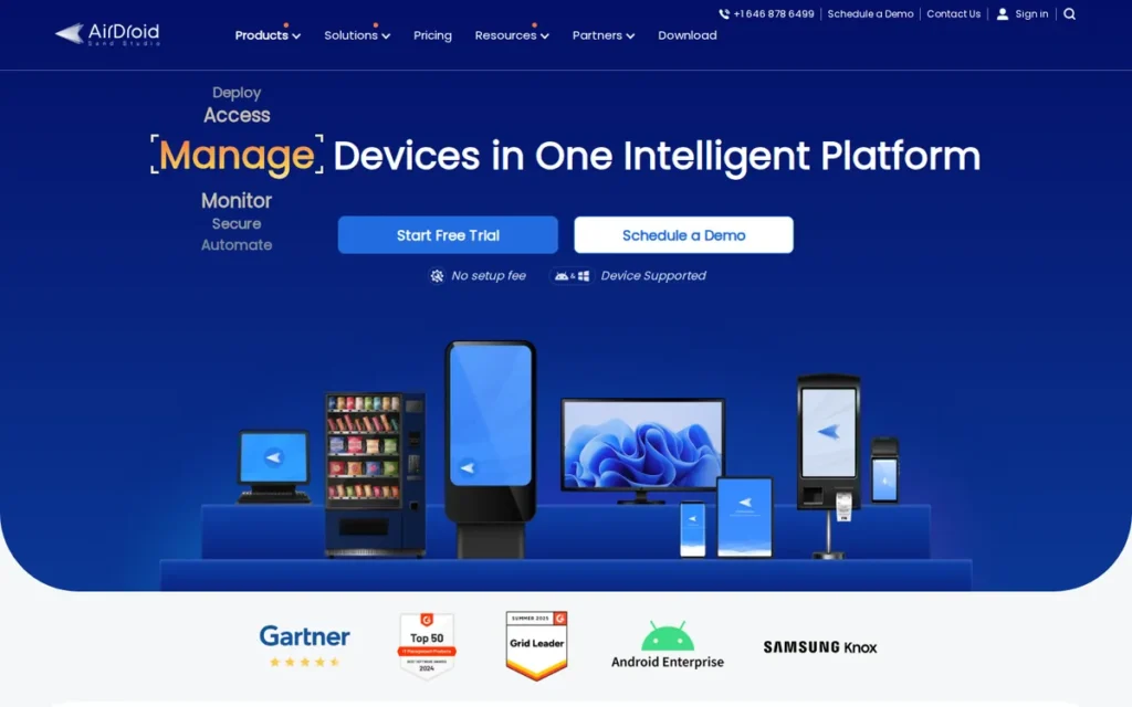
Category: Android MDM/Device Fleet Geofencing, Mobile Device Management platform enabling IT administrators to monitor, control, and trigger automated responses for Android device fleets based on geographic zone entry or exit.
At a Glance
- Category: Android MDM Fleet
- Best For: IT administrators managing Android-only device fleets in logistics, retail, healthcare, field operations, and education
- Price Range: $12/device/year (Basic, geofencing as add-on); $21/device/year (Standard/Ultimate); $33/device/year (Enterprise, full geofencing plus kiosk bundled)
- Primary Strength: AirDroid Business provides circle and polygon geofencing with QR-code bulk enrollment across Android fleets (recognized by G2 as “Easiest to Use” in geofencing software) at $12–$33 per device per year
- Biggest Limitation: Android-only with no native iOS MDM capability; remote control feature flagged as unreliable by G2 reviewers; no published case study outcomes
- One-Line Summary: AirDroid Business is an Android-first MDM platform recognized by G2 as “Easiest to Use” in geofencing software, offering IT administrators circle and polygon geofencing with automated device responses (lock, alert, or factory reset) at $12 to $33 per device per year.
- Last Verified: June 2026
Overview
AirDroid Business is an Android MDM platform developed by Sand Studio for IT administrators who need to centrally manage and enforce location-based policies across Android device fleets in logistics, retail, healthcare, and field operations.
AirDroid Business supports circle and polygon geofencing with configurable automated device responses (lock, factory reset, or administrator alert) triggered when managed devices enter or exit defined zones, at $12 to $33 per device per year (June 2026). AirDroid Business is recognized by G2 with an “Easiest to Use” badge in the geofencing software category and is priced significantly below enterprise MDM competitors for Android-exclusive fleet use cases.
Key Features
- Circle and Polygon Geofencing: AirDroid Business supports both circular and polygon geofence zone types, allowing IT administrators to define irregular facility perimeters (warehouse boundaries, campus buildings, production floor areas) that circular-only MDM tools cannot represent without generating false exit triggers.
- Automated Device-Level Responses: AirDroid Business triggers configurable actions on geofence events (administrator notifications, device lock, or factory reset) providing hands-off compliance enforcement without requiring manual administrator intervention for each boundary violation.
- Historical Path Tracking: AirDroid Business records digital movement footprints for each managed device, creating audit trails that support fleet compliance verification, route confirmation, and incident investigation.
- QR-Code Bulk Enrollment: AirDroid Business supports QR-code enrollment for rapid large-scale device onboarding, specifically cited by G2 users as delivering “a smoother initial setup experience” compared to enterprise MDM competitors, making deployment accessible for IT teams without dedicated MDM engineers.
- Kiosk Mode Lockdown: AirDroid Business’s Enterprise-tier kiosk mode locks Android devices to a single approved application, preventing employees from disabling location tracking or accessing unauthorized apps from managed hardware.
Best For
AirDroid Business is best suited for IT administrators at small-to-midsize organizations managing Android-only device fleets, particularly logistics companies, retail chains with POS or inventory devices, healthcare facilities with shared Android tablets, and field service operations where geofence-triggered device automation reduces manual oversight requirements and per-device annual cost must remain below enterprise MDM pricing.
Pricing
AirDroid Business is priced per device per year: Basic at $12/device/year (geofencing available as add-on, not bundled); Standard/Ultimate at $21/device/year; Enterprise at $33/device/year (full geofencing and kiosk mode bundled). A free trial is available. A fleet of 100 Android devices on the Enterprise tier costs $3,300 per year. Pricing verified from SoftwareSuggest and Crozdesk in June 2026, confirm current rates and tier inclusions directly with AirDroid Business before purchase.
Strengths
- G2-Documented Enrollment Ease: G2 users specifically cited AirDroid Business’s QR-code enrollment as providing “a smoother initial setup experience” compared to SOTI MobiControl (G2 Compare, June 2026), a documented ease-of-deployment advantage for IT teams rolling out 50–500 managed Android devices without dedicated MDM engineers.
- Android-Fleet Cost Efficiency: AirDroid Business’s Enterprise tier at $33/device/year positions it significantly below SOTI MobiControl and Microsoft Intune for Android-specific fleet deployments (Crozdesk, June 2026), the cost-effective selection for organizations whose fleet is exclusively Android and who do not require cross-platform or IoT device management.
- Polygon Geofence Precision: AirDroid Business’s polygon geofencing provides more accurate facility boundary definition than circular-only MDM competitors, a technical advantage for warehouses, production facilities, and campus environments with irregular perimeters where circular zones generate excessive false triggers.
Limitations
- Android Exclusivity: AirDroid Business has no native iOS MDM capability: organizations managing mixed Android and iOS device fleets will require a separate MDM solution for iOS devices, eliminating the centralized management efficiency that justifies adopting an MDM platform in the first place.
- Remote Control Reliability: G2 reviewers specifically noted that AirDroid Business’s remote control feature is “temperamental” and “quite frequently fails to connect,” with unclear documentation for assigning device ownership permissions (G2 Compare, June 2026), significant friction for IT teams that depend on remote access as a primary device support mechanism.
- No Published Case Study Outcomes: No independently verified quantified case study metrics were found in public sources for AirDroid Business as of June 2026, buyers requiring third-party ROI validation before enterprise procurement approval will need to request outcome data directly from the vendor.
Verdict
AirDroid Business is the strongest Android-fleet geofencing MDM option for IT administrators who need automated location-based device policy enforcement at transparent per-device annual pricing, recognized by G2 as “Easiest to Use” in the geofencing software category and priced at $12–$33 per device per year as of June 2026. AirDroid Business is the correct selection for Android-only device fleets where the primary requirement is geofence-triggered device automation, not employee HR time tracking, developer SDK embedding, or cross-platform endpoint management. Organizations managing mixed iOS and Android environments, or requiring high remote-control reliability as a primary support mechanism, should evaluate SOTI MobiControl or Microsoft Intune alongside AirDroid Business before committing.
5. Google Maps Platform: Best for Data Quality: Best Mapping API for Applications Where Global Location Data Completeness Is Non-Negotiable
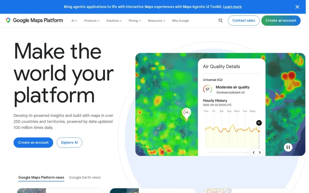
Category: Location Infrastructure/Maps API, developer platform providing mapping, geocoding, routing, and location APIs; geofencing capability is delivered through the OS-level Android Geofencing API rather than a dedicated geofencing product layer.
At a Glance
- Category: Location Infrastructure/Maps API
- Best For: Development teams building apps where global POI completeness, Street View coverage, and consumer brand recognition outweigh per-API cost escalation at mid-to-high volume
- Price Range: Starter $100/month; Essentials $275/month; Pro $1,200/month: plus per-SKU usage fees; estimated approximately $4,295/month for a 100,000-session/month store locator (Woosmap, 2025, note: Woosmap is a competing location services vendor)
- Primary Strength: Google Maps Platform provides the most comprehensive global Points of Interest database and best Street View coverage of any mapping API evaluated here, the data-quality benchmark for consumer-facing applications where location completeness directly affects user trust
- Biggest Limitation: March 2025 pricing restructure significantly increased mid-to-high-volume costs; geofencing limited to 100 OS-level circular zones per Android device with no polygon support, no spoof detection, and no dedicated geofencing analytics
- One-Line Summary: Google Maps Platform is the most widely deployed location API, offering the most comprehensively documented global data quality of any mapping API evaluated here, but its March 2025 pricing restructure has made it cost-prohibitive for geofencing-intensive applications, with independent analysis estimating $4,295/month for a 100,000-session-per-month store locator.
- Last Verified: June 2026
Overview
Google Maps Platform is a developer location services platform operated by Alphabet Inc. offering maps rendering, geocoding, places search, routing, Street View, and geolocation APIs, making it the most widely deployed mapping infrastructure in the world.
Google Maps Platform delivers geofencing capability on Android through the OS-level Android Geofencing API (limited to 100 active circular geofences per device with no polygon zone support, no spoof detection, and no dedicated geofencing analytics) rather than through a standalone geofencing product. Google Maps Platform underwent a major pricing restructure in March 2025, replacing a flat $200/month developer credit with per-SKU subscription tiers that significantly increased costs for many mid-volume applications and accelerated developer migration to cost-competitive alternatives.
Key Features
- Best-in-Class Global POI Database: Google Maps Platform provides the most comprehensive global Points of Interest database and the broadest Street View coverage of any mapping API evaluated here (BuildMVPFast.com, 2024), the data-quality benchmark for applications where business listing accuracy and visual map completeness directly affect user trust.
- Android OS Geofencing API Access: Google Maps Platform’s developer ecosystem includes the Android OS Geofencing API, enabling developers to define up to 100 active circular geofences per device and receive entry and exit transition events, at no additional API cost within an existing Google Maps developer account.
- Comprehensive Location API Stack: Google Maps Platform provides three core API types within a single Google Cloud developer account:
- Routes API: turn-by-turn navigation and distance matrix calculations
- Places API: location search, business listings, and address autocomplete
- Geocoding API: address-to-coordinate and coordinate-to-address conversion
- Largest Global Developer Community: Google Maps Platform benefits from the largest global developer community, 20-plus years of StackOverflow documentation, and Google’s developer relations support, reducing onboarding time and troubleshooting friction for teams implementing location features for the first time.
- 2025 Subscription Structure: Google Maps Platform’s current tier structure (Starter, Essentials, Pro) provides a predictable base cost at lower usage volumes, though per-SKU billing at scale results in costs estimated at approximately $4,295/month for a 100,000-session/month store locator (Woosmap, 2025, note: Woosmap is a competing location services vendor).
Best For
Google Maps Platform is best suited for development teams building applications where global map data quality, POI completeness, and consumer brand recognition are primary requirements, specifically teams in real estate, travel, enterprise navigation, and global consumer apps where location data quality justifies premium per-API costs and cost escalation at scale is an accepted, budgeted trade-off.
Pricing
As of March 2025, Google Maps Platform offers three tiers: Starter at $100/month, Essentials at $275/month (100,000 free monthly combined API calls, per Google’s current pricing documentation), and Pro at $1,200/month (with free monthly Pro SKU events). Per-SKU usage beyond thresholds: Dynamic Maps at approximately $7/1,000 requests; Place Details (Pro) at approximately $17/1,000 requests; Route Matrix at approximately $5/1,000 elements. Independent analysis from a competing location services vendor estimates a 100,000-session/month store locator at approximately $4,295/month (Woosmap, 2025). Verify current tiers and per-SKU rates from Google’s pricing documentation before purchase. Pricing verified June 2026.
Strengths
- Unmatched Global Data Maturity: Google Maps Platform is the most widely deployed mapping API globally, powering delivery services, real estate platforms, and enterprise navigation applications after 20-plus years of investment (BuildMVPFast.com, 2024), providing the most mature geographic data coverage from any single vendor, particularly outside North America and Western Europe.
- Best POI and Street View Coverage: Google Maps Platform offers the most comprehensive global Points of Interest database and the best Street View coverage of any mapping API evaluated here (BuildMVPFast.com, 2024), decisive advantages for consumer-facing applications in travel, real estate, and local search where business listing accuracy directly affects user trust and engagement.
- Zero-Cost Android Geofencing Entry Point: Google Maps Platform’s Android Geofencing API provides a no-additional-cost path to basic circular geofencing within an existing Google Cloud developer account, removing the need for a separate geofencing vendor for teams whose use case is limited to simple circular zone entry and exit events on Android.
Limitations
- Cost Escalation at Scale: Google Maps Platform’s March 2025 restructure replaced a flat $200/month credit with per-SKU subscription tiers (independent analysis from a competing vendor estimates a 100,000-session/month store locator at approximately $4,295/month (Woosmap, 2025) note: Woosmap is a competing location services vendor), driving active developer migration to alternatives like Radar priced at approximately $0.50/1,000 versus Google’s approximately $7/1,000 for Dynamic Maps.
Community members on r/googlecloud documented the real-world billing impact after the March 2025 restructure:
“i used google geocoding a long time ago before the they raised the prices insanely high, now i am using mapbox as alternative to google maps geocoding, it is a lot less precise, it struggles to find a lot of adresses but is the only way to go now. 200.000 requests on mapbox is something like $30.75 on google by the calculator is around $980 insane.” Posted by u/d34dpixel
Takeaway: Developers who migrated away from Google Maps Platform after the pricing restructure consistently report the same cost-quality tradeoff, dramatically lower costs from alternatives, but a measurable accuracy penalty that varies in significance depending on the application’s address resolution requirements.
- No Dedicated Geofencing Product: Google Maps Platform does not offer a dedicated geofencing product, Android geofencing is limited to 100 active circular geofences per device with no polygon zone support, no spoof detection, no dwell time triggers, and no geofencing-specific analytics, requiring supplemental SDKs for any production-grade geofencing implementation.
- iOS Requires a Separate Implementation: Google Maps Platform provides no iOS geofencing capability, iOS geofencing requires Apple’s Core Location framework, which introduces the native 100-meter-plus accuracy floor documented by developers as causing curbside pickup notifications to fire while users are still in traffic.
“Native iOS geofences are 100+ meters accurate. The plan seems acceptable at first until you notice it covers half a city block. We had users getting pickup notifications while they were still in traffic, nowhere near the store.” (r/ProductManagement)
Takeaway: The 100-meter iOS accuracy floor is not a minor precision limitation, it means a geofenced zone covers approximately the area of a city block, producing false proximity alerts that eliminate precision use cases like curbside pickup confirmation or venue-level check-ins entirely.
Verdict
Google Maps Platform provides the most comprehensively documented global location data quality of any mapping API evaluated here, per independent developer analysis (BuildMVPFast.com, 2024), making it the defensible default for applications where POI completeness, Street View coverage, and consumer brand trust are primary requirements. Google Maps Platform ranks #5 in this evaluation, below AirDroid Business (#4), because the March 2025 pricing restructure combined with the absence of a dedicated geofencing product layer produces a lower feature-completeness score for geofencing-specific use cases, the primary evaluation criterion in this comparison. Development teams for whom geofencing is a primary feature should model their actual API consumption against Google’s current per-SKU rates and compare directly with Radar’s published pricing before committing to the platform.
6. Netcore Cloud: Best for Marketing Automation: Best Omnichannel Customer Engagement Platform with Integrated Geofencing Triggers

Category: Marketing Automation/Customer Engagement, omnichannel customer lifecycle platform with geofencing as a native campaign trigger feature, enabling marketing teams to send personalized messages when users enter, exit, or dwell in defined location zones.
At a Glance
- Category: Marketing Automation
- Best For: Enterprise marketing directors and CRM managers needing location-triggered campaign automation within a unified omnichannel engagement platform
- Price Range: Custom enterprise pricing: quote required; no public tiers available as of June 2026
- Primary Strength: Netcore Cloud integrates geofencing entry, exit, and dwell triggers with AI-driven omnichannel automation across push, email, SMS, in-app, and WhatsApp, holding a G2 “Top Trending” designation in geofencing software as of June 2026
- Biggest Limitation: No independently verified geofencing performance benchmarks found in public sources; geofencing is a platform feature rather than the primary product; pricing fully opaque
- One-Line Summary: Netcore Cloud is an AI-powered omnichannel customer engagement platform that integrates geofencing entry, exit, and dwell triggers into campaign journeys across push notifications, email, SMS, in-app messaging, and WhatsApp, with a G2 “Top Trending” designation in the geofencing software category as of June 2026.
- Last Verified: June 2026
Overview
Netcore Cloud is an AI-powered customer engagement and marketing automation platform that includes geofencing as a native feature within its Journey campaign automation module, enabling marketing teams to trigger personalized messages when users enter, exit, or dwell within defined location zones.
Netcore Cloud supports configurable radius settings, a default 15-minute dwell time threshold, and active duration windows, combined with geolocation-based content personalization by country, state, or city for non-real-time targeting use cases. Netcore Cloud holds a G2 “Top Trending” designation in the geofencing software category as of June 2026, with G2 reviewers praising AI-driven personalization, unified omnichannel workflow, and faster campaign execution with reduced manual effort.
Key Features
- Geofence-Triggered Campaign Journeys: Netcore Cloud’s Journey module attaches geofence entry, exit, or dwell triggers to multi-channel campaign flows, automatically sending personalized push notifications, email, SMS, or WhatsApp messages when a user’s device crosses a defined geographic zone without requiring manual campaign execution per event.
- Dual Location Strategy: Reactive and Proactive: Netcore Cloud combines real-time geofence proximity triggers with historical geolocation-based personalization, enabling marketing teams to deliver content based on both a user’s current physical location and past location behavior within the same platform.
- AI-Driven Message Optimization: Netcore Cloud’s AI layer optimizes message content, timing, and channel selection at the individual user level for geofence-triggered campaigns, connecting location signals to broader behavioral and lifecycle context rather than treating every zone entry as a generic trigger event.
- Full Omnichannel Post-Trigger Delivery: Netcore Cloud delivers geofence-triggered messages across push notifications, email, SMS, in-app messaging, and WhatsApp from a single platform, enabling marketing teams to reach users on the channel they actually engage with rather than defaulting to push-only delivery.
- Dwell-Time Confirmation: Netcore Cloud’s configurable dwell time threshold (default 15 minutes) enables campaigns requiring confirmed physical presence rather than a brief proximity signal, reducing false triggers that erode campaign effectiveness and engagement credibility.
Best For
Netcore Cloud is best suited for enterprise marketing directors and CRM managers who need geofencing as an integrated campaign trigger within a unified omnichannel customer lifecycle platform, particularly organizations in retail, quick-service restaurants, banking, and e-commerce who want location-contextual messaging without requiring a separate geofencing vendor relationship.
Pricing
Netcore Cloud does not publish public pricing. Pricing is customized based on Monthly Active Users, channels enabled, and features in use. Buyers must request a custom demo and quote from Netcore Cloud’s sales team directly. No public tiers are available as of June 2026.
Strengths
- G2 Omnichannel Validation: G2 reviewers praise Netcore Cloud for AI-driven personalization, unified omnichannel workflow, and faster campaign execution with reduced manual effort (G2 Reviews, June 2026), strengths that position geofencing triggers as part of a broader lifecycle automation capability rather than an isolated location feature requiring separate management.
- G2 “Top Trending” Momentum: Netcore Cloud holds a G2 “Top Trending” designation in the geofencing software category as of June 2026, indicating above-average recent review velocity and active market adoption momentum relative to other listed products.
- WhatsApp-Enabled Post-Trigger Delivery: Netcore Cloud’s omnichannel delivery encompasses WhatsApp alongside push, email, SMS, and in-app messaging, enabling post-geofence-trigger engagement on channels with significantly higher open and response rates than push notifications alone.
Limitations
- No Public Geofencing Performance Benchmarks: No independently verified geofencing-specific metrics (campaign conversion lift, footfall attribution rates, or engagement rate improvements) were found in public sources as of June 2026, creating an evidence gap for marketing directors who require quantified ROI justification for location-based campaign investment.
- Feature vs. Dedicated Platform: Netcore Cloud’s geofencing is a campaign automation trigger within a broader marketing platform rather than a primary product, buyers requiring geofencing technical depth (polygon zones, spoof detection, SDK API access, or compliance-grade verification) will find substantially less location-native specificity than purpose-built platforms like Radar or GeoComply.
- Pricing Opacity: Netcore Cloud’s custom enterprise quote-only structure creates a self-serve evaluation barrier, buyers cannot reach cost estimates without initiating a sales conversation, disadvantaging organizations in early-stage vendor research with limited procurement bandwidth.
Verdict
Netcore Cloud is a capable omnichannel customer engagement platform that integrates geofencing triggers naturally within AI-driven campaign journeys, making it a practical choice for enterprise marketing teams who need location-contextual messaging as part of a unified customer lifecycle platform, not as a standalone geofencing deployment, with G2 “Top Trending” recognition in the geofencing category confirming current adoption momentum as of June 2026. Netcore Cloud is not the right choice for HR time tracking, fleet management, compliance verification, or developer SDK integration, its geofencing is purpose-built for marketing trigger logic within a unified campaign stack. Buyers for whom geofencing is the primary evaluation criterion should weigh Netcore’s absence of public pricing and independently verified geofencing benchmarks against its omnichannel delivery breadth and AI personalization depth before requesting a quote.
7. PlotProjects: Best Proximity SDK: Best Lightweight Geofencing SDK for App Publishers Needing Footfall Attribution
Category: Proximity Marketing SDK, a lightweight, developer-integrated geofencing SDK for mobile app publishers enabling location-triggered push notifications and footfall attribution measurement without building geofencing backend infrastructure from scratch.
At a Glance
- Category: Proximity Marketing SDK
- Best For: Mobile app developers at retail brands, restaurant chains, airlines, and media publishers adding proximity notifications and footfall measurement to an existing application
- Price Range: Free Developer tier (up to 10,000 MTU, 1,000 geofences); Growth at max €0.01/MTU plus €0.01/geofence (up to 100,000 MTU); Enterprise at custom pricing
- Primary Strength: PlotProjects provides a geofencing SDK with a founding date of 2011 per company-reported sources, footfall attribution measurement, a free developer tier, and enterprise clients including Groupon, Coca-Cola, and Burger King (G2 Category Listing, June 2026; not independently confirmed by brand-published case studies at time of research)
- Biggest Limitation: Weakest public evidence footprint in this evaluation: no confirmed G2 numeric rating, no independent performance benchmarks, and EUR-denominated pricing from third-party sources only
- One-Line Summary: PlotProjects is a Netherlands-based geofencing SDK with a founding date of 2011 per company-reported sources, a free developer tier, footfall attribution measurement, and enterprise clients including Groupon, Coca-Cola, and Burger King, offering mobile app publishers a proven proximity marketing tool without geofencing infrastructure investment.
- Last Verified: June 2026
Overview
PlotProjects is a specialized geofencing SDK built for mobile app publishers who need location-triggered push notifications and footfall attribution without constructing geofencing infrastructure from scratch, providing a Plot Dashboard for managing notification campaigns, geofence zones, and analytics with SDK configuration handled at the app build level.
PlotProjects was founded in 2011 per company-reported founding date (confirmed by comparison directories; founding year not independently verified at time of research) in the Netherlands, and has served enterprise clients including Groupon, Coca-Cola, Burger King, and Shopfully (G2 Category Listing, June 2026; not independently confirmed by brand-published case study materials at time of research). PlotProjects’ technical standing in the proximity marketing SDK category is reflected by its inclusion as a named comparison alternative on both Radar’s and Bluedot’s competitive comparison pages, a signal that both category vendors consider PlotProjects’ feature set directly comparable.
Key Features
- Geofence-Triggered Push Notification Delivery: PlotProjects’ SDK enables mobile app publishers to deliver push notifications when users enter defined location zones, with campaign management handled through the Plot Dashboard by marketing teams without requiring per-campaign engineering resources.
- Footfall Attribution Measurement: PlotProjects includes footfall attribution as a core capability, enabling retail brands and QSR operators to quantify how geofencing notification campaigns translate into physical store visits, providing measurable ROI beyond notification delivery and open rate statistics.
- Battery-Optimized SDK Architecture: PlotProjects’ SDK is designed with battery consumption optimization as a stated primary engineering objective, intended to minimize background GPS drain; note that independent benchmark validation for battery impact figures was not confirmed at time of research.
- Free Developer Evaluation Tier: PlotProjects’ free Developer tier supports up to 10,000 Monthly Tracked Users and 1,000 geofences at no cost, enabling developers to prototype, test, and validate proximity notification features in a production environment before committing to paid volume.
- Self-Service Campaign Dashboard: PlotProjects’ Plot Dashboard provides campaign management, geofence zone configuration, and performance analytics in a single web interface, allowing marketing teams to update notification content and zone definitions without engineering resources for routine campaign changes.
Best For
PlotProjects is best suited for mobile app developers and digital marketing teams at retail brands, restaurant chains, airlines, and media publishers who need to add location-triggered push notifications and footfall measurement to an existing mobile application, particularly teams with limited geofencing engineering resources who want a self-contained SDK rather than a full-stack location platform requiring deeper backend integration work.
Pricing
PlotProjects offers three tiers: a free Developer tier for up to 10,000 Monthly Tracked Users and 1,000 geofences; a Growth tier at a maximum of €0.01 per Monthly Tracked User and €0.01 per geofence (up to 100,000 MTU, 10,000 geofences, unlimited users, two apps); and an Enterprise tier at custom pricing with unlimited MTU, geofences, users, and apps. A 14-day free trial is available. Pricing figures are EUR-denominated and were sourced from third-party listing data (360Quadrants, June 2026), verify USD equivalents, current tiers, and any changes directly with PlotProjects before purchase.
Strengths
- Enterprise Client Validation: PlotProjects lists Groupon, Coca-Cola, Burger King, and Shopfully as clients on its G2 category listing (G2 Category Listing, June 2026; not independently confirmed by brand-published case studies at time of research), global brands with high-volume mobile applications that, if confirmed, validate the SDK’s production-scale reliability despite the company’s smaller organizational footprint.
- SDK Engineering Longevity: PlotProjects was founded in 2011 per company-reported date, providing geofencing SDK development experience across multiple generations of iOS and Android OS permission frameworks and background location policy changes, a longevity credential that indicates stable SDK maintenance and accumulated knowledge of location technology edge cases.
- Footfall Attribution as Core Capability: PlotProjects’ footfall measurement enables retail and QSR clients to quantify physical store visit rates attributable to geofencing campaigns (G2 Category Listing, June 2026), a commercially specific ROI output that pure push-notification platforms without attribution tracking cannot provide and that retail marketing directors specifically require for campaign performance reporting.
Limitations
- Weakest Evidence Footprint in Evaluation: PlotProjects has no verified G2 numeric rating or review count, no independent battery drain benchmarks, no published campaign performance metrics, EUR-denominated pricing from a single third-party source, and enterprise client relationships (Coca-Cola, Burger King) that appear on G2’s category listing but were not confirmed by independent brand-published press releases as of June 2026, creating the highest validation friction of all seven products in this evaluation.
- Narrow Native Integration Ecosystem: PlotProjects offers a smaller pre-built integration library than Radar, buyers who need geofencing events to connect to CDP, marketing automation, or analytics platforms may require custom engineering rather than pre-built connectors available through Radar for Braze, Segment, Amplitude, and Mixpanel.
- Smaller Organizational Support Scale: PlotProjects’ company footprint suggests more limited dedicated support resources and SLA guarantee depth relative to platform-scale vendors, a procurement consideration for enterprise buyers requiring formal vendor support commitments, dedicated account management, or published uptime SLAs.
Verdict
PlotProjects is a legitimate proximity marketing SDK for mobile app publishers needing location-triggered push notifications and footfall attribution without full-stack location platform investment, backed by geofencing SDK engineering history since 2011 per company-reported founding date and named enterprise clients including Coca-Cola, Burger King, and Groupon on its G2 listing as of June 2026. PlotProjects’ free Developer tier and per-MTU Growth pricing make it the most accessible evaluation path among proximity SDK options for independent developers and small publishers validating geofencing before committing to paid volume. Buyers requiring a strong public evidence base, verified G2 ratings, independent performance benchmarks, or USD-transparent pricing, should weigh PlotProjects’ validation gaps carefully and request independent technical evaluation results from the vendor’s sales team before advancing beyond the free developer tier.
What Red Flags Should I Watch For When Evaluating Geofencing Software?
Five red flags predict the most expensive geofencing software mismatches: feature-gated GPS enforcement, Android-only fleet coverage, opaque pricing, single-signal geolocation in compliance contexts, and no offline fallback for zero-connectivity worksites. Each targets a different buyer category and has documented post-purchase impact across community reviews and analyst reports.
Red Flag #1: Feature-Gated GPS Enforcement
Geofencing enforcement features (automatic clock-out, live breadcrumb tracking, and polygon zone support) are frequently locked behind the highest pricing tier. Connecteam’s auto clock-out and live GPS require the $99/month Expert plan, while geofencing itself is unavailable at the $29/month Basic plan. Buyers evaluating only the lowest listed price will not experience the platform’s core enforcement capability.
Red Flag #2: Android-Only Device Fleet Coverage
An MDM platform that manages only Android devices cannot serve as a unified endpoint management solution for mixed-fleet organizations. AirDroid Business’s Android exclusivity is a genuine deployment constraint, organizations managing both Android and iOS hardware will need a separate MDM solution for iOS, eliminating the operational efficiency that justifies adopting an MDM platform in the first place.
Red Flag #3: Opaque Pricing Without Public Tiers
Custom-quote-only pricing (required for GeoComply and Netcore Cloud in this evaluation) prevents independent budget modeling before initiating a sales conversation. Pricing opacity delays evaluation timelines and makes fair multi-vendor cost comparison impossible for buyers in early-stage research. Require a published price range or sample tier structure before advancing any vendor to active shortlisting.
Red Flag #4: Single-Signal Geolocation in Compliance Contexts
Tools that rely solely on GPS for location verification are legally insufficient for regulated industries including iGaming, sports betting, and fintech. Pennsylvania state legislative testimony (2017) confirmed that multi-signal geolocation, GPS plus Wi-Fi plus cellular plus IP, is the compliance standard. In most regulated U.S. iGaming and fintech jurisdictions, single-source GPS vendors that cannot detect VPNs, fake GPS apps, or device emulators do not satisfy current jurisdictional verification requirements, confirm specific standards with your compliance counsel before finalizing any vendor.
Red Flag #5: No Offline Fallback for Zero-Connectivity Worksites
No geofencing platform in this evaluation supports full offline time tracking. Connecteam explicitly requires active internet connectivity, a documented limitation affecting construction, utilities, and agricultural teams in rural dead zones or underground sites. Confirm NFC kiosk, QR code, or paper-based fallback procedures before relying on any GPS-dependent geofencing tool as the primary attendance mechanism for zero-connectivity environments.
Red Flag #6: Self-Reported Technical Claims Without Independent Verification
Battery efficiency figures (PlotProjects), accuracy specifications (Radar’s 5-meter claim), and uptime statistics (Radar’s 99.99%) are vendor-reported without independent audit corroboration in public sources as of June 2026. For compliance, fintech, and enterprise procurement contexts, require third-party certification documentation (not vendor-produced data sheets) before advancing a platform to contract negotiation.
What Questions Should I Ask Before Choosing a Geofencing Platform?
These six questions surface platform mismatches, hidden costs, and deployment risks that most geofencing buyers discover only after purchase, after a trial has begun or a contract has been signed. Ask all six of every vendor before advancing to formal evaluation.
Question #1: Does the geofencing enforcement mechanism match my specific requirement, hard block, soft restriction, or automated device response?
Hard blocking (Connecteam prevents clock-in outside the defined zone entirely) serves HR time theft prevention. Automated device response (AirDroid Business locks or resets devices on zone exit) serves IT security compliance. Multi-signal compliance verification (GeoComply runs hundreds of anti-fraud checks per transaction) serves regulated industries. Applying the wrong enforcement model produces a product that technically geofences but fails the actual operational problem.
Question #2: What specific features are included at my actual budget tier, and which require an upgrade?
Connecteam requires the $49/month Advanced plan minimum for geofencing, the $29/month Basic plan includes GPS stamps but not boundary enforcement, and auto clock-out requires the $99/month Expert plan. AirDroid Business bundles full geofencing in the $33/device/year Enterprise tier but lists it as an add-on at $12/device/year Basic. Require a written tier-to-feature map from every vendor before committing to any trial or pilot program.
Question #3: Does the platform support offline operation, or does it provide a tested connectivity fallback for your specific worksites?
No product in this evaluation supports full offline geofencing time tracking. Confirm your worksites’ connectivity profile before shortlisting any GPS-dependent platform. For sites with zero or intermittent connectivity (rural construction, underground utilities, basement facilities) require the vendor to demonstrate a tested NFC, QR, or kiosk fallback before accepting the online-only limitation as operationally acceptable.
Question #4: What independent certification or audit validates the vendor’s accuracy, reliability, and security claims?
Self-reported accuracy figures, PlotProjects’ battery efficiency, Radar’s 5-meter accuracy claim, carry lower evidential weight than third-party audits. Radar’s SOC 2 Type II and GLI certifications are independently verified (IT Brew, 2024). GeoComply’s multi-signal accuracy is validated by Pennsylvania state legislative testimony (2017). Require third-party certification documentation, not vendor-produced accuracy data sheets, for compliance, fintech, and enterprise procurement contexts.
Question #5: What is the vendor’s end-user privacy disclosure approach?
Geofencing tools require employees or consumers to share location data, often continuously during work hours or app sessions. GeoComply’s system-level checks extend to detecting installed software on end-user devices, generating documented privacy backlash from the r/privacy community (1.6M subscribers, June 2026). Workforce management tools like Connecteam require employees to opt into GPS tracking. Request the vendor’s standard end-user disclosure template before deployment to understand what consent language your legal team must review.
Question #6: Does the vendor have publicly verifiable client outcomes or third-party audit certifications relevant to your use case?
Named client outcomes and third-party certifications are the strongest evidence in this category. Radar’s Bojangles cost reduction is vendor-reported but corroborated by IT Brew (2024). GeoComply’s compliance depth is validated by Pennsylvania legislative testimony (2017). AirDroid Business and PlotProjects have no independently verified quantified outcomes in public sources as of June 2026. Understand the evidence tier you are acting on before committing to a pilot or contract.
How Did We Rank These Geofencing Tools?
These rankings were determined by scoring all seven platforms against five criteria (documented evidence, peer review ratings, feature completeness, pricing transparency, and compliance credentials) using exclusively third-party verified data, with no vendor self-reporting accepted without independent corroboration.
What Research Process Was Used?
Ranking these seven platforms required four parallel research streams:
- Querying multiple AI search engines (Perplexity and ChatGPT with two prompts each) to identify current LLM recommendations and evidence gaps in existing AI coverage
- Gathering independent web research from G2, Capterra, SoftwareSuggest, Crozdesk, GeoWeekNews, IT Brew, Woosmap, BuildMVPFast.com, and 360Quadrants
- Analyzing Reddit community sentiment across r/Connecteam, r/privacy, and r/ProductManagement for unfiltered buyer and end-user perspectives unavailable through structured review platforms
- Cross-referencing all vendor claims against at least one independent source: no vendor’s self-reported marketing was accepted without corroborating third-party evidence
What Five Criteria Were Applied to All Seven Products?
Criterion 1: Documented Real-World Evidence: Operations managers making platform decisions need proof of results at scale, not feature lists. Named client outcomes, regulatory citations, and audit certifications provide the evidentiary confidence a buyer needs to shortlist rather than speculate. Why it matters: buying on feature lists alone is the documented root cause of post-purchase mismatch in this category.
Criterion 2: Independent Review Ratings and Volume: Peer review ratings represent aggregated buyer experience that is harder to manufacture than vendor marketing. Review volume matters alongside rating: a 4.6/5.0 from 3,505 reviews carries substantially more evidentiary weight than a 4.6 from 15 reviews. Why it matters: volume and recency distinguish genuine market adoption from a curated handful of favorable reviews.
Criterion 3: Feature Completeness for Category Use Case: Geofencing software spans five buyer categories with incompatible success criteria. Feature completeness is evaluated category-by-category, a product excellent within its declared category but mismatched to a buyer’s actual use case scores low regardless of total feature count. Why it matters: the wrong category choice costs more time and credibility than choosing the wrong product within the correct category.
Criterion 4: Pricing Transparency and Value: SMB buyers cannot shortlist a tool whose pricing is opaque. Whether pricing is publicly available and whether a free or entry tier delivers meaningful geofencing functionality is a direct evaluation factor for budget-constrained buyers across all five categories. Why it matters: custom-quote-only pricing creates a self-serve evaluation barrier that disadvantages independent researchers and elongates procurement cycles.
Criterion 5: Technical Differentiators and Compliance Credentials: Polygon versus circular geofences, spoof detection, multi-signal accuracy, offline support, and compliance certifications (SOC 2 Type II, GLI audit, GDPR, CCPA) determine whether a product actually solves the buyer’s specific problem. Why it matters: self-reported technical claims without independent corroboration cannot be acted on by compliance, fintech, or enterprise procurement teams and are noted as unverified throughout this article.
How Were Conflicting Evidence Sources Weighted?
When PlugRoute encounters conflicting evidence, specificity and recency determine weight. A dated, methodology-documented community stress test with named comparison reasoning outweighs a generic multi-year-old review. A legislative transcript outweighs a vendor-produced data sheet because legislative records are immune to marketing incentives.
For vendor-sourced case study data republished by editorial outlets (including the Bojangles 60% cost reduction cited for Radar and the Dabble 90% KYC pass rate cited for GeoComply) the article uses “reported” rather than “verified” to accurately represent the evidence tier. Buyers performing ROI modeling should request customer-verifiable references directly from each vendor.
How Were Vendor Claims Validated?
Vendor-reported statistics are labeled as such throughout this article. Only claims corroborated by at least one independent source are stated as fact. Self-reported figures (including PlotProjects’ battery efficiency claims and Radar’s 5-meter accuracy figure) are noted with source attribution so readers can assess the evidence tier independently before acting on a claim.
The Woosmap $4,295/month Google Maps cost estimate is cited as independent analysis throughout this article. Readers should note that Woosmap is a competing location services vendor with a commercial interest in the outcome, the directional estimate is credible, but the source’s competitive interest is disclosed here in full.
When Will This Evaluation Be Updated?
This article was researched and published in June 2026. All pricing data, G2 ratings, and product feature availability carry a June 2026 verification date and a standard caveat to confirm directly with vendors before purchase, as SaaS pricing and feature sets change frequently. This article is scheduled for editorial review every six months.
Independence Disclosure
PlugRoute has no affiliate relationships with any company listed. Rankings are determined entirely by research data and objective evaluation criteria.
Frequently Asked Questions
What is the best geofencing software for employee time tracking in 2026?
Connecteam is the best geofencing software for employee time tracking in 2026, holding a verified G2 rating of 4.6/5.0 from 3,505 reviews and ranked #1 for enforcement rigor in a June 2026 community stress test across seven competing HR time-tracking apps. The Advanced plan at $49/month for the first 30 users includes geofencing enforcement; the Expert plan at $99/month adds automatic clock-out and live GPS breadcrumb tracking. A free tier covers up to 10 users with full platform access.
Can geofencing software automatically clock employees in when they arrive at a job site?
No geofencing software in this evaluation automatically initiates a clock-in when an employee enters a geofenced zone, geofencing time tracking enforces where employees can manually clock in or out, not whether the clock-in is triggered automatically. Connecteam’s Expert plan offers automatic clock-out when an employee leaves a zone, but clock-in still requires a manual action. Buyers requiring fully automated attendance without any employee-initiated action should evaluate NFC kiosk or biometric solutions alongside geofencing enforcement.
How does PlugRoute determine its geofencing software rankings?
PlugRoute scored all seven platforms against five equally applied criteria, documented real-world evidence, independent review ratings and volume, feature completeness for each product’s declared buyer category, pricing transparency and value, and technical differentiators and compliance credentials, using exclusively third-party verified data with no vendor self-reporting accepted without corroboration. The platform has no affiliate relationships with any company listed, and the product with the highest weighted score earned rank 1 regardless of company size or marketing prominence.
What Do Key Geofencing Terms Mean?
Polygon Geofence: A geographic boundary defined by multiple latitude/longitude coordinate points rather than a single center point and radius, enabling precise irregular shapes (L-shaped properties, loading dock areas, drive-thru lanes) that circular geofences cannot accurately represent. Radar and AirDroid Business both support polygon geofencing in this evaluation.
Multi-Signal Geolocation: A location verification methodology that simultaneously processes GPS, Wi-Fi, cellular/GSM, and IP address data to produce a more accurate and tamper-resistant location determination than single-source GPS alone. GeoComply’s multi-signal approach was validated by Pennsylvania state legislative testimony (2017) as the compliance standard for regulated-market jurisdiction verification.
Mobile Device Management (MDM): A category of enterprise software enabling centralized control, monitoring, and policy enforcement for organizational mobile devices (including remote lock, factory reset, and geofence-triggered automated responses) as distinct from employee-facing HR time tracking tools. AirDroid Business is the MDM platform evaluated in this comparison.
Footfall Attribution: The measurement of how many users who received a geofencing-triggered notification subsequently visited a physical store or venue, enabling retail brands and QSR operators to quantify the real-world conversion impact of proximity marketing campaigns beyond notification delivery statistics. PlotProjects includes footfall attribution as a core SDK capability.
Spoof Detection: A geofencing security feature that identifies location manipulation attempts (including fake GPS applications, device emulators, VPNs, and proxies) and flags or blocks transactions from devices exhibiting suspicious location behavior. Spoof detection is a differentiating capability of Radar and GeoComply in this evaluation, distinguishing them from tools relying on single-source GPS without fraud verification.
Glossary: Key Terms Used in This Comparison
Polygon Geofence: A geographic boundary defined by multiple latitude/longitude coordinate points rather than a single center point and radius, enabling precise irregular shapes (such as drive-thru lanes, loading docks, or L-shaped properties) that circular geofences cannot accurately represent. Radar and AirDroid Business both support polygon geofencing in this evaluation.
Multi-Signal Geolocation: A location verification methodology that simultaneously processes GPS, Wi-Fi, cellular/GSM, and IP address data to produce a more accurate and tamper-resistant location determination than single-source GPS alone. GeoComply’s multi-signal approach was validated by Pennsylvania state legislative testimony (2017) as the compliance standard for regulated-market jurisdiction verification.
Spoof Detection: A geofencing security feature that identifies location manipulation attempts (including fake GPS applications, device emulators, VPNs, and proxies) and flags or blocks transactions from devices exhibiting suspicious location behavior. Spoof detection distinguishes platforms like Radar and GeoComply from tools that rely on single-source GPS without fraud verification.
Footfall Attribution: The measurement of how many users who received a geofencing-triggered notification subsequently visited a physical store or venue, enabling retail brands and QSR operators to quantify the real-world conversion impact of proximity marketing campaigns beyond notification delivery statistics. PlotProjects includes footfall attribution as a core SDK capability.
Mobile Device Management (MDM): A category of enterprise software enabling centralized control, monitoring, and policy enforcement for organizational mobile devices (including remote lock, factory reset, and geofence-triggered automated responses) as distinct from employee-facing HR time tracking tools. AirDroid Business is the MDM platform evaluated in this comparison.
Which Geofencing Software Is Right for You?
The right geofencing tool is determined by your buyer category, not your budget, brand recognition, or LLM citation frequency. Here is what the evidence in this evaluation shows.
Key Insights
- Connecteam is the top-rated HR geofencing platform by peer validation: A G2 score of 4.6/5.0 from 3,505 reviews and an independent June 2026 stress-test #1 enforcement ranking make Connecteam the clearest starting point for operations managers and HR directors eliminating location-based time theft among deskless hourly workforces.
- Radar is the strongest developer geofencing platform for teams exiting Google Maps Platform: A Bojangles-reported 60% cost reduction, 100 billion-plus API calls per year at 99.99% uptime IT Brew, 2024, and SOC 2 Type II plus GLI audit certifications establish Radar as the most evidence-backed developer platform, with per-request pricing approximately 93% lower than Google Maps Platform following the March 2025 restructure.
- GeoComply is the dominant compliance geolocation standard with no comparable evaluated alternative: With 95% of North American legal sports bets processed by GeoComply per its IETF workshop presentation and multi-signal methodology validated by Pennsylvania state legislative testimony (2017), GeoComply functions as infrastructure dependency rather than a competitive selection for iGaming, sports betting, fintech, and export control operators.
- No current geofencing platform auto-initiates a clock-in on zone entry: No geofencing time-tracking platform in this evaluation (including Connecteam) automatically initiates a clock-in when an employee enters a defined zone; every HR geofencing product restricts where manual clocking can occur rather than replacing the manual clock-in action entirely.
- Fleet and vehicle tracking is the fastest-growing geofencing segment and is not covered here: Fleet-native platforms, Samsara, Verizon Connect, Geotab, serve the buyer category identified by Fortune Business Insights (2025) as the fastest-growing geofencing segment. See [Fleet Geofencing Article, link to be inserted when published] for that dedicated evaluation.
If your problem is payroll accuracy and attendance fraud among deskless workers, start with Connecteam’s free 10-user plan, then upgrade to the $49/month Advanced plan for geofencing enforcement when ready. If your problem is building location features at lower API infrastructure cost, model Radar’s free 100,000 API calls/month against your actual usage before committing to Google Maps Platform’s per-SKU billing. If your problem is Android device fleet security and geofence-triggered automation, AirDroid Business’s $33/device/year Enterprise tier delivers the complete feature set at a fraction of enterprise MDM pricing.
Every product in this evaluation is the right answer for the buyer segment it was built to serve, and the wrong answer for every other segment. Use the category framework, the Quick Decision Table, and the ranked entry evidence to identify your category first; the product recommendation follows directly from that match.
We update this guide quarterly. Last updated: June 2026. For additional independent geofencing and location software evaluations, visit PlugRoute.