DroneDeploy leads for cloud-based construction and enterprise drone programs; Pix4D sets the professional photogrammetry benchmark for sub-centimeter accuracy; Propeller Aero dominates earthworks volumetrics with Trimble-validated precision. No single platform serves every use case, and three tools commonly recommended by AI assistants carry undisclosed compliance risks, deprecated product lines, or hidden hardware costs.
Choosing among dozens of overlapping drone analytics platforms creates genuine selection paralysis for GIS specialists, construction project managers, and enterprise drone program operators. The trade-offs are real and non-negotiable: cloud processing versus desktop control, hardware compatibility breadth versus survey-grade accuracy, operational speed versus precision deliverables. The most consequential evaluation gaps in 2026 are precisely the ones most AI assistant recommendations omit, new DJI hardware procurement restrictions under the FCC Covered List (December 2025), Pix4Dmapper’s confirmed maintenance-only status, and Propeller Aero’s ~$800/unit AeroPoint hardware costs concealed behind custom pricing.
As one user on r/UAVmapping described:
“I’ve been a commercial drone pilot for 6 years and have largely only been involved in the data collection side of things. I used to work for a larger company who used Dronedeploy, MetaShape, AgiSoft, whatever the job really called for to be honest, with other people to work on managing the data. Now I’m hitting out with a start up company and given that there’s so much choice, I want to make the best informed decision I can, without Google just spitting lists at me.” Posted by u/Kestrel_Rose
Takeaway: Even veteran commercial drone operators with six years of multi-platform field experience find drone analytics software selection genuinely paralyzing, confirming that platform fragmentation creates evaluation friction at every experience level, not just for beginners.
PlugRoute has no affiliate relationships with any company listed; rankings are determined entirely by research data and objective evaluation criteria.
TL;DR: All 7 Platforms at a Glance
- DroneDeploy: cloud-first enterprise construction with the deepest BIM integrations and a verified G2 rating of 4.5/5.0 from 99 reviews
- Pix4D: survey-grade photogrammetry benchmark delivering sub-centimeter precision for GIS specialists and licensed surveyors
- Propeller Aero: automated stockpile volumetrics purpose-built for mining, earthworks, and aggregate programs with Trimble-endorsed 3cm PPK accuracy
- Sitemark: the only purpose-built solar energy EPC and O&M inspection lifecycle platform, with a verified G2 rating of 4.8/5.0 from 29 reviews
- Airdata UAV: enterprise fleet safety, FAA compliance, and predictive maintenance for 178+ drone models (not a mapping platform, pairs with any geospatial tool above)
- FlytBase: BVLOS autonomous operations and Physical AI coordination for security and infrastructure programs (not a mapping platform, feeds DroneDeploy, Pix4D, or Strayos)
- DJI Terra: DJI-native desktop mapping at the lowest entry price ($300/year Agriculture tier); new DJI hardware procurement is blocked for US federal buyers under the FCC Covered List (December 2025)
What Are the Three Categories of Drone Analytics Software?
Drone analytics platforms divide into three functional groups: geospatial output platforms that convert raw drone data into maps and measurement reports; vertical inspection platforms built for specific industries; and operational management platforms that handle fleet safety, compliance, and autonomous operations without producing mapping outputs. Identifying the correct category is the single most important evaluation step before any shortlisting.
Geospatial Output Platforms produce orthomosaics, point clouds, and deliverable-ready measurement reports:
- DroneDeploy: cloud-native construction and enterprise mapping
- Pix4D: professional photogrammetry and multi-sensor processing
- DJI Terra: hardware-native desktop mapping for DJI drone operators
Vertical Inspection Platforms serve specific industries with purpose-built toolsets:
- Sitemark: solar energy lifecycle inspection and component-level digital twins
- Propeller Aero: earthworks volumetrics, mining stockpile analytics, and machine telematics
Operational Management Platforms automate fleet operations and compliance, they do not produce mapping outputs:
- Airdata UAV: drone fleet safety, compliance, and predictive maintenance management
- FlytBase: BVLOS drone autonomy, drone-in-a-box, and Physical AI orchestration
Critical: Airdata UAV and FlytBase do not produce maps or geospatial analytics outputs. Enterprise programs needing both capabilities require two separately budgeted platform subscriptions from day one.
How Do the 7 Drone Analytics Platforms Compare at a Glance?
| Rank | Company | Category | Best For | One-Line Summary | Key Capabilities | Primary Strength | Key Limitation |
|---|---|---|---|---|---|---|---|
| 1 | DroneDeploy | Cloud Analytics | Construction PMs, enterprise drone programs | DroneDeploy is the leading cloud-native drone analytics platform for construction and enterprise programs, with a verified G2 rating of 4.5/5.0 from 99 reviews, the deepest BIM integrations, and an active 2025–2026 AI roadmap. | Cloud photogrammetry, Agentic AI, in-flight RTK via 8,000+ stations, DJI Dock autonomy, BIM sync | G2 4.5/5.0 (99 reviews), four category badges; native Autodesk Build, Autodesk Construction Cloud, and Procore integrations | Cloud-only; no offline processing; GDPR subprocessor exposure (OpenAI, Labelbox) |
| 2 | Pix4D | Professional Photogrammetry | GIS specialists, licensed surveyors, government agencies | Pix4D is the professional photogrammetry benchmark for survey-grade accuracy, supporting six sensor data types in one pipeline with 20+ export formats and sub-centimeter precision. | Sub-centimeter accuracy with GCPs, rayCloud editor, 6 sensor types, 20+ export formats, hybrid desktop/cloud | Sub-centimeter (1–2cm) accuracy; evaluated in CalTrans Research Report CA21-3039 (2021); January 2026 Pix4Dmatic/Pix4Dsurvey unification | Pix4Dmapper is maintenance-only since 2024; all new purchases must target Pix4Dmatic; steep learning curve; 2–8 hour desktop processing |
| 3 | Propeller Aero | Earthworks & Volumetric Analytics | Mining operators, civil contractors, aggregate site managers | Propeller Aero is the leading cloud-based earthworks and mining analytics platform, delivering documented 3cm PPK accuracy and formally endorsed via the Trimble Stratus resale partnership. | 3cm PPK via single AeroPoint, DirtMate telematics, automated stockpile volumetrics, cut/fill tracking, Trimble Stratus | 3cm PPK accuracy (Trimble Stratus Accuracy White Paper, SITECH Solutions, 2024); DirtMate machine telematics unique in category | AeroPoint hardware lock-in (~$800/unit); custom pricing opacity; 24-hour turnaround unsuitable for daily monitoring |
| 4 | Sitemark | Solar Asset Inspection | Solar EPC contractors, O&M asset managers, renewable energy operators | Sitemark is the leading AI-powered drone analytics platform for solar energy lifecycle management, with a verified G2 rating of 4.8/5.0 from 29 reviews and 310+ GWp managed across 1,100+ companies. | 25+ AI thermography anomaly types, 60-min C&I turnaround, EPC construction monitoring, component-level GIS digital twin | 310+ GWp managed; G2 4.8/5.0 (29 reviews), Highest Performer designation; full EPC-through-O&M lifecycle coverage | Solar-vertical only; unsuitable for any non-solar analytics use case; custom enterprise pricing |
| 5 | Airdata UAV | Fleet Safety & Compliance | Enterprise fleet managers, public safety agencies, multi-brand programs | Airdata UAV is the leading drone fleet safety and compliance management platform, processing 62+ million flights from 454,000+ pilots across 232 countries with support for 178 drone models. | 178-model fleet analytics, automated safety scoring, FAA Part 107 tools, predictive maintenance, LAANC integration | 454,000+ registered pilots; 62M+ flights processed; 178 drone models including non-DJI; LVMPD public safety reference | Does not produce mapping outputs; must be paired with a separate analytics platform; adds to total cost rather than consolidating it |
| 6 | FlytBase | Autonomous Operations | Security integrators, BVLOS operators, critical infrastructure programs | FlytBase is the leading enterprise drone autonomy platform in 2026, delivering production-ready BVLOS operations and, per DroneLife (February 2026), a reported Physical AI system coordinating drones, robots, counter-UAS, and CCTV. | Production-ready BVLOS, 5D Mission Planner, Flinks/Flows automation, air-gapped deployment, Pix4D/DroneDeploy/Strayos integration | 14 major autonomy updates in 2025; air-gapped deployment; $99/month Pro Plan (confirmed May 2026); reported Physical AI (DroneLife, Feb 2026) | No native mapping outputs; requires downstream integration with Pix4D, DroneDeploy, or Strayos |
| 7 | DJI Terra | Hardware-Native Mapping | DJI hardware operators in non-NDAA-restricted private-sector environments | DJI Terra is DJI’s native desktop mapping software; the most hardware-optimized option for DJI operators, but constrained by DJI-hardware exclusivity, 2.5x lower point cloud density versus Pix4D, and new DJI hardware procurement restrictions under the FCC Covered List (December 2025). | DJI-optimized photogrammetry, native LiDAR pipeline, real-time 2D/3D mapping, PPK, four vertical license tiers | Fastest desktop processing for DJI imagery; Agriculture license $300/year (3 devices); active v5.2.0 April 2026 updates | DJI-only hardware dependency; new DJI hardware procurement blocked for US federal/NDAA-covered buyers (FCC Covered List, December 2025); 2.5x lower point cloud density vs. Pix4D |
Which Drone Analytics Platform Should I Choose for My Use Case?
| Your #1 Priority | Recommended Tool | Why | Acceptable Alternative |
|---|---|---|---|
| Construction progress monitoring + BIM integration | DroneDeploy | G2 4.5/5.0 (99 reviews), Leader badge; native Autodesk Build, Autodesk Construction Cloud, and Procore integrations confirmed | Pix4D (Pix4Dmatic) for programs requiring survey-grade deliverables |
| Survey-grade photogrammetry (sub-centimeter) | Pix4D (Pix4Dmatic) | Sub-centimeter accuracy; evaluated in CalTrans Research Report CA21-3039 (2021); hybrid desktop/cloud | DroneDeploy for construction-only programs without precision survey requirements |
| Earthworks, mining, and stockpile volumetrics | Propeller Aero | 3cm PPK accuracy (Trimble Stratus White Paper, 2024); DirtMate telematics; Trimble Stratus endorsement | Pix4D with external GNSS rover for teams with existing survey equipment |
| Solar EPC construction and O&M inspection | Sitemark | Only purpose-built solar lifecycle platform; 310+ GWp managed; G2 4.8/5.0 from 29 reviews | No viable general-purpose substitute at equivalent solar vertical depth |
| Fleet safety, compliance, and maintenance tracking | Airdata UAV | 454,000+ pilots; 62M+ flights; 178 drone models; FAA Part 107 tools; LVMPD reference | No direct equivalent; Airdata UAV is the category standard for fleet compliance |
| BVLOS automation and drone-in-a-box operations | FlytBase | Production-ready BVLOS; $99/month Pro Plan; air-gapped deployment; Physical AI (DroneLife, Feb 2026) | DroneDeploy for non-BVLOS enterprise construction operations |
| DJI-ecosystem mapping (non-NDAA environment only) | DJI Terra | Native hardware optimization; Agriculture license $300/year (3 devices); active v5.2.0 updates | Pix4D or DroneDeploy for non-DJI hardware or NDAA-covered procurement environments |
| Budget-constrained open-source alternative | OpenDroneMap / WebODM | Community-validated free photogrammetry before committing to $329+/month commercial subscriptions | DroneDeploy’s free flight planning app as a cloud-workflow evaluation entry point |
Total Cost of Ownership Warning: Several platforms in this evaluation have published software pricing that excludes mandatory hardware (Propeller Aero: ~$800/unit AeroPoints), multi-platform requirements (Airdata UAV must be paired with a mapping platform), or implementation overhead (FlytBase enterprise deployment). Pricing shown above reflects confirmed subscription costs only, full budget estimates require direct vendor contact.
The 7 Best Drone Analytics Platforms in 2026, Ranked
1. DroneDeploy: Best Overall: Cloud-Native Construction and Enterprise Drone Analytics

Category: Cloud Analytics Platform, processes drone imagery entirely in the cloud and delivers AI-powered maps, progress monitoring, and analytics dashboards without local desktop installation or dedicated GPU hardware.
At a Glance
- Category: Cloud Analytics Platform
- Best For: Construction project managers, site supervisors, and enterprise drone programs needing cloud-based aerial mapping, AI progress monitoring, and native Autodesk Build or Procore workflow integration
- Price Range: Starter ~$3,948/year (~$329/month billed annually); Business ~$5,988+/year (~$499+/month); Enterprise custom pricing via sales (verified May 2026)
- Primary Strength: DroneDeploy holds a verified G2 rating of 4.5/5.0 from 99 reviews and four category badges (Leader, Easiest to Use, Top Trending, and Best Free Software) the strongest independently verified review profile in this 2026 evaluation (G2, May 2026)
- Biggest Limitation: DroneDeploy’s cloud-only architecture provides no offline processing mode, no desktop deployment, and no self-hosted option; its use of third-party AI subprocessors including OpenAI and Labelbox creates documented GDPR compliance concerns for European enterprise users and regulated industries
- One-Line Summary: DroneDeploy is the leading cloud-native drone analytics platform for construction and enterprise programs, with the deepest BIM and project management integrations in the category, a verified G2 rating of 4.5/5.0 from 99 reviews, and an active 2025–2026 AI roadmap spanning autonomous site management, safety monitoring, and ground robotics integration.
- Last Verified: May 2026
Overview
DroneDeploy is a cloud-native drone analytics platform serving construction, surveying, solar, and enterprise inspection programs, deployed across 400,000+ job sites in 180+ countries since its 2013 founding, designed for teams that need AI-powered site monitoring and real-time collaboration without photogrammetry expertise. DroneDeploy processes aerial data from any GPS-capable drone through a browser-based interface, delivering orthomosaics, 3D models, and AI-analyzed site reports without local software installation.
DroneDeploy’s 2025–2026 roadmap expanded from mapping into Agentic AI for autonomous site management, Safety AI for real-time risk flagging, and Embodied AI for ground robotics integration, positioning DroneDeploy as a site intelligence platform rather than a photogrammetry-first tool.
Key Features
- Cloud-Native Processing: DroneDeploy processes photogrammetric and AI-analyzed aerial data entirely in the cloud, delivering orthomosaics, 3D models, and progress reports through a browser interface without local software installation or a dedicated GPU workstation.
- Agentic AI Suite: DroneDeploy’s Agentic AI suite (launched 2025) includes Progress AI for automated trade-install tracking, Safety AI for aerial risk detection, and AI Walk Paths that generate 95% accuracy indoor progress previews in under 15 minutes (DroneDeploy Blog, October 2025).
- Enterprise Construction Integrations: DroneDeploy integrates natively with Autodesk Build and Autodesk Construction Cloud (including automated IFC/DXF BIM model sync and multi-model phase management by discipline) and Procore, embedding drone-derived site data directly into existing project management workflows (DroneDeploy Blog, April 2025).
- Autonomous Mission and RTK Support: DroneDeploy supports in-flight RTK via an 8,000+ base station network and DJI Dock multi-battery autonomous missions, delivering 40% larger map areas per flight and 29% faster mapping following its January 2025 DJI M4E/T integration update (DroneDeploy Blog, January 2025).
- Embodied AI for Ground Robotics: DroneDeploy’s January 2026 release introduced Embodied AI for ground robot integration (beta), extending the platform from aerial-only analytics to unified aerial-and-terrestrial reality capture across construction sites (DroneDeploy Blog, January 2026).
Best For
DroneDeploy is best for construction project managers, general contractors, and enterprise drone programs that need rapid cloud-based aerial documentation, AI-driven site progress monitoring, and seamless Autodesk or Procore integration, particularly where multiple non-expert operators must access and annotate drone data collaboratively without photogrammetry training.
Strengths
- DroneDeploy holds a verified G2 rating of 4.5/5.0 from 99 reviews and four category-level designations in the Drone Analytics category (Leader, Easiest to Use, Top Trending, and Best Free Software) the strongest independently verified review profile of any platform in this 2026 evaluation (G2, May 2026).
- DroneDeploy delivered a 40% increase in map area per flight and 29% faster mapping following its January 2025 DJI M4E/T integration update, demonstrating active hardware optimization for dock-based autonomous operations that enterprise construction and energy customers increasingly require (DroneDeploy Blog, January 2025).
- DroneDeploy’s native integration with Autodesk Build and Autodesk Construction Cloud (including automated IFC/DXF BIM model sync, multi-model phase management, and Procore workflow embedding) represents the deepest construction platform integration in the drone analytics category as of May 2026 (DroneDeploy Blog, April 2025).
- DroneDeploy’s AI Walk Paths feature delivers 95% accuracy indoor progress previews in under 15 minutes, addressing the weekly survey cadence of construction site management without requiring full photogrammetric processing cycles (DroneDeploy Blog, October 2025).
Limitations
DroneDeploy’s most consequential structural limitation is its exclusive cloud-only architecture, DroneDeploy offers no offline processing mode, no desktop deployment, and no self-hosted option, creating a hard internet-connectivity dependency that prevents use on remote job sites, in classified environments, or under strict data sovereignty requirements. Compounding this architectural constraint, DroneDeploy’s documented use of third-party AI subprocessors, including OpenAI and Labelbox, raises substantive GDPR compliance concerns for European enterprise users and regulated industries, a limitation that gained community traction in 2024–2025 as the AI toolset expanded (Checkthat.ai, 2025). For operators requiring sub-centimeter accuracy for legally defensible geospatial deliverables, DroneDeploy is not the appropriate tool, photogrammetry professionals in r/UAVmapping consistently describe DroneDeploy as a construction operations platform first and a photogrammetry output tool second. Experienced commercial operators note persistent friction with client-facing annotation workflows compared to desktop-first alternatives.
“DroneDeploy does not share as well, most importantly the client’s ability to do their own markups.” (u/ElphTrooper, r/UAVmapping, 2021)
Takeaway: Even operators who prefer DroneDeploy for team-side workflow efficiency identify client-facing deliverable sharing as its most consistent real-world gap versus desktop-first alternatives.
Community practitioners also flag DroneDeploy’s subscription economics as a recurring barrier relative to perpetual-license desktop competitors on r/UAVmapping:
“Easy hosting/sharing of data is totally Drone Deploy’s biggest upside, but again the cost/economics of DD’s pricing was a hard pill for me to swallow. I am very excited about DroneDB because it looks like it will fill the sharing void at a much cheaper price point.” Posted by u/MrConnery24
Takeaway: DroneDeploy’s cloud subscription pricing model consistently surfaces as the primary barrier for small-to-mid-tier drone service providers evaluating long-term total cost of ownership against perpetual-license desktop alternatives.
Verdict
DroneDeploy is the best-validated cloud drone analytics platform available in 2026, earning its #1 ranking through the strongest independently verified review profile in the category (G2 4.5/5.0, 99 reviews, four category badges), the deepest enterprise construction integrations in the evaluation, and one of the most active AI development roadmaps of any reviewed platform. DroneDeploy is the correct first evaluation for construction teams, enterprise drone programs, and organizations where non-expert operators need cloud-based aerial documentation without photogrammetry training. Teams requiring survey-grade accuracy for legally defensible deliverables, offline processing for remote or classified environments, or GDPR-compliant cloud analytics without third-party AI subprocessors should evaluate Pix4D (#2) before committing to DroneDeploy’s subscription model.
2. Pix4D: Best for Professional Photogrammetry, Survey-Grade Accuracy, and Multi-Data-Type Processing

Category: Professional Photogrammetry Suite, desktop-first and cloud-hybrid platform delivering sub-centimeter accuracy point clouds, orthomosaics, and multi-format geospatial exports from photogrammetric and multi-sensor drone data.
At a Glance
- Category: Professional Photogrammetry Suite
- Best For: GIS specialists, licensed survey engineers, government agencies, and geospatial consultants requiring sub-centimeter accuracy and 20+ format exports for legally defensible deliverables
- Price Range: Pix4Dmatic perpetual ~€3,900 (European market); Pix4Dmapper perpetual ~$5,700–$5,990 (maintenance-only since 2024 (not recommended for new purchase); Pix4Dcloud Starter and Pro tiers available (exact pricing not publicly disclosed, May 2026) verify directly with Pix4D)
- Primary Strength: Pix4D delivers sub-centimeter (1–2cm) absolute accuracy with ground control points, the precision standard required for legally defensible survey deliverables, evaluated for infrastructure mapping applications in California Department of Transportation Research Report CA21-3039 (2021)
- Biggest Limitation: Pix4Dmapper is in confirmed maintenance-only status since 2024, buyers purchasing a Pix4Dmapper perpetual license acquire a static product with no new feature development, no new sensor compatibility, and no OS updates; all 2026 purchase decisions must target Pix4Dmatic
- One-Line Summary: Pix4D is the professional photogrammetry benchmark for survey-grade accuracy and multi-data-type processing, delivering sub-centimeter precision and supporting RGB, LiDAR, multispectral, thermal, fisheye, and video in one pipeline with 20+ export formats.
- Last Verified: May 2026
Overview
Pix4D is a Swiss photogrammetry software suite, founded around 2011 in Lausanne, Switzerland, designed for GIS specialists, licensed surveyors, and geospatial professionals who require engineering-grade accuracy for formal deliverables, processing RGB, thermal, multispectral, fisheye, 360°, and video data types in a single pipeline with 20+ export formats. Pix4D’s current active flagship is Pix4Dmatic, a critical distinction from the legacy Pix4Dmapper, which Pix4D has confirmed is in maintenance-only status as of 2024.
Following a January 2026 product unification that merged Pix4Dmatic and Pix4Dsurvey into a single desktop application with Standard, Analyst, and Pro tiers, Pix4D consolidated its professional photogrammetry-to-survey workflow under one license for the first time (Pix4D Support, January 2026).
Key Features
- Sub-Centimeter Processing Accuracy: Pix4Dmatic delivers sub-centimeter (1–2cm) absolute accuracy with ground control points and RTK integration, with large-scale aerotriangulation processing up to 50% faster than prior versions, meeting the precision standards required for legally defensible survey deliverables (Pix4D, 2026).
- January 2026 Product Unification: Pix4D’s January 2026 merger of Pix4Dmatic and Pix4Dsurvey into a single desktop application with Standard, Analyst, and Pro tiers enables a complete large-scale photogrammetry-to-point-cloud-survey workflow under one license (Pix4D Support, January 2026).
- rayCloud Precision Editor: Pix4D’s rayCloud editor enables manual point cloud refinement, visual marker editing, and machine learning classification within the processing pipeline, a precision control capability that cloud-only competitors cannot replicate for operators who need to diagnose errors or optimize for specific site conditions.
- Six-Sensor-Type Pipeline: Pix4D processes RGB, thermal, multispectral, fisheye, 360°, and video data in one pipeline and exports to 20+ formats including LAS, LAZ, DXF, OBJ, GeoTIFF, and KMZ, supporting full interoperability with ESRI, Autodesk, Trimble, and BIM authoring tools.
- Custom Vegetation Indices via Pix4Dfields: Pix4Dfields provides dedicated multispectral agriculture processing with custom vegetation index calculation (NDVI, NDRE, and user-defined indices from MicaSense, Sentera, and DJI Multispectral sensors) distinguishing Pix4D from platforms limited to predefined index libraries.
Best For
Pix4D is best for GIS specialists, licensed survey engineers, government agencies, and geospatial consulting firms that require sub-centimeter photogrammetric accuracy, desktop control over processing parameters, multi-sensor pipeline support including LiDAR, multispectral, and thermal, and 20+ format export for CAD, BIM, or GIS delivery, particularly where offline desktop processing is required due to connectivity constraints or data sensitivity.
Strengths
- Pix4D is the only platform in this evaluation that was evaluated for infrastructure mapping applications in an institutional government study (the California Department of Transportation Research Report CA21-3039 (2021)) confirming institutional-grade precision appropriate for civil infrastructure deliverables (CalTrans, 2021).
- Pix4D’s January 2026 unification of Pix4Dmatic and Pix4Dsurvey delivers 50% faster large-scale aerotriangulation versus prior versions and consolidates professional photogrammetry and point cloud survey into one license, reducing the multi-product licensing complexity that constrained prior Pix4D workflows (Pix4D Support, January 2026).
- Pix4D supports the broadest multi-sensor data processing of any evaluated platform (RGB, thermal, multispectral, fisheye, 360°, and video in a single pipeline with 20+ export formats) enabling full interoperability with ESRI, Autodesk, and Trimble for organizations managing mixed data types across projects.
- Pix4D’s hybrid desktop/cloud architecture and perpetual licensing options give survey firms and government agencies offline processing control and data sovereignty that cloud-only platforms structurally cannot provide, including the ability to process sensitive datasets with zero external data transmission.
Limitations
Pix4D’s most consequential limitation for 2026 buyers is Pix4Dmapper’s confirmed maintenance-only status, per community reports in r/UAVmapping (2024) citing Pix4D support responses and Pix4D’s confirmed retirement of the Pix4Dmapper legacy cloud processing pipeline (support.pix4d.com). Buyers who purchase a Pix4Dmapper perpetual license receive a static product with no new feature development, no new sensor compatibility, and no updates for new OS versions or GPU drivers, a compounding gap that widens annually. Community consensus is unambiguous: “I wouldn’t bother with Mapper at all” (u/morhavok, r/UAVmapping, 2024). Beyond the lifecycle issue, Pix4D’s product lineup complexity, Pix4Dmatic, Pix4Dmapper, Pix4Dcloud, Pix4Dfields, Pix4Dcatch, and multiple license tiers, creates genuine buyer confusion that the January 2026 consolidation has only partially resolved. Desktop processing requires a dedicated GPU workstation and 2–8 hours per dataset (SkyeBrowse, 2024), creating hardware cost and turnaround barriers that cloud alternatives avoid. Community consensus from r/UAVmapping also identifies poor mesh reconstruction quality for dense urban building environments, where Agisoft Metashape is the preferred alternative, as a genuine technical gap in Pix4D’s algorithm.
“I wouldn’t bother with Mapper at all… Metashape still the best deal.” (u/morhavok, r/UAVmapping, 2024)
Takeaway: Professional community consensus in 2024 shifted away from Pix4Dmapper toward Pix4Dmatic or Agisoft Metashape, confirming that Pix4Dmapper’s maintenance-only status is widely understood among active drone mapping practitioners.
The mesh quality limitation extends specifically to Pix4Dmatic as well. Users on r/UAVmapping reported:
“Recent testing of Pix4D matic went super poorly for models with detailed oblique features. Was nice and fast to process large datasets, but the mesh was super poor / unusable for urban features / buildings etc. I suspect for large scale low detail terrain it’s fine.” Posted by u/No_Manufacturer928
Takeaway: Pix4Dmatic’s processing speed gains do not resolve its mesh reconstruction weakness on complex urban structures, practitioners evaluating Pix4D for dense building environments should benchmark against Agisoft Metashape before committing to a license.
Verdict
Pix4D is the professional photogrammetry benchmark for survey-grade accuracy in 2026, earning its #2 ranking through institutional-grade precision evaluated in CalTrans Research Report CA21-3039 (2021) and the broadest multi-data-type support of any reviewed platform. Pix4D is the correct choice for GIS specialists, licensed surveyors, and geospatial consultants who require sub-centimeter precision, offline processing control, and multi-format export for formal deliverables. All 2026 purchase decisions must target Pix4Dmatic, not Pix4Dmapper, which is in maintenance-only status and a poor new investment. Teams whose primary need is cloud-based construction collaboration or rapid progress documentation should evaluate DroneDeploy (#1) before committing to Pix4D’s hardware requirements and product complexity.
3. Propeller Aero: Best for Earthworks Volumetrics, Mining Stockpile Analytics, and Civil Construction Site Survey

Category: Earthworks & Volumetric Analytics, cloud-based platform delivering survey-grade stockpile calculations, cut/fill tracking, and site progress analytics purpose-built for construction earthworks, mining, and aggregate operations.
At a Glance
- Category: Earthworks & Volumetric Analytics
- Best For: Civil contractors, mining operators, aggregate site managers, and earthworks project teams needing automated survey-grade stockpile volume calculations, cut/fill tracking, and equipment utilization analytics without requiring GNSS rover expertise in the field
- Price Range: Custom enterprise pricing (not publicly disclosed, verified May 2026); AeroPoint hardware add-on ~$800/unit (community-confirmed); multi-unit AeroPoint kits referenced at $10,000–$21,000
- Primary Strength: Propeller Aero delivers 3cm PPK accuracy using a single AeroPoint ground control device, validated in the Trimble Stratus Accuracy White Paper (SITECH Solutions, 2024), and is formally endorsed by Trimble, which resells the platform as Trimble Stratus
- Biggest Limitation: AeroPoint hardware dependency creates proprietary ecosystem lock-in at ~$800/unit, professional surveyors with existing GNSS rover capability consistently identify AeroPoints as an expensive, less versatile alternative to RTK/PPK drone and GNSS receiver setups
- One-Line Summary: Propeller Aero is the leading cloud-based earthworks and mining analytics platform, delivering documented 3cm survey-grade volumetric measurements from a single AeroPoint device and backed by a Trimble Stratus resale partnership that validates its precision credentials for construction and resource sector applications in 60+ countries.
- Last Verified: May 2026
Overview
Propeller Aero is a cloud-based drone survey platform purpose-built for earthworks, mining, aggregate, and civil construction operations, delivering automated stockpile volume calculations, cut/fill analysis, and site progress monitoring to operators who need survey-grade accuracy without deploying full GNSS rover crews for every measurement cycle, deployed across 60+ countries. Propeller Aero achieves 3cm PPK accuracy with a single AeroPoint ground control device and is formally endorsed by Trimble, which resells the platform as Trimble Stratus.
Propeller Aero’s machine telematics integration (including DirtMate for haul road monitoring and equipment utilization analytics) extends Propeller Aero’s value beyond aerial mapping into operational intelligence that no competing drone analytics platform currently offers.
Key Features
- Single-Device Survey Accuracy: Propeller Aero achieves 3cm PPK accuracy using a single AeroPoint ground control device rather than a traditional 5–10 point GNSS survey setup, enabling non-survey teams to capture precision earthworks data with significantly reduced field crew expertise requirements (Trimble Stratus Accuracy White Paper, SITECH Solutions, 2024).
- Automated Stockpile Volumetrics: Propeller Aero’s automated stockpile volume calculation engine supports adjustable base demarcation and end-of-month (EOM) reconciliation workflows, replacing manual measurement processes with cloud-computed volumetrics shareable directly with site management and accounting teams.
- DirtMate Machine Telematics: Propeller Aero integrates DirtMate machine telematics, connecting aerial volumetric data with haul road monitoring and equipment utilization analytics, providing a combined aerial-and-ground operational intelligence layer for mining and large civil projects that no competing platform offers.
- Environmental Compliance and GIS Export: Propeller Aero supports watershed and flood analysis for environmental compliance reporting, WMTS GIS export for integration with ESRI and other GIS platforms, and real-time mobile site check markup tools for field team annotation.
- Trimble Stratus Endorsement: Propeller Aero is formally endorsed by Trimble, which resells the platform under the Trimble Stratus brand, validating Propeller Aero’s accuracy and workflow credentials within the professional geospatial and construction survey ecosystem (Amerisurv, 2021).
Best For
Propeller Aero is best for civil contractors, mining operators, aggregate site managers, and earthworks project managers who need automated survey-grade volumetric analytics without requiring licensed survey crews for every measurement cycle, particularly operations where monthly stockpile reconciliation, cut/fill tracking, machine telematics monitoring, and environmental compliance reporting are the primary outputs.
Strengths
- Propeller Aero’s 3cm PPK accuracy with a single AeroPoint device is independently validated in the Trimble Stratus Accuracy White Paper (SITECH Solutions, 2024), a primary technical validation document confirming sub-3cm accuracy across all checkpoints, the strongest evidence tier available for a precision volumetric accuracy claim.
- Propeller Aero achieves documented 3cm PPK accuracy with a single AeroPoint rather than the traditional 5–10 surveyed GCP setup, a field workflow simplification that significantly reduces GNSS expertise requirements while maintaining volumetric reconciliation precision, confirmed in the Trimble Stratus accuracy white paper (2024) and practitioner field reports (r/Surveying, 2021–2024).
- Community operators who have deployed Propeller Aero on earthworks projects consistently validate accuracy and support quality: “the accuracy has been bang on, they also have top-quality support too” (u/Hefty_Attention8947, r/Surveying, 2021).
- Propeller Aero’s DirtMate machine telematics integration: connecting aerial survey data with haul road monitoring and equipment utilization analytics, is unique among all evaluated drone analytics platforms, providing combined aerial-and-ground site productivity intelligence that no photogrammetry-focused competitor currently offers.
“The accuracy has been bang on, they also have top-quality support too.” (u/Hefty_Attention8947, r/Surveying, 2021)
Takeaway: Practitioners who have deployed Propeller Aero on earthworks projects consistently report high volumetric accuracy and strong post-processing support quality, the two dimensions most critical to monthly stockpile reconciliation workflows.
Limitations
Propeller Aero’s most consequential trade-off is the AeroPoint hardware dependency, proprietary ground control devices at approximately $800/unit (community-confirmed), creating capital cost and ecosystem lock-in that professional surveyors with existing GNSS rover capability consistently reject: “Unless you are going to use the entire Propeller ecosystem they are overpriced and underwhelming, an RTK/PPK drone and a decent GNSS receiver like an Emlid RS2 is by far a more versatile and resilient method of control” (u/ElphTrooper, r/photogrammetry, 2023). For licensed survey firms with existing GNSS rover equipment, AeroPoints represent an additional capital cost that delivers less positioning flexibility than tools they already own, making Propeller Aero’s workflow simplification benefit relevant primarily to operators without survey-grade GNSS infrastructure. To contextualize the hardware cost: for an operator running concurrent missions at three sites, AeroPoint hardware alone adds a minimum of $2,400–$3,600 in capital before a single software dollar is spent. Custom enterprise-only pricing without published tiers creates additional evaluation friction for smaller operations and budget-sensitive procurement processes. Propeller Aero’s cloud processing turnaround of approximately 24 hours is appropriate for monthly stockpile reconciliation but slower than DroneDeploy for daily construction progress monitoring.
Verdict
Propeller Aero is the strongest evaluated platform for earthworks volumetrics, mining stockpile analytics, and civil construction site management in 2026, earning its #3 ranking through documented 3cm PPK accuracy validated in the Trimble Stratus Accuracy White Paper (SITECH Solutions, 2024), a formal Trimble Stratus endorsement, machine telematics integration unavailable in any competing platform, and consistent practitioner validation of accuracy and support quality across 60+ countries. Propeller Aero is the correct first evaluation for any mining, aggregate, or earthworks program needing automated volume reconciliation without deploying licensed survey crews for every cycle. Teams with existing RTK/PPK drone equipment and GNSS rover capability should run a full total cost of ownership comparison against AeroPoint hardware costs before committing; teams requiring daily construction progress monitoring should evaluate DroneDeploy (#1) in parallel.
4. Sitemark: Best for Solar Energy Inspection, EPC Construction Monitoring, and Lifecycle Digital Twin Management

Category: Solar Asset Inspection Platform, AI-powered thermography, EPC construction monitoring, and lifecycle digital twin platform purpose-built for solar energy contractors and O&M asset managers.
At a Glance
- Category: Solar Asset Inspection Platform
- Best For: Solar EPC contractors, O&M asset managers, renewable energy investors, and drone service providers specializing in solar who need AI thermography inspection, construction QA, and component-level digital twin management across utility-scale or commercial photovoltaic portfolios
- Price Range: Custom enterprise pricing only: no publicly disclosed tiers (verified May 2026)
- Primary Strength: Sitemark holds a verified G2 rating of 4.8/5.0 from 29 reviews and the G2 Highest Performer designation in Drone Analytics (G2, May 2026), manages 310+ GWp of solar assets across 1,100+ companies in 100+ countries, and delivers complete C&I rooftop inspection results in under 60 minutes
- Biggest Limitation: Sitemark is designed exclusively for solar energy infrastructure and is entirely unsuitable for construction photogrammetry, agricultural mapping, stockpile volumetrics, or any non-solar analytics use case
- One-Line Summary: Sitemark is the leading AI-powered drone analytics platform for solar energy lifecycle management, with a verified G2 rating of 4.8/5.0 from 29 reviews, 310+ GWp managed across 1,100+ companies in 100+ countries, and end-to-end coverage from EPC construction monitoring through O&M thermography and persistent component-level GIS digital twins.
- Last Verified: May 2026
Overview
Sitemark is a Belgian drone analytics platform purpose-built for the solar energy lifecycle (from EPC construction monitoring through operations and maintenance thermography inspections to persistent component-level digital twin management) serving solar asset owners, EPC contractors, and drone service providers managing large-scale photovoltaic portfolios across 1,100+ companies in 100+ countries. Sitemark’s AI thermography engine detects 25+ anomaly types and delivers complete commercial and industrial rooftop inspection results in under 60 minutes, while automated corrective action ticket generation converts drone findings into maintenance work orders without manual post-processing.
Sitemark’s end-to-end lifecycle approach (covering EPC construction through O&M and persistent GIS digital twin management) eliminates the multi-vendor workflow fragmentation that solar asset managers encounter when applying general-purpose drone analytics platforms to inspection workflows.
Key Features
- 25+ Anomaly AI Thermography: Sitemark’s AI thermography engine classifies 25+ anomaly types across thermal and visual drone data (including 10+ thermal anomalies (hotspots, bypassed substrings, diode failures, potential-induced degradation, soiling) and 15+ visual anomalies (broken glass, delamination, vegetation encroachment)) delivering panel-level defect analysis in a single inspection pass (Sitemark.com, 2025).
- 60-Minute Turbo Thermography: Sitemark’s Turbo Thermography workflow delivers complete commercial and industrial rooftop inspection results in under 60 minutes on-site, replacing traditional manual thermography workflows that typically require 3–5x longer for equivalent analysis depth.
- Automated Corrective Action Tickets: Sitemark’s construction monitoring module tracks 20+ construction activities overlaid with DXF design files for alignment verification, and generates automated corrective action tickets from any discrepancy found, eliminating manual post-processing for construction QA workflows (Sitemark.com, 2025).
- Component-Level GIS Digital Twin: Sitemark’s GIS-powered digital twin supports component-level geospatial modeling down to individual panel, string, and inverter level, enabling historical trend analysis and long-term degradation tracking across the full operational life of a solar asset.
- Full Lifecycle Solar Coverage: Sitemark covers EPC construction monitoring, commissioning and handover, O&M thermography inspections, and persistent digital twin management, eliminating the need for solar asset owners to maintain separate software vendors across project phases (DJI Enterprise Ecosystem, 2025).
Best For
Sitemark is best for solar EPC contractors, utility-scale asset owners, renewable energy investors, and drone service providers specializing in solar whose primary outputs are thermography inspection reports, construction QA documentation, handover packages, and persistent O&M performance tracking, particularly organizations managing multiple installations where component-level digital twins replace periodic manual inspection cycles.
Strengths
- Sitemark holds a verified G2 rating of 4.8/5.0 from 29 reviews: a per-review satisfaction score higher than DroneDeploy’s 4.5/5.0, and the G2 Highest Performer designation in the Drone Analytics category, complemented by verified Capterra reviews praising Sitemark as a “complete, scalable, easy-to-use solution from construction to monitoring” (Capterra, 2025; G2, May 2026).
- Sitemark manages a verified portfolio of 310+ GWp of solar assets across 1,100+ companies in more than 100 countries, providing deployment-at-scale validation that no other evaluated platform can match for solar-specific workflows (Sitemark.com, verified May 2026).
- Sitemark’s automated corrective action ticket generation converts drone inspection anomaly findings directly into maintenance work orders without manual post-processing, addressing the highest-friction step in solar O&M and enabling asset managers to close the loop from inspection to maintenance action within the same platform session.
- Sitemark’s full-lifecycle coverage across EPC construction monitoring, commissioning handover, O&M thermography, and component-level digital twin management eliminates the need for solar asset owners to maintain separate software vendors across project phases, a direct workflow consolidation advantage over general-purpose drone analytics platforms.
Limitations
Sitemark’s most consequential limitation is its exclusive solar vertical focus, Sitemark is designed entirely for photovoltaic asset inspection and lifecycle management and is unsuitable for any non-solar use case including construction photogrammetry, agricultural mapping, stockpile volumetrics, fleet compliance, or enterprise GIS workflows. Organizations with mixed drone program requirements will require a separate general-purpose platform alongside Sitemark, adding to total software cost and integration complexity. Custom enterprise-only pricing creates evaluation friction for smaller operators and independent drone service providers who cannot assess cost-fit without engaging the sales team. Sitemark’s DJI Enterprise ecosystem partnership, while enhancing hardware integration for DJI operators, introduces an indirect dependency on DJI hardware for some workflows, which creates a planning consideration for US federal-adjacent solar asset programs subject to new DJI hardware procurement restrictions under the FCC Covered List (December 2025). The absence of public professional forum discussion consistent with Sitemark’s niche B2B positioning also limits community-validated independent assessment beyond formal review platforms.
Verdict
Sitemark is the purpose-built drone analytics platform for solar energy lifecycle management in 2026, earning its #4 ranking through the strongest vertical specialization evidence of any evaluated platform, a verified G2 rating of 4.8/5.0 from 29 reviews, 310+ GWp managed in 100+ countries, 25+ AI-classified thermography anomaly types, and a documented 60-minute C&I inspection turnaround. For any solar EPC contractor or O&M asset manager, Sitemark is the correct first and likely only evaluation for inspection and digital twin management, no general-purpose drone analytics platform reviewed in this 2026 evaluation offers comparable solar-specific depth at the thermography classification, digital twin, and lifecycle management levels. Organizations with broader analytics requirements beyond solar should evaluate DroneDeploy (#1) or Pix4D (#2) alongside or instead of Sitemark.
5. Airdata UAV: Best for Enterprise Drone Fleet Safety, Compliance, and Operational Management

Category: Fleet Safety & Compliance Platform, flight log analytics, automated safety scoring, predictive maintenance, FAA/EASA compliance management, and fleet operational intelligence for enterprise drone programs managing multiple pilots, aircraft, and regulatory jurisdictions.
At a Glance
- Category: Fleet Safety & Compliance Platform
- Best For: Enterprise drone program managers, public safety agencies, and commercial operators managing multi-pilot, multi-aircraft fleets who need automated safety scoring, FAA Part 107 compliance logging, and predictive maintenance across 178+ drone models including non-DJI hardware
- Price Range: Not publicly disclosed: requires direct contact (verified May 2026)
- Primary Strength: Airdata UAV has processed 62+ million flights from 454,000+ registered pilots across 232 countries, with support for 178 drone models including non-DJI hardware, the largest operational flight dataset of any evaluated platform, uniquely valuable for NDAA-compliant programs transitioning away from DJI aircraft (airdata.com/about, May 2026)
- Biggest Limitation: Airdata UAV produces no mapping outputs: it is a fleet operational management platform that must be paired with a separate analytics platform (DroneDeploy, Pix4D, or Propeller Aero) and adds to total software cost rather than consolidating it
- One-Line Summary: Airdata UAV is the leading drone fleet safety and compliance management platform, processing 62+ million flights from 454,000+ registered pilots globally with automated safety scoring, FAA Part 107 compliance tools, and support for 178 drone models, including the non-DJI hardware compatibility essential for NDAA-compliant enterprise programs.
- Last Verified: May 2026
Overview
Airdata UAV is a drone fleet management and operational safety analytics platform serving 454,000+ registered pilots across 232 countries, designed for enterprise drone program managers, public safety agencies, and commercial operators who need automated flight log analysis, safety scoring, predictive maintenance, and regulatory compliance tracking rather than geospatial data processing. Airdata UAV is a fleet operational management platform, not a geospatial analytics tool, Airdata UAV complements rather than replaces mapping platforms like DroneDeploy or Pix4D.
Airdata UAV’s December 2024 Asset Management Suite expansion added QR-based physical equipment tracking, extending Airdata UAV’s scope from flight analytics into full fleet lifecycle management for organizations managing large drone inventories across distributed field teams.
Key Features
- 178-Model Multi-Brand Fleet Analytics: Airdata UAV analyzes flight logs from 178+ drone models including DJI and non-DJI hardware (Autel, Skydio, Parrot, and others), delivering automated safety scoring based on flight parameter analysis and risk metrics across heterogeneous enterprise fleets (Airdata.com, verified May 2026).
- Predictive Maintenance Tracking: Airdata UAV’s predictive maintenance engine tracks automated service schedules based on manufacturer recommendations and flight hour accumulation, generating alerts before maintenance thresholds are reached and maintaining full service history documentation for each aircraft.
- FAA Part 107 Compliance and Airspace Tools: Airdata UAV provides FAA Part 107 compliance tools including flight log archiving, pilot certification tracking with expiration alerts, role-based access control for multi-pilot organizations, and LAANC airspace authorization integration via CAL Analytics, addressing the full regulatory compliance overhead of enterprise drone programs.
- Public Safety Portal: Airdata UAV’s Public Safety Portal (expanded 2026) enables law enforcement agencies to share drone operation data transparently with communities, cited by the Las Vegas Metropolitan Police Department as transforming their community transparency approach (CommercialUAVNews, 2026).
- Asset Management Suite: Airdata UAV’s December 2024 Asset Management Suite added QR code-based equipment check-in/check-out, inventory tracking, and lost/found tools, extending Airdata UAV’s fleet management from flight data analytics into physical asset lifecycle tracking (DroneLife, December 2024).
Best For
Airdata UAV is best for enterprise drone program managers, public safety agencies, utility companies, and commercial operators managing fleets of 20+ aircraft across multiple pilots and geographic locations, particularly programs with active FAA Part 107 compliance requirements, insurance reporting obligations, manufacturer maintenance schedules to track, and multi-brand fleets including non-DJI aircraft where a single operational management layer across all aircraft types is required.
Strengths
- Airdata UAV has processed 62+ million flights from 454,000+ registered pilots across 232 countries as of May 2026, the largest operational flight dataset of any evaluated platform in its functional category, providing the broadest evidence base for safety pattern analysis and predictive maintenance model development (airdata.com/about, verified May 2026).
- Airdata UAV’s support for 178 drone models: including Autel, Skydio, Parrot, and other non-DJI hardware, is uniquely valuable for enterprise programs subject to NDAA procurement restrictions on new DJI hardware, providing flight analytics continuity during hardware transitions without requiring a platform change.
- Airdata UAV is cited unprompted as the benchmark standard for flight log analytics in the drone developer community: “Take a look at AIRDATA UAV, if you can replicate some of their features it’d be super cool” (u/Belgian_dog, r/drones, 2024), an organic endorsement validating product depth beyond what formal review scores reflect.
- The Las Vegas Metropolitan Police Department’s named adoption of Airdata UAV’s Public Safety Portal (documented in 2026 CommercialUAVNews coverage) provides institutional public safety sector validation, with the program manager stating the platform “revolutionized how we share our drone operations with the community” (CommercialUAVNews, 2026).
“Take a look at AIRDATA UAV, if you can replicate some of their features it’d be super cool.” (u/Belgian_dog, r/drones, 2024)
Takeaway: Independent developers benchmarking against Airdata UAV as the gold standard for flight log analytics (unprompted, in a product development discussion) represent the strongest type of organic community endorsement: professional aspiration, not a review.
Limitations
Airdata UAV’s most fundamental limitation for drone analytics buyers is categorical, Airdata UAV generates no orthomosaics, point clouds, volumetric calculations, vegetation indices, thermography reports, or any standard geospatial mapping output, and must be paired with a separate drone analytics platform to produce decision-ready maps. Every organization using Airdata UAV for its primary purpose will also need a separate mapping platform subscription, meaning Airdata UAV adds to total software cost rather than consolidating it, a budget reality that programs must plan for explicitly from day one. Airdata UAV’s analytics depth also varies by drone manufacturer: the platform’s safety scoring algorithms, flight log parsing depth, and maintenance tracking granularity are most fully developed for DJI hardware, with thinner analytics coverage for non-DJI aircraft, enterprise programs transitioning away from DJI hardware under NDAA procurement restrictions may experience a temporary analytics quality reduction for their new fleet until Airdata UAV’s models mature for those aircraft types. Public pricing opacity creates additional evaluation friction, with no published individual or enterprise subscription tiers confirmed.
Verdict
Airdata UAV is the leading enterprise drone fleet safety and compliance management platform in 2026, earning its #5 ranking through the strongest operational scale evidence in its functional category, 454,000+ pilots, 62+ million flights, 178 drone models, a named public safety institutional reference, and community validation as the benchmark tool that competing developers aspire to replicate. Airdata UAV belongs in the technology stack of any enterprise drone program managing 20+ aircraft, multiple pilots, or active FAA compliance requirements. Buyers must clearly understand that Airdata UAV is not a geospatial analytics platform, Airdata UAV should be evaluated and budgeted as an operational management layer that complements DroneDeploy (#1), Pix4D (#2), or Propeller Aero (#3) rather than replacing them.
6. FlytBase: Best for BVLOS Drone Autonomy, Drone-in-a-Box Operations, and Physical AI Integration
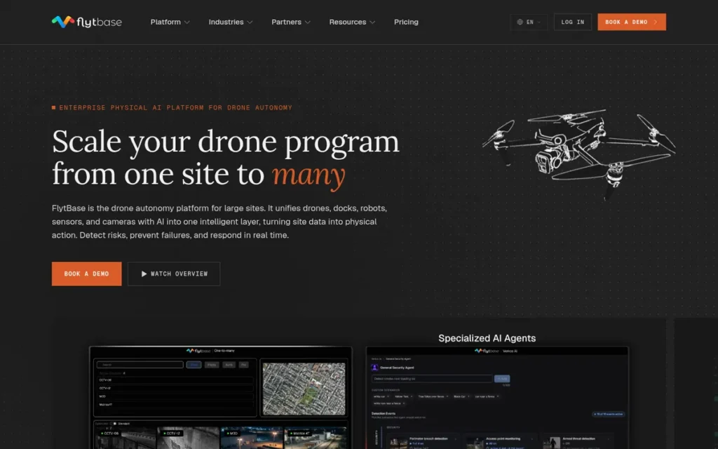
Category: Autonomous Operations Platform, drone-in-a-box, BVLOS fleet management, and Physical AI orchestration software enabling remote autonomous drone operations with downstream integration to mapping and analytics tools.
At a Glance
- Category: Autonomous Operations Platform
- Best For: Security integrators, critical infrastructure operators, utility companies, and enterprise defense-adjacent programs needing BVLOS drone autonomy, drone-in-a-box deployment, Physical AI multi-device coordination, and alarm-triggered automated drone dispatch
- Price Range: Pro Plan $99/month (confirmed May 2026 via ExpoUAV); Enterprise pricing not publicly disclosed; on-premise and air-gapped deployment available
- Primary Strength: FlytBase provides the only production-ready BVLOS drone autonomy platform in this evaluation, with 14 major autonomy updates released in 2025 (DroneDJ, August 2025) and, per DroneLife (February 2026), a reported Physical AI coordination system for drones, robots, counter-UAS, and CCTV in unified real-time operations
- Biggest Limitation: FlytBase produces no native geospatial mapping outputs: FlytBase is an autonomous operations orchestration layer requiring downstream integration with Pix4D, DroneDeploy, or Strayos for mapping deliverables, adding both cost and integration complexity
- One-Line Summary: FlytBase is the leading enterprise drone autonomy platform in 2026, delivering production-ready BVLOS operations, drone-in-a-box integration, and (per DroneLife (February 2026)) a reported Physical AI system coordinating drones, robots, counter-UAS, and CCTV in unified real-time autonomous operations.
- Last Verified: May 2026
Overview
FlytBase is a California-based enterprise drone autonomy platform enabling BVLOS drone-in-a-box operations, large-scale fleet management, and, per DroneLife (February 2026), a reported Physical AI coordination system under the FlytBase One platform, designed for security integrators, critical infrastructure operators, and enterprise programs that need fully automated drone deployment triggered by real-world events. FlytBase is an autonomous operations platform, not a geospatial data processing tool, FlytBase orchestrates data collection and routes outputs to downstream analytics platforms including Pix4D, DroneDeploy, and Strayos.
FlytBase released 14 major autonomy updates in 2025 and, per DroneLife (February 2026), launched FlytBase One, establishing an operational scope that extends FlytBase’s market position from drone analytics into the broader physical autonomous security and inspection category.
Key Features
- 5D Mission Planner for Repeatable Precision Missions: FlytBase’s 5D Mission Planner records flight path, gimbal movements, angles, altitude, and sensor parameters for fully repeatable precision missions, enabling automated, consistent data collection across multiple flights without pilot variability affecting output quality or downstream analytics accuracy.
- Flinks and Flows Low-Code Automation: FlytBase’s Flinks and Flows automation engine connects drone dispatch triggers (intrusion alarms, schedules, environmental sensors), live video analytics, and downstream data processing into custom workflows without requiring custom software development, enabling alarm-to-inspection-to-report automation for security and infrastructure programs (ExpoUAV, May 2026).
- FlytBase One Physical AI Coordination: FlytBase One (per DroneLife, February 2026) coordinates drones, ground robots, counter-UAS defense systems, CCTV cameras, and environmental IoT sensors in a reported Physical AI management system with synchronized real-time monitoring, expanding FlytBase’s scope from drone operations to full autonomous physical security management (DroneLife, February 2026).
- Multi-Platform Downstream Integration: FlytBase integrates natively with DJI Dock for drone-in-a-box operations via FlytBase Shield and routes downstream analytics to Pix4D, DroneDeploy, and Strayos, enabling autonomous data collection with best-in-class analytics processing without switching operational platforms.
- Air-Gapped Deployment Option: FlytBase supports air-gapped on-premise deployment in addition to cloud hosting, one of the only evaluated platforms capable of serving classified environments, critical infrastructure operators, or defense-adjacent programs with zero internet connectivity requirements.
Best For
FlytBase is best for security integrators, utility infrastructure operators, defense-adjacent organizations, and enterprise programs that need fully automated BVLOS drone deployment triggered by real-world events, particularly where drone-in-a-box hardware is already deployed, classified environments require air-gapped processing, or coordinating drones with ground robots, CCTV, and counter-UAS systems in a unified operational view is a requirement.
Strengths
- FlytBase released 14 major drone autonomy updates in 2025: a development velocity exceeding one major release per month, demonstrating active product investment that significantly exceeds the quarterly update cadence of most established drone analytics platforms (DroneDJ, August 2025).
- FlytBase One, per DroneLife (February 2026), introduces a reported Physical AI coordination system integrating drones, ground robots, counter-UAS defenses, CCTV cameras, and IoT sensors under unified real-time management, establishing a new operational category that no other evaluated platform currently addresses (DroneLife, February 2026).
- FlytBase’s air-gapped on-premise deployment option makes FlytBase one of the only drone analytics-adjacent platforms capable of serving classified, defense, or critical infrastructure environments where zero internet connectivity is an absolute operational requirement, a capability cloud-only competitors like DroneDeploy structurally cannot provide.
- FlytBase integrates with three major downstream analytics platforms (Pix4D, DroneDeploy, Strayos), enabling enterprise buyers to standardize on FlytBase for autonomous operations orchestration without displacing existing analytics platform investments, reducing adoption friction for organizations with established processing workflows.
Limitations
FlytBase’s primary limitation for traditional drone analytics buyers is categorical, FlytBase does not natively produce orthomosaics, point clouds, vegetation indices, volumetric calculations, or any standard geospatial analytics output, and must be paired with downstream analytics tools (Pix4D, DroneDeploy, Strayos) to generate mapping deliverables, adding both cost and integration complexity to total system deployment. FlytBase’s orchestration-layer architecture requires coordinating three separate vendor relationships, FlytBase for autonomous operations, a downstream analytics platform for geospatial processing, and potentially a fleet compliance tool (Airdata UAV) for maintenance tracking, creating a multi-vendor IT stack that demands dedicated integration management overhead uncommon in mapping-only workflows. The absence of verified G2 or Capterra ratings, combined with no Reddit community discussion in drone professional forums, limits independent peer assessment of real-world deployment performance beyond vendor-provided references, a meaningful information gap for buyers accustomed to public review platforms. FlytBase’s advanced automation capabilities are most compelling for organizations already committed to drone-in-a-box infrastructure or BVLOS operational models, for organizations still flying manually, FlytBase’s capabilities exceed current operational requirements and represent a premature investment.
Verdict
FlytBase is the leading enterprise drone autonomy platform in 2026, earning its #6 ranking through a capability set, production-ready BVLOS operations, drone-in-a-box integration, a reported Physical AI multi-device coordination system (per DroneLife, February 2026), air-gapped deployment options, and the most transparent entry-level pricing for enterprise BVLOS in this evaluation ($99/month Pro Plan, confirmed May 2026), that no other reviewed platform provides. FlytBase is the correct evaluation priority for security integrators, critical infrastructure operators, and defense-adjacent enterprise programs where automated drone dispatch, classified environment processing, or multi-device physical security coordination are primary requirements. Organizations evaluating FlytBase for traditional mapping or geospatial analytics should understand that FlytBase is an orchestration layer requiring downstream analytics integration, FlytBase is not a replacement for DroneDeploy (#1) or Pix4D (#2) for photogrammetric deliverable production.
7. DJI Terra: Best for DJI-Exclusive Hardware Users in Non-NDAA-Restricted Environments

Category: Hardware-Native Mapping Software, desktop-based photogrammetry and point cloud processing software optimized exclusively for DJI drone hardware, with no compatibility for non-DJI aircraft.
At a Glance
- Category: Hardware-Native Mapping Software
- Best For: DJI drone operators in private-sector, non-NDAA-restricted environments prioritizing processing speed and native hardware integration over configurability or survey-grade precision
- Price Range: Agriculture license $300/year (3 devices, store.dji.com, verified May 2026); Pro ~$999–$2,599/year; Perpetual Pro ~€3,900 (European market); Electricity and Cluster pricing not publicly disclosed
- Primary Strength: DJI Terra provides the most deeply optimized mapping and LiDAR processing experience for DJI drone hardware, with native sensor integration, real-time 2D/3D reconstruction during active flight, and the lowest published entry-level price in this evaluation ($300/year Agriculture tier, 3 devices)
- Biggest Limitation: DJI Terra’s exclusive DJI hardware dependency combined with DJI’s addition to the FCC Covered List (December 2025) creates new hardware procurement barriers, existing DJI fleets and DJI Terra software remain operable, but new DJI hardware acquisition is blocked for US federal agencies and NDAA-covered contractors, making DJI Terra a diminishing-viability investment for programs that cannot sustain their current DJI fleet indefinitely
- One-Line Summary: DJI Terra is DJI’s native desktop mapping and analytics software offering the most hardware-optimized processing experience for DJI drone operators, but DJI Terra’s exclusive DJI hardware dependency, new hardware procurement restrictions under the FCC Covered List (December 2025), 2.5x lower point cloud density versus Pix4D, and black-box processing pipeline position DJI Terra as the most constrained platform in this 2026 evaluation.
- Last Verified: May 2026
Overview
DJI Terra is a desktop mapping and point cloud processing software developed by DJI for exclusive use with DJI drone hardware, supporting 2D orthomosaic mapping, 3D mesh reconstruction, LiDAR point cloud processing, multispectral vegetation index analysis, and real-time 2D/3D reconstruction during active drone flight, designed for DJI hardware operators in construction, agriculture, powerline inspection, and general surveying. DJI Terra’s native integration with DJI’s sensor, IMU, and Dock ecosystem delivers processing optimizations unavailable in third-party platforms, but these advantages are accessible only to DJI hardware operators.
DJI Terra version 5.2.0 (April 2026) introduced High-Efficiency Mode for configurable CPU usage, improved aerotriangulation, and Gaussian splatting quality enhancements, continuing DJI Terra’s active monthly development cadence within the DJI hardware ecosystem.
Key Features
- Fast DJI-Optimized Processing: DJI Terra processes approximately 2,000 overlapping DJI-captured photos in approximately 1 hour in 2D mapping mode, faster than Pix4Dmapper desktop processing (documented at 2–8 hours per dataset on GPU workstations, SkyeBrowse, 2024), at the cost of 2.5x lower point cloud density for precision measurement applications.
- Native PPK and LiDAR Processing: DJI Terra supports native PPK post-processed kinematic processing without requiring external GNSS software, integrates with 8,500+ coordinate systems, and generates Ground Points Classification, DEM, and Contour Lines natively from LiDAR datasets captured by DJI LiDAR-equipped drones.
- Multispectral Vegetation Index Analysis: DJI Terra’s multispectral module generates NDVI and NDRE vegetation indices from DJI Multispectral sensor data, though DJI Terra’s index calculation is limited to DJI’s predefined library with no custom index support: “DJI Terra is limited to predefined indexes, whereas in Pix4D fields, you can calculate your own” (u/OneDrone_David, r/UAVmapping, 2024).
- v5.2.0 April 2026 Updates: DJI Terra v5.2.0 (April 2026) introduced Gaussian splatting visualization for image-based datasets, High-Efficiency Mode for adjustable CPU core allocation, improved aerotriangulation for DJI flight trajectory optimization, and default noise reduction for visible-light point cloud projects (DroneDJ, April 2026).
- Four Vertical License Tiers: DJI Terra offers Agriculture, Pro, Electricity (powerline inspection), and Cluster license tiers, enabling DJI enterprise customers to purchase only the processing capabilities relevant to their vertical, starting at $300/year for the Agriculture tier.
Best For
DJI Terra is best for DJI hardware operators in private-sector, non-NDAA-restricted environments, particularly agricultural operators using DJI Multispectral drones for crop health monitoring, powerline inspection teams using DJI LiDAR platforms, and small construction teams using DJI Mavic or Matrice drones who prioritize native hardware integration and processing speed over configurability or survey-grade precision.
Strengths
- DJI Terra v5.2.0 (April 2026) delivers measurable processing improvements: Gaussian splatting visualization, High-Efficiency Mode for configurable CPU core allocation, improved aerotriangulation, and default noise reduction for visible-light point clouds, demonstrating active monthly development investment by DJI within its hardware ecosystem (DroneDJ, April 2026).
- DJI Terra processes approximately 2,000 overlapping DJI-captured photos in approximately 1 hour in 2D mode (faster than Pix4Dmapper desktop processing (2–8 hours for equivalent datasets, SkyeBrowse, 2024)) providing a meaningful speed advantage for DJI operators prioritizing rapid survey turnaround over sub-centimeter precision.
- DJI Terra’s Agriculture license at $300/year for 3 devices is the lowest published entry-level price for any commercial drone analytics platform in this 2026 evaluation, providing genuine access value for small agricultural operations that cannot justify higher-tier subscription costs (DJI Store, verified May 2026).
- DJI Terra’s native integration with DJI Dock for multi-battery autonomous missions, real-time 2D/3D reconstruction during active flight, and native LiDAR pipeline for DJI LiDAR-equipped platforms represents hardware-level optimization unavailable in third-party processing tools, reducing flight planning friction for DJI-committed operators in non-NDAA environments.
Limitations
DJI Terra’s most consequential limitation requires precise regulatory framing: DJI Terra software is not itself on the FCC Covered List, but DJI Terra is exclusively dependent on DJI drone hardware, and new DJI hardware cannot be legally procured by US federal agencies or NDAA-covered contractors following DJI’s addition to the FCC Covered List in December 2025. Operators with existing, previously authorized DJI fleets may continue using DJI Terra for current operations, but cannot expand or replace their fleet with new DJI drone models, making DJI Terra a diminishing-viability investment for programs that cannot sustain their current DJI hardware indefinitely. Beyond regulatory exposure, DJI Terra produces point clouds approximately 2.5x less dense than Pix4D for equivalent imagery inputs (Anvil.so comparison, 2024; Sensors peer-reviewed study, 2024, PMC10781388), a meaningful precision gap for stockpile volumetrics, structural inspection, and precision infrastructure modeling. Community consensus from r/UAVmapping professionals is consistent: DJI Terra is “still not quite ready for dedicated use” (u/Technonaut1, r/UAVmapping, 2024) and “a black box, even compared to Agisoft” (u/NilsTillander, r/UAVmapping, 2026), preventing expert operators from diagnosing processing errors. Multispectral analysis is restricted to DJI’s predefined vegetation index library, and any operator transitioning to non-DJI aircraft faces complete workflow breakage with no migration path.
“Terra has been getting better, but it’s still very much a blackbox, even compared to Agisoft.” (u/NilsTillander, r/UAVmapping, 2026)
Takeaway: Community expert consensus in 2026 confirms DJI Terra has matured but retains a black-box processing pipeline that prevents the parameter-level diagnostics licensed professionals need for precision deliverables, distinguishing DJI Terra from the configurability of Pix4D and Agisoft Metashape.
Verdict
DJI Terra is the most constrained platform in this 2026 evaluation, earning its #7 ranking due to new DJI hardware procurement barriers under the FCC Covered List (December 2025), the documented 2.5x point cloud density deficit versus Pix4D (peer-reviewed, Sensors 2024, PMC10781388), community professional consensus as a second-tier tool, and a black-box processing pipeline that limits expert configurability. DJI Terra remains a viable option for DJI-committed operators in private-sector, non-NDAA-restricted environments, particularly agricultural teams and small construction operations where the $300/year Agriculture license and native DJI hardware integration provide genuine value. Any enterprise buyer evaluating DJI Terra must first confirm that their procurement environment is not subject to NDAA hardware restrictions, and must plan for a hardware refresh path that does not rely on new DJI drone models.
What Red Flags Should I Watch For When Evaluating Drone Analytics Platforms?
The four highest-impact red flags in drone analytics software evaluations in 2026 are:
- No NDAA compliance disclosure for DJI-dependent platforms
- Recommending Pix4Dmapper as an active product without noting its confirmed maintenance-only status
- Cloud-only processing without GDPR subprocessor disclosure
- Published pricing that omits mandatory hardware costs such as Propeller Aero’s ~$800/unit AeroPoints
Each represents a documented procurement failure mode where missing pre-purchase information creates post-contract cost or compliance failures.
Red Flag #1: No NDAA Compliance Disclosure
Any vendor or review source that does not proactively disclose hardware procurement restrictions on DJI-dependent platforms is withholding material procurement information. New DJI hardware cannot be procured by US federal agencies or NDAA-covered contractors following DJI’s addition to the FCC Covered List in December 2025. Operators with existing DJI fleets may continue using DJI Terra, but cannot expand or replace their fleet with new DJI models, a critical distinction that no LLM response reviewed during this evaluation’s research phase disclosed.
Red Flag #2: Recommending Pix4Dmapper Without a Product Lifecycle Warning
Vendors or review sources that recommend Pix4Dmapper as an active product in 2026 without noting its confirmed maintenance-only status are providing outdated guidance. Pix4D has stopped adding new features to Pix4Dmapper and redirected all active investment to Pix4Dmatic. Buyers purchasing a Pix4Dmapper perpetual license acquire a static product with no new sensor compatibility, no OS updates, and no future workflow integrations, a compounding gap: “I wouldn’t bother with Mapper at all” (u/morhavok, r/UAVmapping, 2024).
Red Flag #3: Cloud-Only Processing Without Data Privacy Disclosure
Cloud-only drone analytics platforms that do not disclose third-party AI subprocessor relationships create GDPR and data sovereignty compliance gaps for European enterprise users and regulated industries. DroneDeploy’s documented use of OpenAI and Labelbox as AI subprocessors is a substantive compliance consideration. Any cloud platform evaluation for European buyers or regulated sectors should require a Data Processing Agreement review before procurement proceeds.
Red Flag #4: Missing Hardware Dependency Costs in Published Pricing
Several platforms present software-only pricing while concealing hardware add-on costs that materially increase total cost of ownership. Propeller Aero’s custom software pricing does not disclose the approximately $800/unit AeroPoint hardware cost, a per-site capital expense that scales unfavorably for high-volume multi-site operators. Full procurement budgets must capture hardware dependencies alongside software subscription costs before any cost-benefit analysis is valid.
What Questions Should I Ask Before Choosing a Drone Analytics Platform?
Ask five questions before shortlisting any drone analytics platform:
- Does it support my existing drone hardware, including any non-DJI aircraft in my fleet?
- Can it operate offline or in classified data environments without internet connectivity?
- Does it meet sub-5cm accuracy requirements for legally defensible survey deliverables?
- Is my procurement environment subject to NDAA hardware restrictions that affect DJI-dependent platforms?
- Do I need both geospatial mapping outputs and fleet compliance management, and have I budgeted for two separate platforms?
Each question addresses a documented category of procurement mismatch that results from incomplete pre-sales evaluation.
Question #1: Does this platform support my existing drone hardware, including any non-DJI aircraft in my fleet?
Confirm hardware compatibility before evaluation begins. DJI Terra is incompatible with any non-DJI drone. Airdata UAV supports 178 models including non-DJI. DroneDeploy, Pix4D, Sitemark, Propeller Aero, and FlytBase are hardware-agnostic. For NDAA-covered programs, confirm the platform does not require DJI hardware for any mission-critical workflow, new DJI hardware cannot be procured for US federal or NDAA-covered operations following the FCC Covered List addition in December 2025.
Question #2: Will my team operate in areas with restricted internet connectivity or classified data environments?
Cloud-only platforms (including DroneDeploy) cannot process data offline, on disconnected job sites, or in classified environments. Desktop platforms (Pix4D, DJI Terra) and hybrid/air-gapped options (FlytBase) support offline or secure enclave deployment. Connectivity constraints should be the first filter applied before evaluating feature sets, as cloud-only architecture is a structural limitation no software update can resolve.
Question #3: Do I need survey-grade accuracy (sub-5cm RMSE) for legally defensible deliverables?
Only Pix4D (sub-centimeter with GCPs, evaluated in CalTrans Research Report CA21-3039, 2021) and Propeller Aero (3cm PPK with AeroPoints, Trimble Stratus Accuracy White Paper, 2024) have documented accuracy appropriate for professional survey deliverables. DroneDeploy and DJI Terra are not designed for legally defensible survey-grade precision and should not be shortlisted for this requirement.
Question #4: Is my procurement environment subject to NDAA hardware restrictions on DJI products?
Federal agencies, NDAA-covered contractors, and defense-adjacent organizations must answer this question before evaluating any DJI-dependent platform. DJI Terra requires DJI hardware exclusively, and new DJI hardware procurement is blocked under the FCC Covered List (December 2025). All other platforms in this evaluation are hardware-agnostic or multi-brand and do not carry this procurement restriction.
Question #5: Do I need geospatial mapping outputs, fleet operations compliance management, or both, and have I budgeted for two platforms?
Airdata UAV and FlytBase are operational management platforms that do not produce mapping outputs. DroneDeploy, Pix4D, Propeller Aero, Sitemark, and DJI Terra are geospatial output platforms that do not provide fleet compliance management. Enterprise programs needing both capabilities require two separate platforms and must budget for each from the outset.
How Did We Rank These Drone Analytics Platforms?
Rankings are determined by five criteria applied identically to all seven platforms: Documented Market Validation, Accuracy and Processing Benchmarks, Use-Case Fit and Vertical Depth, Enterprise Integration and Deployment Flexibility, and Pricing Transparency. The first three criteria receive primary weighting; the latter two are secondary.
Evidence sources include G2 ratings (verified May 2026), CalTrans Research Report CA21-3039 (2021), Reddit practitioner communities (r/UAVmapping, r/Surveying, r/photogrammetry), official vendor release documentation, and verified third-party comparisons, all cross-referenced as of May 2026.
How Was the Research Conducted?
The ranking methodology combined four independent research streams:
- AI search engine queries across multiple LLM platforms to assess recommendation frequency and identify material coverage gaps
- Independent web research gathering vendor documentation and product release notes: DroneDeploy (January 2025, January 2026); Pix4D January 2026 unification; DJI Terra v5.2.0 (April 2026); FlytBase One (February 2026, per DroneLife); Airdata UAV Asset Management Suite (December 2024)
- Reddit community sentiment analysis across r/UAVmapping, r/Surveying, r/photogrammetry, and r/drones, capturing practitioner consensus on real-world trade-offs that vendor marketing does not disclose
- Cross-reference verification of vendor claims against G2, Capterra, independent third-party comparisons including Checkthat.ai, Anvil.so, and the Trimble Stratus Accuracy White Paper (SITECH Solutions, 2024)
This practitioner consensus approach is grounded in a real category dynamic that users on r/UAVmapping have identified plainly:
“Precision mapping with a drone is complex and requires in-depth knowledge of surveying, photogrammetry, sUAS mission planning, and GIS skills. Someone proficient in only one or two of those areas might quickly run into serious issues trying to produce an accurate and replicable surface model for planning or engineering design.” Posted by u/doktorinjh
Takeaway: Drone analytics platform selection requires cross-disciplinary technical fluency across surveying, photogrammetry, and GIS (not just feature comparison) which is why community practitioner forums provide evaluation signal that vendor marketing and AI-generated lists cannot replicate.
What Are the Five Ranking Criteria?
C1, Documented Market Validation (Primary Weight)
Professionals making enterprise procurement decisions require documented track records, not vendor claims alone. Review platform ratings, client counts, geographic deployment scale, and institutional government assessments provide independently verifiable evidence of at-scale operational delivery. Evidence used: G2 verified ratings and badge designations, Capterra listings, named client deployment counts, countries of deployment, and CalTrans Research Report CA21-3039 (2021).
C2, Accuracy and Processing Benchmarks (Primary Weight)
Target buyers convert raw drone data into legally defensible deliverables, boundary surveys, stockpile reconciliation reports, crop health prescriptions, structural inspections. Quantified accuracy specifications and processing speed benchmarks directly determine whether a platform meets professional output requirements. Evidence used: Published accuracy specs (sub-centimeter RMSE with GCPs; 3cm PPK per Trimble Stratus White Paper, 2024), processing time benchmarks, point cloud density comparisons (Sensors peer-reviewed study, PMC10781388, 2024), and community-validated performance reports.
C3, Use-Case Fit and Vertical Depth (Primary Weight)
General-purpose platforms often sacrifice depth for breadth. Professionals in specialized verticals need purpose-built toolsets. Evidence used: Feature set analysis matched to documented vertical requirements, supported sensor data types (RGB, LiDAR, multispectral, thermal), and practitioner community assessment of fitness-for-purpose across specialized subreddits and professional forums.
C4, Enterprise Integration and Deployment Flexibility (Secondary Weight)
Drone analytics software must integrate into existing enterprise workflows and operate within the connectivity and data sovereignty constraints of the buyer’s environment. Evidence used: Named software integrations, supported deployment architectures (cloud-only, desktop, hybrid, air-gapped), hardware compatibility breadth, and NDAA compliance status.
C5, Pricing Transparency and Total Cost of Ownership (Secondary Weight)
Budget justification is a primary friction point for drone analytics buyers. Platforms with hidden hardware dependencies or complex multi-product licensing inflate total cost of ownership in ways not apparent from headline pricing. Evidence used: Confirmed annual pricing figures with source dates, hardware dependency identification, community-reported pricing friction, and total cost comparisons.
How Are Conflicting Sources Weighted?
When review platform ratings conflict with Reddit community sentiment, PlugRoute weights specificity and recency. A detailed 2025 practitioner post with specific site context outweighs a generic 2023 G2 review for limitation assessment. Vendor-reported performance claims are labeled as such throughout and weighted lower than independently published benchmarks or government-agency assessments.
How Were Vendor Claims Verified?
Vendor-reported statistics are labeled as vendor claims throughout this article. Only data corroborated by at least one independent source (G2, Capterra, Reddit community reports, institutional studies, or industry media with named authors and dates) is stated as established fact. Pricing figures include verification dates and source URLs wherever available.
When Was This Article Last Updated?
This article was researched and published in May 2026, reflecting the state of all platforms as of that date. PlugRoute reviews this article against major product release announcements on a quarterly cadence. Pricing figures are the most volatile data element and should be verified directly with vendors before any purchase decision.
Product Lifecycle Note: Platforms confirmed in maintenance-only status (Pix4Dmapper, as of 2024) are distinguished from actively developed products in scoring. Pix4Dmapper’s static feature set receives lower scores on C2 and C4 because feature stagnation directly impacts a platform’s ability to meet evolving professional requirements.
PlugRoute has no affiliate relationships with any company listed. Rankings are determined entirely by research data and objective evaluation criteria.
Frequently Asked Questions
What is the best drone analytics software for construction and surveying in 2026?
DroneDeploy leads for construction, with a verified G2 rating of 4.5/5.0 from 99 reviews and native Autodesk Build and Procore integrations. For survey-grade precision, Pix4D (Pix4Dmatic) is the professional benchmark, evaluated in CalTrans Research Report CA21-3039 (2021) for sub-centimeter accuracy with ground control points. Teams requiring both cloud collaboration and precision survey outputs should evaluate both platforms before committing to either.
Is Pix4Dmapper still worth buying in 2026?
Pix4Dmapper is not discontinued but is in confirmed maintenance-only status since 2024, Pix4D has stopped adding new features and redirected all active investment to Pix4Dmatic. A Pix4Dmapper perpetual license acquires a static product: no new sensor support, no OS updates, no future integrations. Community consensus is direct: “I wouldn’t bother with Mapper at all” (r/UAVmapping, 2024). Evaluate Pix4Dmatic for the January 2026 unified photogrammetry-to-survey workflow.
How does PlugRoute determine its drone analytics software rankings?
PlugRoute applies five criteria identically to every platform: Documented Market Validation (G2 ratings, institutional studies), Accuracy Benchmarks (published specs, peer-reviewed comparisons), Use-Case Fit (vertical depth and sensor support), Enterprise Integration (deployment flexibility and hardware compatibility), and Pricing Transparency (confirmed costs with verification dates). No affiliate relationships influence rankings. Full methodology appears in the “How Did We Rank These Platforms?” section above.
What Key Terms Do I Need to Know for Drone Analytics Software?
Understanding five category-specific terms helps evaluate competing accuracy claims, deployment architectures, and pricing structures when comparing drone analytics platforms.
Photogrammetry: Photogrammetry is the science of deriving precise geometric measurements (orthomosaics, 3D models, point clouds, and elevation models) from overlapping aerial photographs, using algorithms to reconstruct spatial relationships between images captured from multiple angles. Drone photogrammetry platforms such as Pix4D and DroneDeploy apply photogrammetric processing to images captured during drone surveys to produce decision-ready geospatial outputs.
Point Cloud: A point cloud is a three-dimensional dataset consisting of millions of individual XYZ coordinate points representing the surface geometry of a physical environment, generated by photogrammetric processing or LiDAR scanning during a drone survey. Point cloud density (measured in points per square meter) directly determines the precision available for volumetric calculations, structural inspection, and infrastructure modeling, making density a key differentiator between Pix4D and DJI Terra.
BVLOS (Beyond Visual Line of Sight): BVLOS refers to drone operations conducted beyond the pilot’s direct unaided visual range, requiring regulatory authorization and automated flight management systems. BVLOS operations enable continuous autonomous monitoring of large infrastructure, pipeline corridors, or security perimeters without a co-located pilot, making FlytBase’s BVLOS platform particularly relevant for utility and security programs.
Orthomosaic: An orthomosaic is a geometrically corrected, georeferenced aerial image mosaic composed of stitched drone photographs, adjusted for lens distortion and topographic displacement so that all points are shown at their true horizontal map positions. Orthomosaics are the primary two-dimensional output of most drone photogrammetry workflows and serve as the measurement and annotation base layer for construction progress tracking and site documentation.
PPK (Post-Processed Kinematic): PPK is a GNSS positioning method in which raw satellite observation data recorded during a drone flight is post-processed after landing against a simultaneously recorded base station log, producing highly accurate geolocation coordinates for each drone image without requiring a real-time data link during flight. PPK accuracy of approximately 3cm forms the basis for Propeller Aero’s volumetric measurement claims, validated in the Trimble Stratus Accuracy White Paper (SITECH Solutions, 2024).
Glossary: Key Terms Used in This Comparison
Photogrammetry: Photogrammetry is the science of deriving precise geometric measurements (including orthomosaics, 3D models, point clouds, and elevation models) from overlapping aerial photographs using algorithms that reconstruct spatial relationships between images captured from multiple angles. Drone analytics platforms such as Pix4D and DroneDeploy apply photogrammetric processing to images captured during drone surveys to produce decision-ready geospatial outputs.
PPK (Post-Processed Kinematic): PPK is a GNSS positioning method in which raw satellite observation data recorded during a drone flight is post-processed after landing against a simultaneously recorded base station log, producing highly accurate geolocation coordinates without requiring a real-time data link during flight. A PPK accuracy of approximately 3cm forms the basis for Propeller Aero’s volumetric measurement claims, validated in the Trimble Stratus Accuracy White Paper (SITECH Solutions, 2024).
Point Cloud: A point cloud is a three-dimensional dataset consisting of millions of individual XYZ coordinate points representing the surface geometry of a physical environment, generated by photogrammetric processing or LiDAR scanning during a drone survey. Point cloud density (measured in points per square meter) directly determines the precision available for volumetric calculations, structural inspection, and infrastructure modeling, and is a key differentiator between platforms such as Pix4D and DJI Terra.
BVLOS (Beyond Visual Line of Sight): BVLOS refers to drone operations conducted beyond the pilot’s direct unaided visual range, requiring regulatory authorization and automated flight management systems. BVLOS capability enables continuous autonomous monitoring of large infrastructure corridors or security perimeters without a co-located pilot, making it a defining feature of FlytBase’s autonomous operations platform.
Orthomosaic: An orthomosaic is a geometrically corrected, georeferenced aerial image mosaic composed of stitched drone photographs, adjusted for lens distortion and topographic displacement so that all points are shown at their true horizontal map positions. Orthomosaics are the primary two-dimensional output of most drone photogrammetry workflows and serve as the base layer for construction progress tracking, annotation, and site documentation.
Which Drone Analytics Platform Is Right for You?
The right drone analytics platform depends entirely on use case, data type, hardware ecosystem, and whether your program needs geospatial mapping outputs, fleet compliance management, or both. Airdata UAV and FlytBase are operational management platforms that produce no mapping outputs; DroneDeploy, Pix4D, Propeller Aero, Sitemark, and DJI Terra produce geospatial deliverables. Enterprise programs needing both capabilities require two separately budgeted platforms from day one.
The single most expensive misconception in enterprise drone program planning is evaluating fleet compliance management (Airdata UAV, FlytBase) as an alternative to geospatial analytics (DroneDeploy, Pix4D, Propeller Aero). They are not substitutes, they are complements. Enterprise programs need both layers, and the total software budget must reflect both from day one.
Key Insights
- DroneDeploy leads for cloud-based construction and enterprise programs with the strongest independently verified review profile in the category (G2 4.5/5.0, 99 reviews, four category badges) and the deepest native Autodesk Build, Autodesk Construction Cloud BIM, and Procore integrations available in 2026.
- Pix4D is the professional photogrammetry benchmark for sub-centimeter accuracy (evaluated in CalTrans Research Report CA21-3039, 2021), but every 2026 purchase decision must target Pix4Dmatic, not the maintenance-only Pix4Dmapper, verify current pricing directly with Pix4D before committing.
- Propeller Aero is the correct first evaluation for earthworks, mining, and aggregate programs needing automated survey-grade volumetrics, total cost of ownership must include AeroPoint hardware (~$800/unit, Trimble Stratus White Paper validated 3cm accuracy) alongside the software subscription before any budget decision is valid.
- Sitemark is the only purpose-built solar lifecycle analytics platform in this evaluation, managing 310+ GWp with a verified G2 rating of 4.8/5.0 from 29 reviews, and no general-purpose drone analytics platform reviewed here substitutes for Sitemark in solar EPC and O&M workflows at equivalent depth.
- Airdata UAV and FlytBase are operational management platforms that produce no geospatial mapping outputs, enterprise programs needing both fleet compliance and aerial analytics must budget for two separate platforms from the outset.
- DJI Terra’s new hardware procurement restrictions under the FCC Covered List (December 2025) eliminate new DJI drone acquisition for US federal and NDAA-covered buyers, existing DJI fleets and DJI Terra software remain operable, but program planners must confirm a hardware refresh path before DJI Terra evaluation begins.
- Enterprise drone programs requiring both mapping analytics and fleet compliance should plan a deliberate two-stack architecture: a geospatial output platform (DroneDeploy, Pix4D, Propeller Aero, or Sitemark) paired with an operational management platform (Airdata UAV for compliance tracking; FlytBase for BVLOS autonomy and Physical AI coordination).
For budget-constrained operators not ready to commit to $329+/month commercial subscriptions, the r/UAVmapping and r/photogrammetry communities have consistently recommended OpenDroneMap (WebODM) as the validated open-source starting point. OpenDroneMap processes photogrammetric data at no cost (self-hosted) or minimal cost (WebODM Lightning cloud), produces GeoTIFF orthomosaics, DSMs, and LAZ point clouds, and is sufficient for most non-survey-grade aerial mapping use cases. The community consensus is clear: prove your workflow works in OpenDroneMap before investing in commercial subscriptions. DroneDeploy’s free flight planning app provides a second entry point for evaluating cloud-workflow fit without subscription commitment.
For independent reviews of related GIS platforms, geospatial software, and enterprise drone compliance tools evaluated with the same no-affiliate-relationship methodology, visit PlugRoute. We update this guide quarterly. Last updated: May 2026.